NOAA’s Office of Coast Survey is pleased to announce its first one-day open house in conjunction with the International Cartographic Conference (held this year in Washington, DC, at Marriott Wardman Park). This one-day event will focus on nautical cartography, highlighting the field of charting and GIS. It will offer nautical cartography-themed posters, presentations, tours, and exhibits. Participants will include industry partners, government agencies, and charting offices from around the world. This event is open to the public. Continue reading “NOAA announces open house on nautical cartography”
NOAA Ship Rainier surveys the waters around Kodiak Island
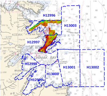
by ENS Michelle Levano
Kodiak Island is the 2nd largest island in the United States; it is part of the Kodiak Island Archipelago, a group of islands roughly the size of Connecticut. Due to the island’s location in the Gulf of Alaska and North Pacific Ocean, Kodiak is ranked as third in commercial fishing ports in the U.S. in terms of value of seafood landed. In 2015, the Port of Kodiak was responsible for 514 million pounds of fish and $138 million of product. More than one-third of the jobs in Kodiak are related to the fishing industry.
The Port of Kodiak is home to more than 700 commercial fishing vessels, and has more than 650 boat slips and three commercial piers that can dock vessels up to 1,000 feet. In addition to fishing, Kodiak is the hub of the Gulf of Alaska container logistics system, serving the southwest Alaskan communities with consumer goods and outbound access to the world’s fish markets. Continue reading “NOAA Ship Rainier surveys the waters around Kodiak Island”
Coast Survey hurricane prep starts now
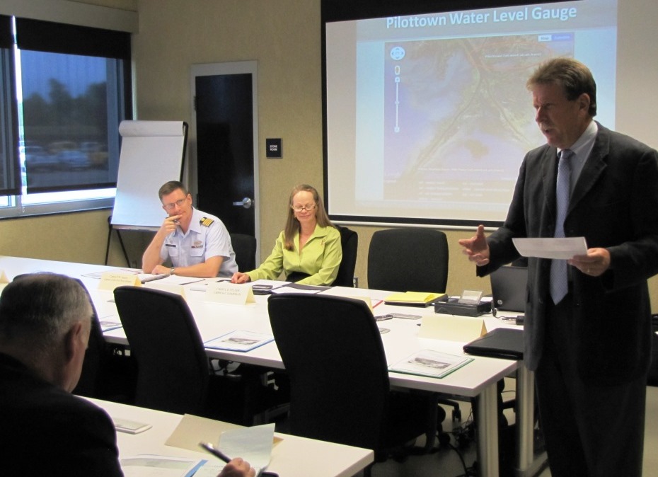
Official hurricane season doesn’t start until June 1, but Coast Survey’s navigation managers are heavily involved throughout April and May in training exercises with the U.S. Coast Guard, ports authorities and NOAA’s National Weather Service.
Why is Coast Survey involved? With our expertise in underwater detection, NOAA navigation response teams and survey ships are often the first ones in the water after a hurricane, looking to make sure that no hidden debris or shoaling poses a danger to navigation. The faster we can advise “all clear” to the Captain of the Port, the faster the U.S. Coast Guard can re-open sea lanes for the resumption of shipping or homeland security and defense operations. So our East Coast and Gulf Coast navigation managers – who are NOAA’s “ambassadors” to the maritime public – engage with response partners during hurricane exercises. Their reports of NOAA survey capabilities and assets are an important factor in testing federal response options. Continue reading “Coast Survey hurricane prep starts now”
Teaming up with small business to expand hydrographic technology
Sandy shoals in certain near shore areas shift continuously and present a danger to navigation. It is logistically impossible to keep nautical charts current using the traditional survey methods when the bottom contours change so rapidly. NOAA’s Office of Coast Survey leverages remote sensing data in new ways to derive bathymetry for the purposes of updating nautical charts in dynamic coastal areas. An exciting new method Coast Survey is exploring is X-band radar wave imaging. Marine radar is not a new technology, however, there are advantages to exploring old technology for new purposes. Many NOAA vessels and other coastal installations are already equipped with the hardware to facilitate this type of data acquisition. Continue reading “Teaming up with small business to expand hydrographic technology”
NOAA Coast Survey 2017 leadership team
NOAA Office of Coast Survey has some new faces on its leadership team this year.
Director, Coast Survey: Rear Admiral Shepard M. Smith
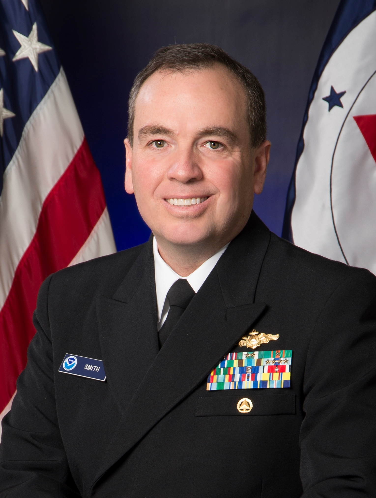 Rear Admiral Shepard M. Smith was named director of the NOAA Office of Coast Survey in August 2016. As director, Smith oversees NOAA’s charts and hydrographic surveys, ushering in the next generation of navigational products and services for mariners who need integrated delivery of coastal data. Smith has served with NOAA for 23 years, during which time he has been deeply involved in advancing the state-of-the-art in hydrography and nautical cartography. He most recently served as the commanding officer of NOAA Ship Thomas Jefferson and previously served as the chief of Coast Survey’s Marine Chart Division, managing the privatization of paper chart printing and distribution. He also served on the interagency response teams for the search and recovery of TWA flight 800, EgyptAir flight 990, and the private plane piloted by John F. Kennedy, Jr. He also commanded the Thomas Jefferson during her six-week response to the Deepwater Horizon oil spill. Rear Adm. Smith attended Deep Springs College and Cornell University, where he graduated with a Bachelor of Science in mechanical engineering and earned a Master of Science in ocean engineering from the University of New Hampshire. Continue reading “NOAA Coast Survey 2017 leadership team”
Coast Survey in World War 1: “an instant and eager response to the country’s call for help”
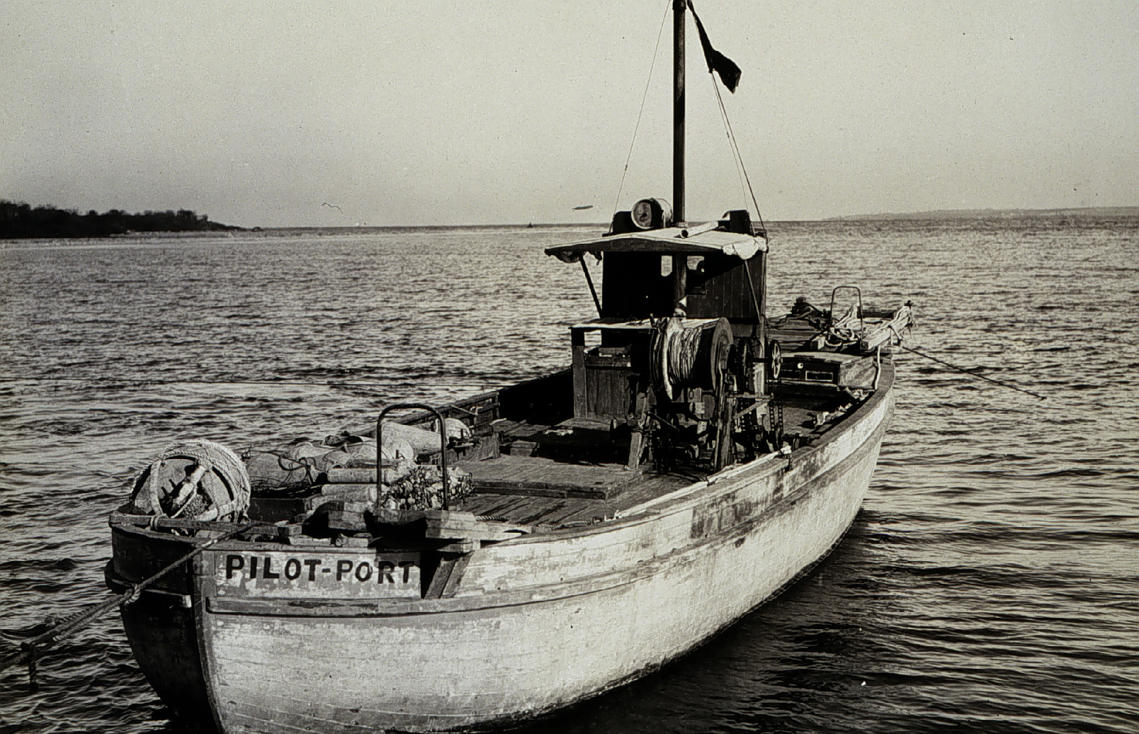
On April 6, 1917, the United States declared war on Germany, in the World War that began three years earlier, when Archduke Franz Ferdinand was assassinated. By 1918, over 30 percent of Coast and Geodetic Survey personnel were on active duty with the Army and Navy. With 272 members of the C&GS in active military service, and 5 survey vessels transferred into naval service, the Survey curtailed much of their regularly scheduled hydrographic work. Instead, personnel directed most of their energies to the assistance of the military branches, with the remaining hydrographic parties conducting special confidential surveys for the Navy Department. Continue reading “Coast Survey in World War 1: “an instant and eager response to the country’s call for help””
NOAA Coast Survey offers new certification program in nautical cartography
The International Board on Standards and Competence for Hydrographic Surveyors and Nautical Cartographers (IBSC) recognized and approved Coast Survey’s new certification program in cartography (CAT-B) at their 40th meeting in Willington, New Zealand. Capt. Andy Armstrong (NOAA, ret.), co-director of the Center for Coastal & Ocean Mapping/Joint Hydrographic Center at the University of New Hampshire, presented the program at the meeting. Continue reading “NOAA Coast Survey offers new certification program in nautical cartography”
NOAA wants to learn from you

Coast Survey is in a constant conversation with chart users, marine electronics firms, and maritime officials, listening to the ideas and observations of the people we serve. We want to hear from you!
There are several ways to make a request or suggest an improvement to Coast Survey’s navigational products. You can let us know about a chart discrepancy. You can ask a question online, or call us at 888-990-6622. You can meet with one of our regional navigation managers who are stationed around the U.S. coasts. Or, you can get involved through the Hydrographic Services Review Panel, a federal committee – with public members – who interact with NOAA experts and advise the NOAA administrator. Continue reading “NOAA wants to learn from you”
Coast Survey joins Florida to survey sensitive site
One of Coast Survey’s navigation response teams (NRT) recently responded to a request by the State of Florida, who needed help surveying a submerged prehistoric archaeological site located offshore of Sarasota County. Last week’s survey and investigation were necessary to map the full extent of the site and the surrounding area. Continue reading “Coast Survey joins Florida to survey sensitive site”
Collaborative effort to create new nautical chart returns recreational boaters to Haverhill, Massachusetts
NOAA’s Office of Coast Survey released a new electronic navigation chart (NOAA ENC®) of Haverhill, Massachusetts, and the Merrimack River (US5MA1AM). With this new chart, recreational boaters now can safely navigate the Merrimack River from the entrance at Newburyport all the way to Haverhill, just in time for boating season.
Haverhill is a historic New England town that has recently undergone an urban renewal with new federal, state, and private investment in the downtown and waterfront areas. Until now, this area of the river was not depicted at an appropriate scale on a nautical chart for recreational boaters to navigate safely. The community of Haverhill recognized the importance of recreational boaters to their local economy and led a grassroots effort to have a new chart created. Continue reading “Collaborative effort to create new nautical chart returns recreational boaters to Haverhill, Massachusetts”