Storms, particularly hurricanes, can be unpredictable. Therefore, NOAA’s hydrographic survey response teams that aid in the reopening of ports following storms, are designed to be flexible, proactive, and are on call 24/7 should the need arise to identify dangers to navigation.
Continue reading “NOAA searches for dangers to navigation following Hurricane Dorian”Hawaiian island surveys will update nautical charts and support habitat mapping efforts
By Ens. Lyle I. Robbins
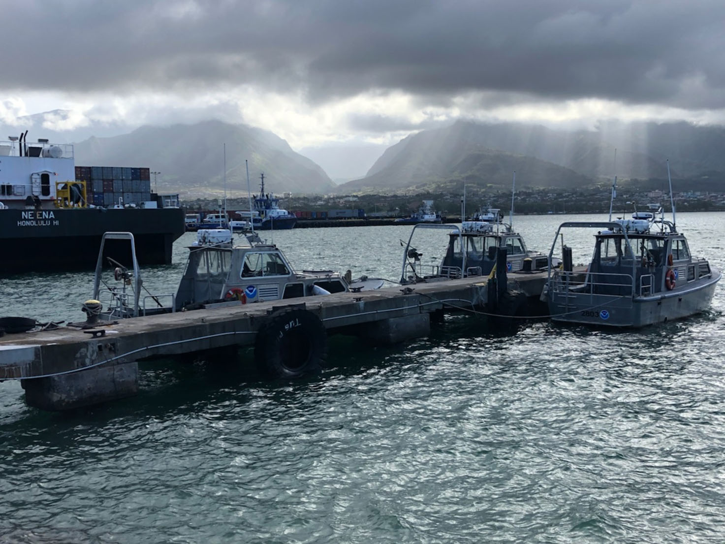
For more than 50 years, NOAA Ship Rainier and its hydrographic survey launches have surveyed the Pacific seafloor. During this time, Rainier sailed thousands of miles, including the entire U.S. west coast, Alaska, and Hawaii. This year, Rainier expands on its traditional role of hydrographic survey and is supporting dive operations in the Northwest Hawaiian Islands and in the Papahānaumokuākea Marine National Monument. While Rainier is sailing these remote coral atolls, the survey launches — that are usually in its davits and deployed directly from the ship — are tasked to their own surveys around the islands of Maui, Moloka’i, and O’ahu.
Continue reading “Hawaiian island surveys will update nautical charts and support habitat mapping efforts”NOAA releases 2019 hydrographic survey plans
NOAA’s Office of Coast Survey is the nation’s nautical chartmaker, and maintains a suite of more than a thousand nautical charts. Coast Survey is responsible for charting U.S. waters and Great Lakes covering 3.4 million square nautical miles (SNM) of water and 95,000 miles of coastline.
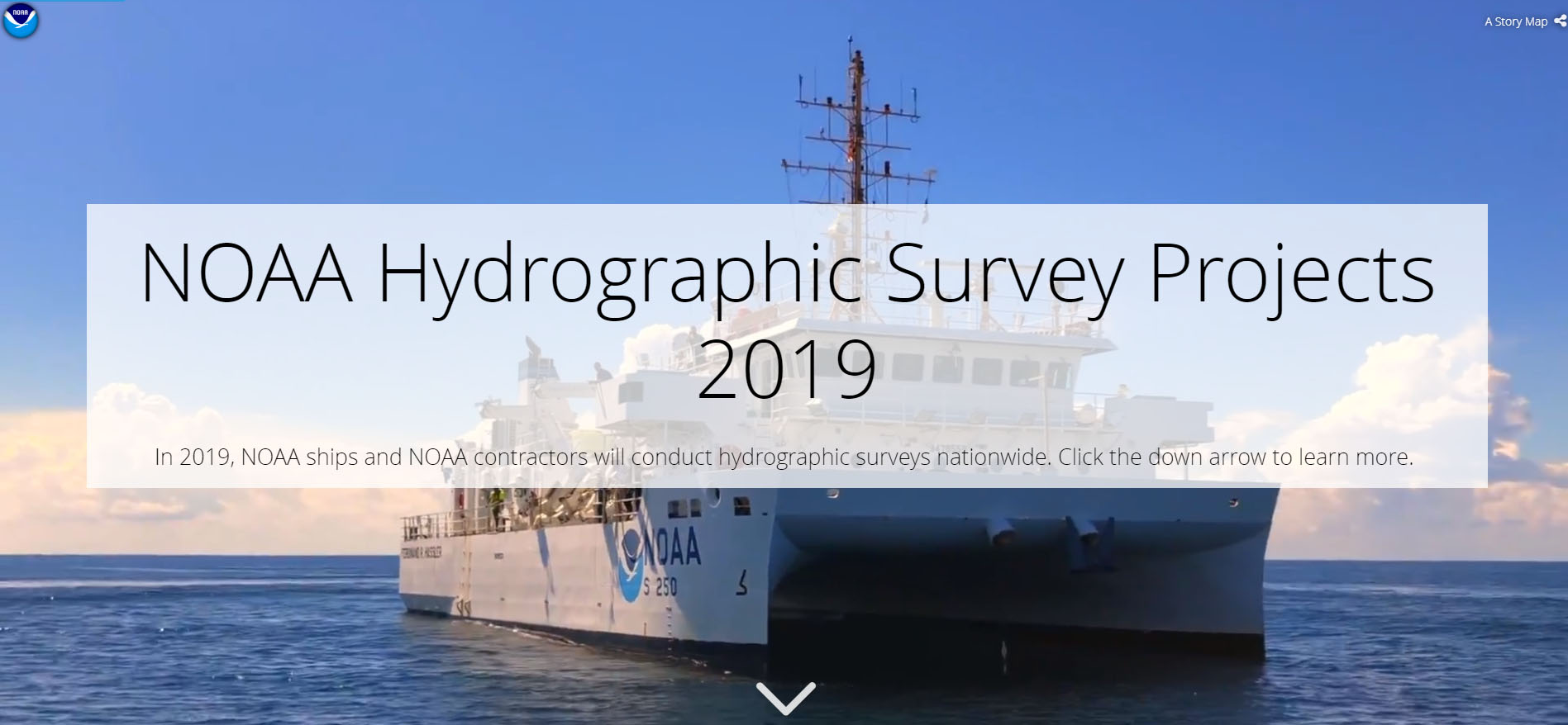
NOAA’s hydrographic survey ships along with hydrographic contractor vessels, recently kicked off the 2019 hydrographic survey season. These surveys not only update the suite of nautical charts, but also help to maintain the safety of maritime commerce, recreational boaters, natural ecosystems, and much more. Operations are scheduled for maritime priority areas around the country and are outlined in Coast Survey’s “living” story map. Here is a list of where they are headed this year:
Continue reading “NOAA releases 2019 hydrographic survey plans”NOAA releases new edition of nautical chart symbol guide

Edition 13 of U.S. Chart No. 1 is now available to download for free on Coast Survey’s website. Paper copies may also be purchased from any of four NOAA Chart No. 1 publishing agents.
This 130-page book describes the symbols, abbreviations, and terms used on paper NOAA nautical charts and for displaying NOAA electronic navigational chart (NOAA ENC®) data on Electronic Chart Display and Information Systems (ECDIS). The document also shows paper chart symbols used by the National Geospatial-Intelligence Agency and symbols specified by the International Hydrographic Organization.
Continue reading “NOAA releases new edition of nautical chart symbol guide”NOAA Improves Etolin Strait Data with New NOAA ENC® Layout
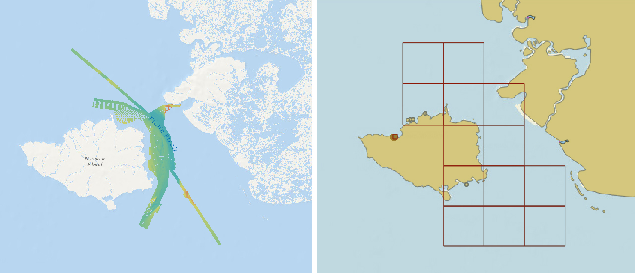
NOAA recently released 13 new large-scale electronic navigational charts (NOAA ENC®) of Etolin Strait, Alaska. These charts provide a nearly twenty-fold increase in scale over the previous ENC coverage. New Etolin Strait hydrographic surveys and the resulting ENCs served as a pilot project for the overall rescheming of the entire NOAA ENC suite with a regular, gridded layout for ENC charts, as outlined in NOAA’s National Charting Plan. No corresponding NOAA raster nautical chart products in Etolin Strait will be produced. This is in keeping with Coast Survey’s “ENC-only” production concept, which generally maintains the current raster chart product coverage, but only creates new larger scale coverage in the ENC product line.
Continue reading “NOAA Improves Etolin Strait Data with New NOAA ENC® Layout”
NOAA announces change in channel depths on raster nautical chart products
NOAA’s Office of Coast Survey recently announced plans to change the U.S. Army Corps of Engineers (USACE) maintained channel depth values on raster nautical chart products, which include paper nautical charts and the corresponding digital raster navigational charts (NOAA RNC®). Minimum depths (also called controlling depths) are collected during periodic USACE sonar surveys of channels. In the past, these depths were provided on raster charts, but controlling depths will now be replaced with the original channel design dredging depths used by the USACE (called project depths). Standardizing depth presentation on these products will improve data consistency and overall safety. Implementation begins in early 2019.
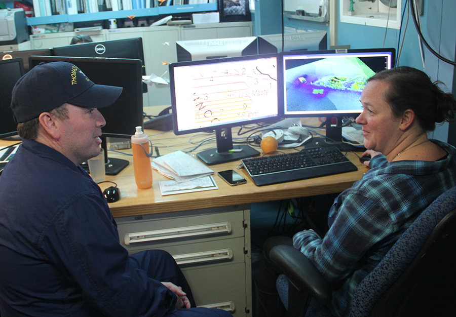
Continue reading “NOAA announces change in channel depths on raster nautical chart products”NOAA Ship Thomas Jefferson presents survey work to Puerto Rico South Coast stakeholders
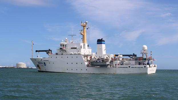
By Cmdr. Chris van Westendorp, Commanding Officer of NOAA Ship Thomas Jefferson
Almost one year following the passage and destruction of Hurricane Maria, NOAA Ship Thomas Jefferson has returned to Puerto Rico. Following the storm, Thomas Jefferson deployed in September 2017 for hydrographic hurricane response work in Puerto Rico and the U.S. Virgin Islands (PR/USVI). The ship and crew surveyed 18 individual port facilities to ensure safety of navigation and help re-open the region for maritime commerce. Thomas Jefferson’s second major project of 2018 has brought the ship back to Puerto Rico from August to November, conducting follow-up survey work along the north and south coasts. Continue reading “NOAA Ship Thomas Jefferson presents survey work to Puerto Rico South Coast stakeholders”
NOAA surveys the unsurveyed, leading the way in the U.S. Arctic
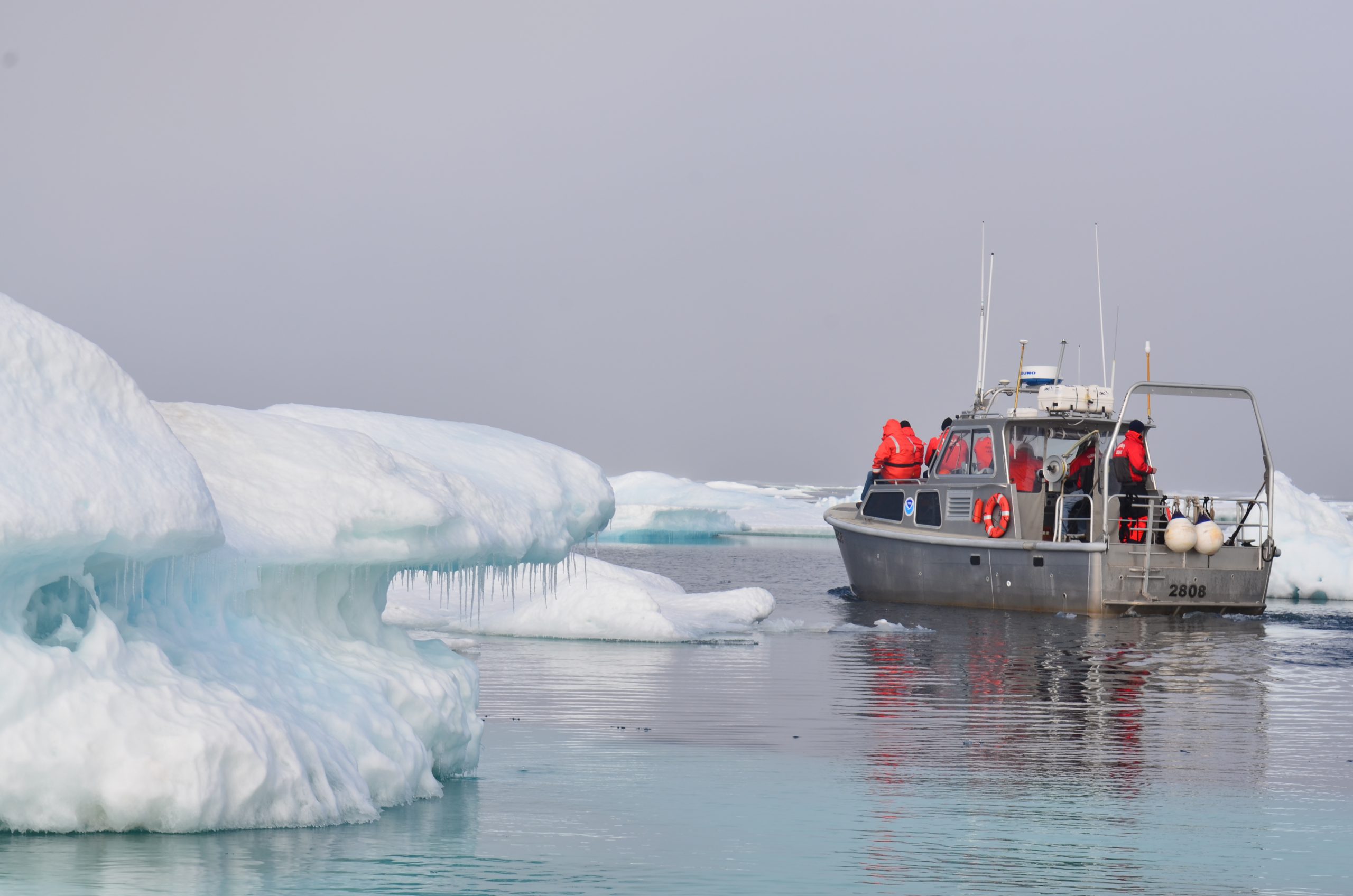
President Thomas Jefferson, who founded Coast Survey in 1807, commissioned Lewis and Clark’s Corps of Discovery Expedition in 1803, the first American expedition to cross the western portion of the contiguous United States. Today there remains a vast western America territory that is largely unknown and unexplored – the U.S. waters off the coast of Alaska. As a leader in ocean mapping, NOAA Coast Survey launches hydrographic expeditions to discover what lies underneath the waves.
Alaska is one-fifth the size of the contiguous United States, and has more than 33,000 miles of shoreline. In fact, the Alaskan coast comprises 57 percent of the United States’ navigationally significant waters and all of the United States’ Arctic territory. Alaskan and Arctic waters are largely uncharted with modern surveys, and many areas that have soundings were surveyed using early lead line technology from the time of Capt. Cook, before the region was part of the United States. Currently only 4.1 percent of the U.S. maritime Arctic has been charted to modern international navigation standards. Continue reading “NOAA surveys the unsurveyed, leading the way in the U.S. Arctic”
Crew of NOAA Ship Rainier surveys Everett, Washington, to update charts
By Lt. j.g. Michelle Levano

As NOAA Ship Rainier underwent repairs in South Seattle, the ship’s survey launches and their crews carried out a project to update nautical charts around the Port of Everett and its approaches in Possession Sound. The boats used state-of-the-art positioning and multibeam echo sounder systems to achieve full bottom coverage of the seafloor.
The ports of Seattle, Tacoma, and Everett have experienced an increase in vessel traffic and capacity within the last decade. The Port of Everett serves as an international shipping port bringing jobs, trade, and recreational opportunities to the city. Across Possession Sound, Naval Station Everett is the homeport for five guided-missile destroyers, and two U.S. Coast Guard cutters. The data collected from this project will support additional military traffic transiting to and from Naval Submarine Base Bangor in addition to the Washington State Ferries’ Mukilteo/Clinton ferry route, commercial and tribal fishing, and recreational boating in the area. Continue reading “Crew of NOAA Ship Rainier surveys Everett, Washington, to update charts”
From seaports to the deep blue sea, bathymetry matters on many scales
By Rear Adm. Shep Smith, director of the Office of Coast Survey
On Thursday, June 21, we celebrate World Hydrography Day. This year’s theme—Bathymetry – the foundation for sustainable seas, oceans and waterways—is very timely as many hydrographic organizations worldwide are focusing on bathymetry at local and global scales. While we work to perfect real-time data and high-resolution bathymetry for ports, we are still working to build a foundational baseline dataset of the global seafloor. Our work at both scales have implications for the local and global economies.
Continue reading “From seaports to the deep blue sea, bathymetry matters on many scales”