NOAA’s Office of Coast Survey maintains the nautical charts and publications for U.S. coasts and the Great Lakes. This is over a thousand charts covering 95,000 miles of shoreline and 3.4 million square nautical miles of waters. Measuring depths and determining new dangers to navigation in this large area is a monumental job given the seafloor is constantly changing.
One of NOAA Coast Survey’s biggest tasks during the winter months is to plan hydrographic survey projects for the coming field season. Survey planners consider requests from stakeholders such as marine pilots, local port authorities, the Coast Guard, and the boating community, and also consider other hydrographic priorities in determining where to survey and when. Continue reading “NOAA releases 2017 hydrographic survey season plans”
Assisting tow industry along Chandeleur Sound Alternate Route
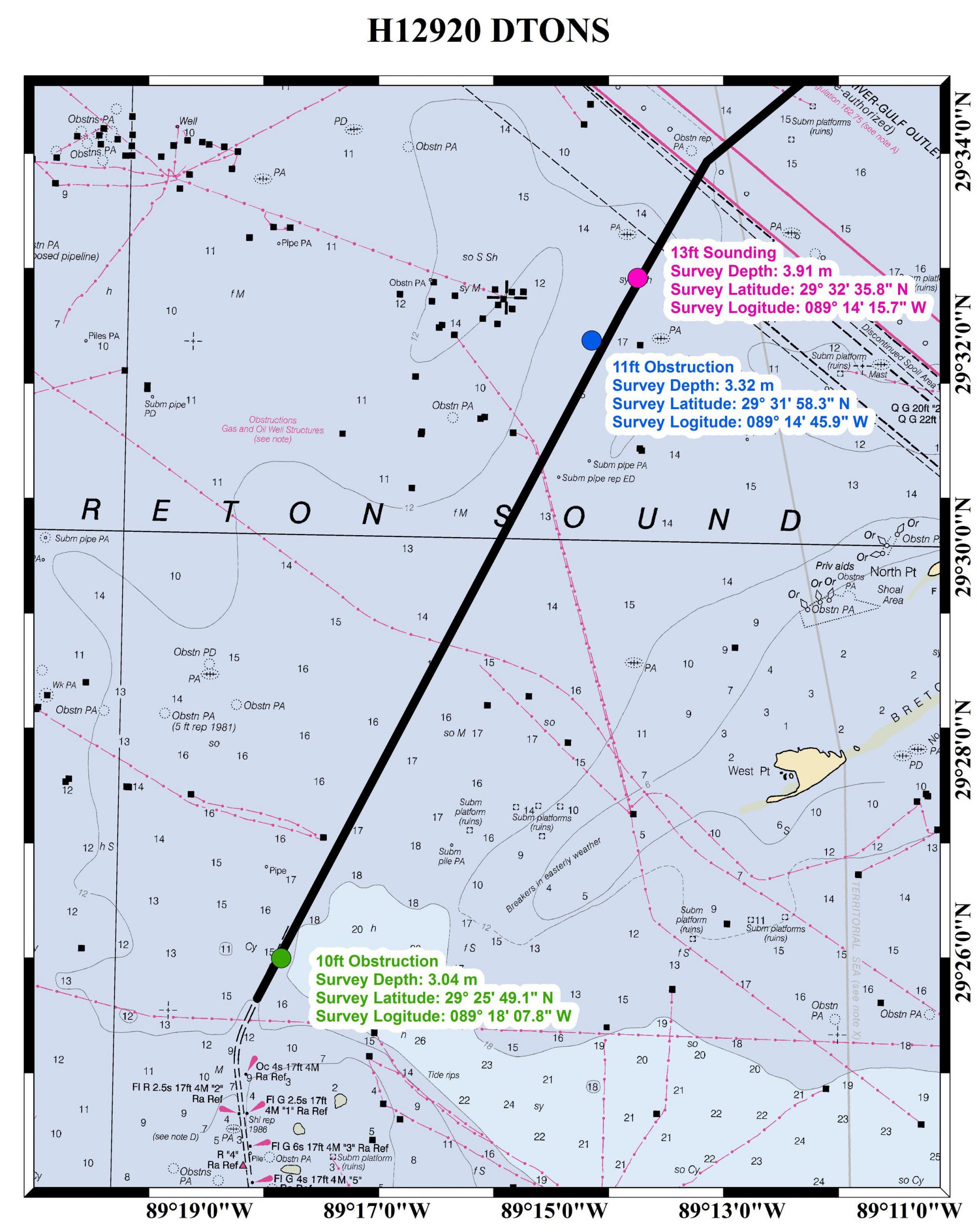
The Inner Harbor Navigation Channel in New Orleans facilitates the transportation of tens of millions of tons of cargo each year. Since the channel was recently closed for repairs, a temporary Chandeleur Sound Alternate Route was established to ensure the flow of commerce between the western and eastern reaches of the Gulf Intracoastal Waterway. NOAA experts assisted with the alternate route development in various ways, collaborating with the U.S. Coast Guard, U.S. Army Corps of Engineers, and the maritime industry.
Continue reading “Assisting tow industry along Chandeleur Sound Alternate Route”
NOAA Coast Survey, Coast Guard, and Army Corps of Engineers schedule public “listening sessions”
Over the past few decades, mariners have witnessed the rapid development, reliability, and availability of e-navigation components, such as the global positioning system (GPS) and electronic chart display and information systems (ECDIS). These systems, and other technology, have fundamentally changed mariners’ reliance on traditional navigation services. In addition, the ability to manage data and information provided to the mariner through the automatic identification system (AIS) and cellular service has enhanced the interconnectivity between shore side information providers and shipboard users. These technological advances and data flow will help the mariner receive data, transmit data, and generally improve bridge resource management, situational awareness, and navigational safety.
Continue reading “NOAA Coast Survey, Coast Guard, and Army Corps of Engineers schedule public “listening sessions””
NOAA navigation response teams improve charts for ships transiting Miami and San Francisco
Coast Survey’s navigation response teams, which are 3-person hydrographic survey teams on small boats, have made a fast start on this year’s survey season.
In Florida, where Coast Survey is preparing to issue a “new and improved” Miami Harbor Chart 11468 to alleviate vessel congestion at the Port of Miami, a navigation response team finished final hydrographic surveys to ensure the new chart has the latest and most accurate depth measurements around several areas identified as critical within the port. In just ten days, team members Erik Anderson, James Kirkpatrick, and Kurt Brown acquired, processed, and submitted the multibeam survey data covering 64 nautical miles.
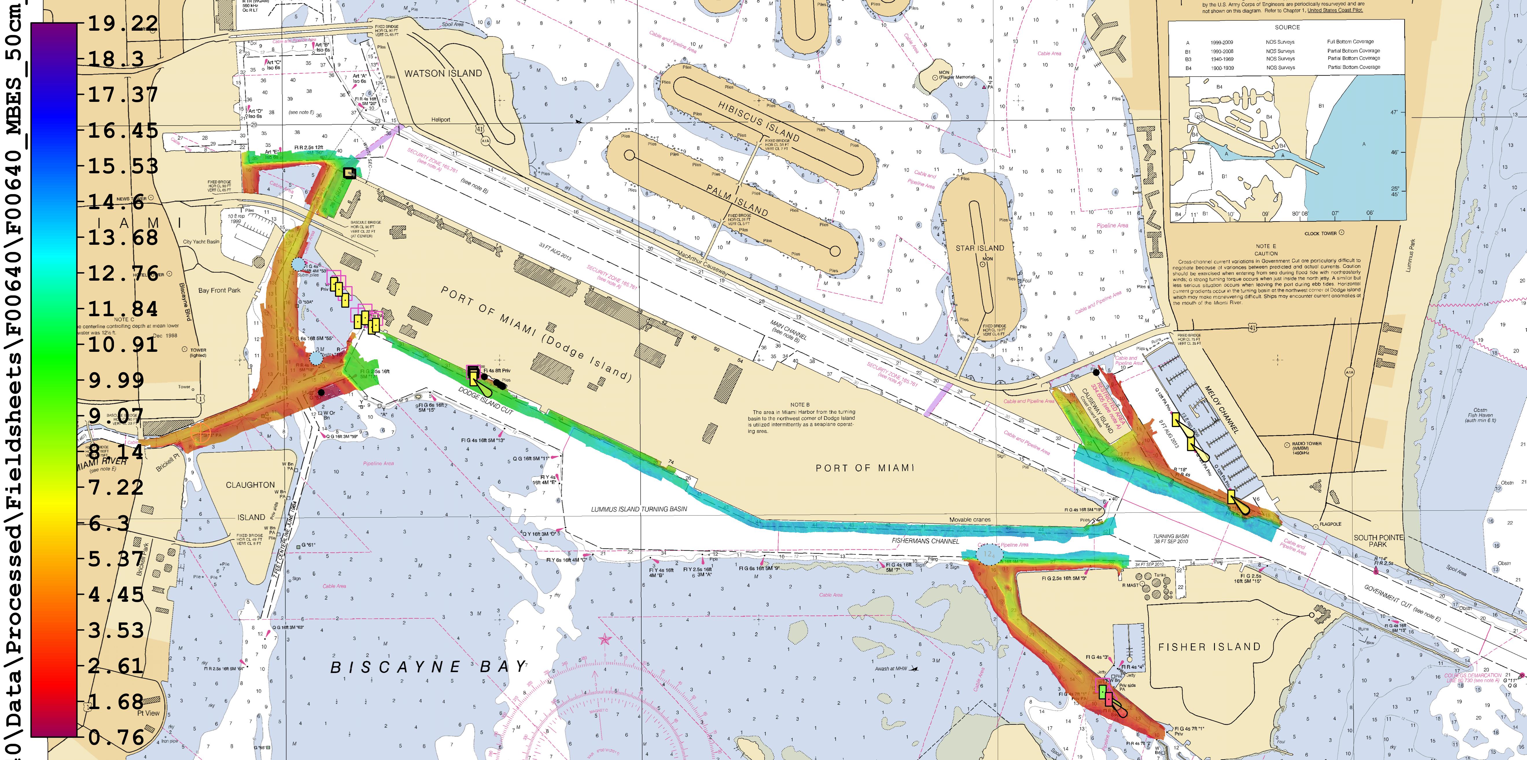
Continue reading “NOAA navigation response teams improve charts for ships transiting Miami and San Francisco”
Great Lakes mariners get new NOAA nautical chart for St. Mary’s River
Vessel operators transiting St. Mary’s River, between Lake Superior and the lower Great Lakes, have a new nautical chart to help lessen the dangers inherent in this narrow and complicated waterway. The first edition of Chart 14887 (St. Marys River – Vicinity of Neebish Island) is available this week as a paper print-on-demand chart, PDF, and raster navigational chart. The electronic navigational chart will be available by March, in time for the beginning of the shipping season. (UPDATE, 2/12/14: NOAA ENC US5MI50 is now available.)
Coast Survey has built the chart from original sources, providing the highest standard of accuracy for hydrographical and topographical features and aids to navigation. The chart provides large-scale (1:15,000) coverage of the up bound and down bound channels of the St. Mary’s River – one of the busiest waterways in the nation. Over 4,100 transits of commercial and government vessels move about 75 million tons of cargo through the 300-day shipping season.
Continue reading “Great Lakes mariners get new NOAA nautical chart for St. Mary’s River”
NOAA and Coast Guard release Cooperative Maritime Strategy
NOAA and the U.S. Coast Guard recently released the Cooperative Maritime Strategy developed by the two agencies. The introduction to the document, signed by Admiral Papp and Dr. Lubchenco, is a stirring testament to our shared legacy and commitment. We reprint that introduction here.
25 February 2013

We are pleased to promulgate our Nation’s first-ever Cooperative Maritime Strategy between the United States Coast Guard and the National Oceanic and Atmospheric Administration. For over 200 years, our Services have stood in partnership on maritime resilience, environmental sustainability, and scientific research. Indeed, America is a maritime nation, and the oceans, coasts, rivers and Great Lakes are the lifeblood of our economy. The maritime commons promote economic growth, advance technology, and challenge the human spirit. Our Services share a legacy and are committed to a future that honors our responsibilities as stewards of the oceans.
Continue reading “NOAA and Coast Guard release Cooperative Maritime Strategy”
What is the future of e-Navigation? CMTS wants to hear from you
The U.S. Committee on the Marine Transportation System, a federal inter-agency partnership that develops national MTS policy, is asking for your ideas on the future of e-navigation.
They’ve set up a unique online site to facilitate the conversation, and they invite anyone with an interest in the U.S. marine transportation system to join the discussion. (Deadline for comments is February 28.) For background, you might want to read the committee’s e-Navigation Strategic Action Plan.
 As defined by the International Maritime Organization (IMO), e-navigation is “the harmonized collection, integration, exchange, presentation, and analysis of maritime information onboard and ashore by electronic means to enhance berth-to-berth navigation and related services for safety and security at sea and protection of the marine environment.”
Continue reading “What is the future of e-Navigation? CMTS wants to hear from you”