It wasn’t just Jefferson. Congress initiated Coast Survey legislation, approved #OTD 210 years ago

On this date in 1807, President Thomas Jefferson approved an act to provide for surveying the coasts of the United States. NOAA has long honored Jefferson — but what of the legislators who saw the need, wrote the bill, and sent it to the president?
On December 15, 1806, Samuel W. Dana (CT) introduced a resolution instructing the House of Representatives’ Committee of Commerce and Manufactures to “inquire into the expediency of making provision for a survey of the coasts of the United States, designating the several islands, with the shoals and roads, or places of anchorage, within twenty leagues of any part of the shores of the United States.” Dana was joined in debate by Jacob Crowninshield (MA-2), the chair of the Committee of Commerce and Manufactures. Continue reading “It wasn’t just Jefferson. Congress initiated Coast Survey legislation, approved #OTD 210 years ago”

What does a zip file have to do with historic slave ship AMISTAD?

History is never completely written. There are always new discoveries, new understanding.
NOAA historian John Cloud recently sent Coast Survey an intriguing report:

Yesterday I was looking for some historic Chesapeake Bay T sheets [topography drafts]…  Anyway, down in the bottom of a folder, there was a zipped file, dated 2009, never unzipped. I thought: well, since I have noticed this now, why don’t I unzip it? It turned out to be two overly rescaled jpgs, but using my Keith Bridge tricks [a technique developed by a former Coast Survey historical chart expert] I found the two full-scale originals. It was one chart, with a small part cut off to make two separate files: the original 1838 hydrography for New Haven Harbour!

Continue reading “What does a zip file have to do with historic slave ship AMISTAD?”

A monumental history

On September 15, 2016, President Obama designated the first marine national monument in the Atlantic Ocean. The Northeast Canyons and Seamounts Marine National Monument includes two areas: one that includes four undersea mountains, called “seamounts” – Bear, Mytilus, Physalia, and Retriever; and an area that includes three undersea canyons – Oceanographer, Lydonia, and Gilbert – that cut deep into the continental shelf. These sea features have monumental histories.

Monuments map, by Leland Snyder, Office of Coast Survey
Coast Survey cartographer Leland Snyder used several data sources to create this map of the Northeast Canyons and Seamounts Marine National Monument.

Continue reading “A monumental history”

Four Gulf of Mexico basins named for officers who led EEZ bathymetric mapping

The U.S. Board on Geographic Names recently named four previously unknown basins in the United States Exclusive Economic Zone (EEZ) in the Gulf of Mexico, honoring retired NOAA officers who mapped the area in the late 1980s and early 1990s. The names — Armstrong Basin, Floyd Basin, Matsushige Basin and Theberge Basin — were proposed by Texas A&M University, based on their new compilation of bathymetry drawn largely from the NOAA multibeam mapping project conducted by now-decommissioned NOAA ships Whiting and Mt. Mitchell.

Newly named Armstrong Basin
A basin in the Gulf of Mexico was named after retired NOAA Captain Andrew Armstrong.

Retired NOAA Capt. Richard P. Floyd was the commanding officer of NOAA Ship Whiting from February 1990 to March 1992; he was followed by retired Capt. Andrew A. Armstrong III, who was CO from February 1992 to January 1994. Retired NOAA Capt. Roy K. Matsushige was commanding officer of NOAA Ship Mt. Mitchell from December 1988 to January 1991, followed by retired Capt. Albert E. Theberge, who served as CO from January to November 1991. The officers led the bathymetric mapping operations under the direction of NOAA’s Office of Charting and Geodetic Services, a predecessor of today’s Office of Coast Survey.
Continue reading “Four Gulf of Mexico basins named for officers who led EEZ bathymetric mapping”

Happy 209th anniversary to the Office of Coast Survey, the oldest federal scientific organization

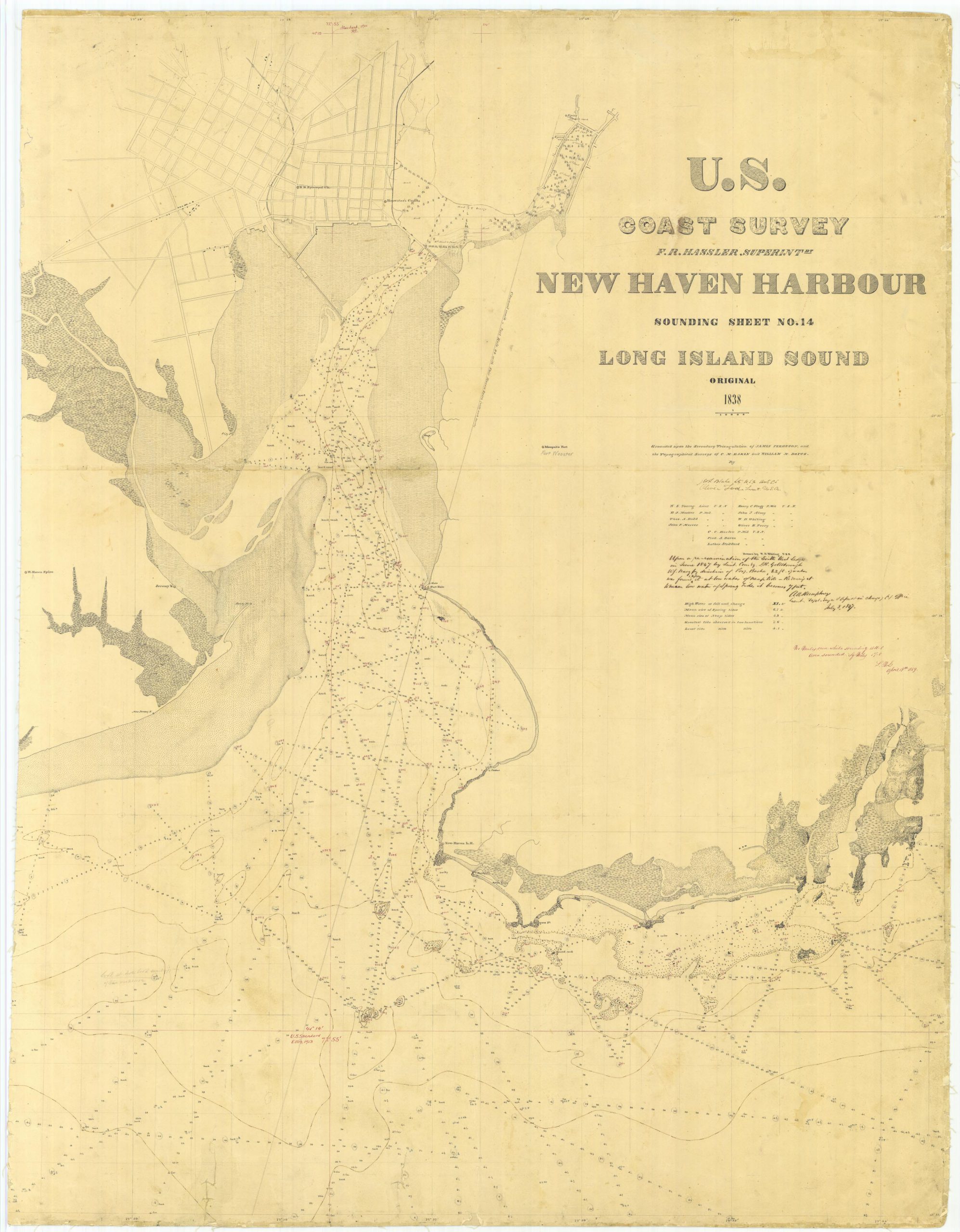
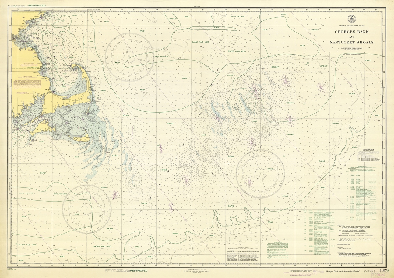
The Office of Coast Survey dates from 1807, when much of the commerce between the states was by coastal shipping. And all foreign trade, especially critical to our prosperity, had to come by ship. With so many ships coming into our ports and harbors, shipwrecks were common, and it was clear the young maritime nation needed accurate nautical charts.

NINTH CONGRESS OF THE UNITED STATES
At the Second Session,
Begun and held at the city of Washington, in the territory of Columbia,
on Monday the first of December, one thousand eight
hundred and six.

AN ACT to provide for surveying the coasts of the United States.

Be it enacted by the Senate and House of Representatives of the United States of America, in Congress assembled, that the president of the United States shall be, and he is hereby authorized and requested, to cause a survey to be taken of the coasts of the United States, in which shall be designated the islands and shoals, with the roads or places of anchorage, within twenty leagues of any part of the shores of the United States; and also the respective courses and distances between the principal capes, or head lands, together with such other matters as he may deem proper for completing an accurate chart of every part of the coasts within the extent aforesaid.
Continue reading “Happy 209th anniversary to the Office of Coast Survey, the oldest federal scientific organization”

Today in WWII history: Adm. Nimitz recognizes Coast & Geodetic Survey assistance in “making possible” Japanese surrender

Adm. Nimitz inscribes photo, expresses appreciation for USC&GS contributions.

On September 2, 1945, the Japanese officially surrendered to end WWII. A photo from the day, showing Admiral Chester Nimitz signing the Japanese surrender document, has his personal message: “To Rear Admiral H. Arnold Karo, USC&GS — with best wishes and great appreciation of the assistance of the U. S. Coast and Geodetic Survey in making possible the above scene. C. W. Nimitz, Fleet Admiral, U. S. Navy.”
Continue reading “Today in WWII history: Adm. Nimitz recognizes Coast & Geodetic Survey assistance in “making possible” Japanese surrender”

What does the age of the survey mean for nautical charts?

Vintage of Alaska survey

Alaska’s nautical charts need to be updated — we all know that. The diagram below shows the vintage of survey data currently used for today’s charts in Alaska. The graphic includes all surveys done by NOAA’s Office of Coast Survey (and its predecessors), and some limited data acquired by other agencies, i.e., the U.S. Coast Guard. Areas that are not colored in have never been surveyed or have data acquired by another source — from Russia or Japan, for instance — before the U.S. was responsible for charting in that area.
Continue reading “What does the age of the survey mean for nautical charts?”

NOAA dedicates memorial at Absecon Lighthouse

Sunday, June 21, was World Hydrography Day, a day set aside to recognize the important work of hydrographers.  Measuring and describing the physical features of oceans, seas, and coastal areas is essential not only to the safe navigation of the everyday mariner, but to our nation’s economic development, security and defense, scientific research, and environmental protection.

Absecon lighthouse with NOAA flag
The NOAA flag flies at the Absecon Lighthouse during the memorial dedication. Photo by David Hall

This year’s observation was particularly noteworthy for NOAA, as we honored the lost crew members of the U.S. Coast Survey Steamer Robert J. Walker, by dedicating a memorial at the Absecon Lighthouse in New Jersey.
On June 21, 1860, the Robert J. Walker was hit by a commercial schooner while transiting from Norfolk to New York after months of surveying in the Gulf of Mexico. The ship sank 12 miles offshore, as they were heading to the Absecon Lighthouse after they were hit. Coast Survey lost twenty crew members that night, and another man died from his injuries the next day, in the largest single loss of life in Coast Survey and NOAA history.
Continue reading “NOAA dedicates memorial at Absecon Lighthouse”