NOAA surveys Lake Champlain for improved flood modeling and mitigation strategies

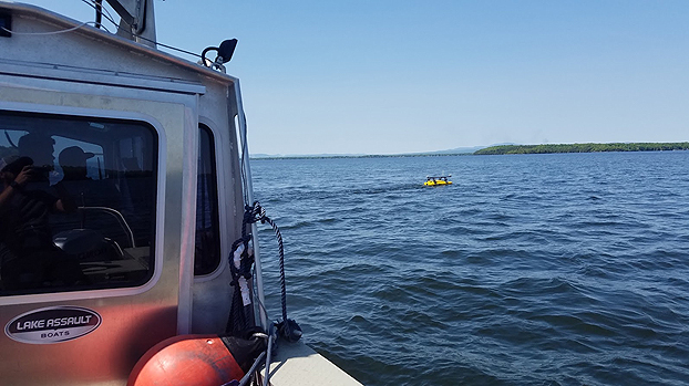
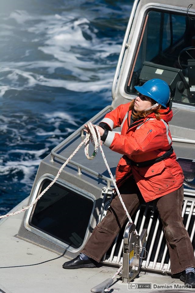
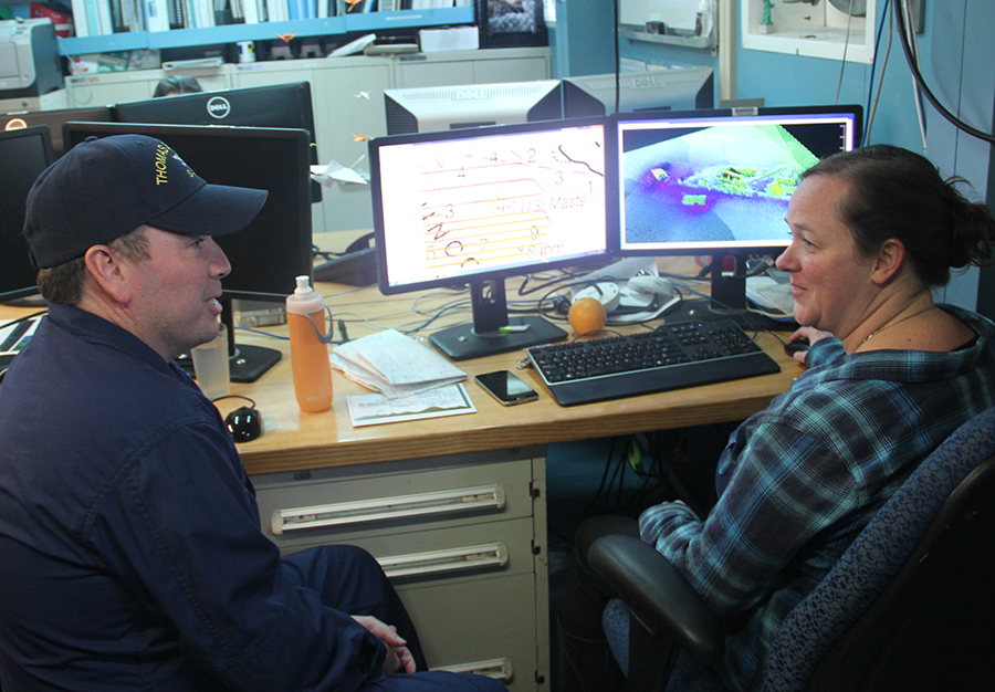
At the request of the NOAA Great Lakes Environmental Research Lab (GLERL), NOAA’s Office of Coast Survey deployed a survey team and a new autonomous surface vehicle (ASV) to gather hydrographic data in and around the narrow causeway inlets that dot the Lake Champlain basin in Vermont. GLERL will use the data to improve flood forecast models and analyze flood mitigation strategies in the Lake Champlain-Richelieu River system as part of a U.S. and Canada study led by the International Joint Commission.
Continue reading “NOAA surveys Lake Champlain for improved flood modeling and mitigation strategies”

Coast Survey spotlight: Meet Starla Robinson

Starla Robinson served as a crew member on the NOAA Ship Rainier. Photo credit: Lt. Damian Manda, NOAA Corps

Ever wonder what it’s like to be a member of the NOAA Coast Survey team? We will use the Coast Survey spotlight blog series as a way to periodically share the experiences of Coast Survey employees as they discuss their work, background, and advice.


Starla Robinson, Physical Scientist

The work we do has real value and every sounding takes a team of professionals from multiple disciplines. I like being a part of something greater.

Continue reading “Coast Survey spotlight: Meet Starla Robinson”

From seaports to the deep blue sea, bathymetry matters on many scales

By Rear Adm. Shep Smith, director of the Office of Coast Survey

On Thursday, June 21, we celebrate World Hydrography Day. This year’s theme—Bathymetry – the foundation for sustainable seas, oceans and waterways—is very timely as many hydrographic organizations worldwide are focusing on bathymetry at local and global scales. While we work to perfect real-time data and high-resolution bathymetry for ports, we are still working to build a foundational baseline dataset of the global seafloor. Our work at both scales have implications for the local and global economies.
Continue reading “From seaports to the deep blue sea, bathymetry matters on many scales”

NOAA announces launch of crowdsourced bathymetry database

The crowdsourced bathymetry database, displayed in the IHO Data Centre for Digital Bathymetry Data Viewer, has an updated user interface.

By Lt. Cmdr. Adam Reed, Integrated Oceans and Coastal Mapping (IOCM) assistant coordinator

Today NOAA announces the end of a testing phase in the development of a new crowdsourced bathymetry database. Bathymetric observations and measurements from participants in citizen science and crowdsourced programs are now archived and made available to the public through the International Hydrographic Organization (IHO) Data Centre for Digital Bathymetry (DCDB) Data Viewer. The operationalized database allows free access to millions of ocean depth data points, and serves as a powerful source of information to improve navigational products.
Continue reading “NOAA announces launch of crowdsourced bathymetry database”

NOAA navigation response team investigates hazardous shoal off Rockaway Point, NY

Recently, NOAA navigation response team 5 (NRT5), responded to a survey request from U.S. Coast Guard (USCG) Sector New York following several groundings near Rockaway Point in Queens, New York. Waves and currents often influence the size and shape of nearshore sandbars, and the USCG was concerned that a sandbar may have expanded beyond the area depicted on the nautical chart. Lt. j.g. Dylan Kosten, Eli Smith, and Michael Bloom traveled from New London, Connecticut, to Jersey City, New Jersey, to launch their vessel and start the survey of the area.
Continue reading “NOAA navigation response team investigates hazardous shoal off Rockaway Point, NY”

NOAA ships Fairweather and Rainier mark 50 years of service and survey

NOAA ships Rainier and Fairweather.

To recognize the successful history of NOAA ships Fairweather and Rainier, as well as the professional mariners, hydrographers, and commissioned officers who have served aboard these ships for the last 50 years, NOAA hosted a ceremony and public ship tours at the Marine Operations Center – Pacific (MOC-P) in Newport, Oregon. Continue reading “NOAA ships Fairweather and Rainier mark 50 years of service and survey”

Take a 360 tour of NOAA Ship RAINIER

In celebration of 50 years of survey and service to the nation, NOAA ships Rainier and Fairweather—two of NOAA’s hydrographic survey vessels—will be opening their doors and hosting public ship tours. Since we understand that many of you are unable to be in Newport, Oregon, the afternoon of March 22 to take a tour in person, we are bringing the tour to you! The following 20 images offer a 360 degree view of the interior and exterior of NOAA Ship Rainier. The images were taken last field season on the survey operations mission to Channel Islands, California. From the crew mess and engine room to a view from the bow, we have captured it all.
Continue reading “Take a 360 tour of NOAA Ship RAINIER”

Surveyor Spotlight: NOAA navigation response team member, Erin Diurba

Erin Diurba, hydrographic surveyor on NOAA navigation response team 4, homeported in Galveston, Texas.

Have you ever wondered what it is like to work on a NOAA navigation response team (NRT) or what makes our team members experts in their field?
The Office of Coast Survey deploys NRTs across the country to conduct emergency hydrographic surveys requested by the U.S. Coast Guard, port officials, and other first responders in the wake of accidents and natural events that create navigation hazards. In their day‐to‐day, non‐emergency role, the NRTs work in the nation’s busiest ports, surveying for dangers to navigation and updating nautical chart products.
Meet Erin Diurba, a NOAA navigation response team member homeported in Galveston, Texas. Her self-described “survey wanderlust” has taken her across the globe to gain hydrographic surveying expertise on diverse teams and in unique environments. She tells her story here in this story map. Continue reading “Surveyor Spotlight: NOAA navigation response team member, Erin Diurba”

NOAA Office of Coast Survey wraps up a busy 2017 hurricane season

The 2017 Atlantic hurricane season was powerful, with the strongest storms occurring consecutively from late August to early October. The sequential magnitude of four hurricanes in particular—Harvey, Irma, Maria, and Nate—made response efforts challenging for NOAA’s Office of Coast Survey. Coast Survey summarized this season’s response efforts along with the efforts of NOAA Ship Thomas Jefferson (operated by NOAA’s Office of Marine and Aviation Operations) in the following story map. Continue reading “NOAA Office of Coast Survey wraps up a busy 2017 hurricane season”

Echo sounder encounter: NOAA Ship Rainier finds uncharted shipwreck

By Katy Pridgen

In late spring, while surveying off the coast of Long Island in Kodiak, Alaska, NOAA Ship Rainier found an uncharted shipwreck. Although rocks around the shipwreck were previously charted, this sunken vessel is a new feature. What made the find unique was how the top of wreck’s mast resembled a yellow light at the water’s surface. The Rainier crew fondly nicknamed it “ET’s finger.” Continue reading “Echo sounder encounter: NOAA Ship Rainier finds uncharted shipwreck”