NOAA ship readies for historic deployment to the Western Pacific to map the oceans

NOAA Ship Rainier in the Papahānaumokuākea Marine National Monument.

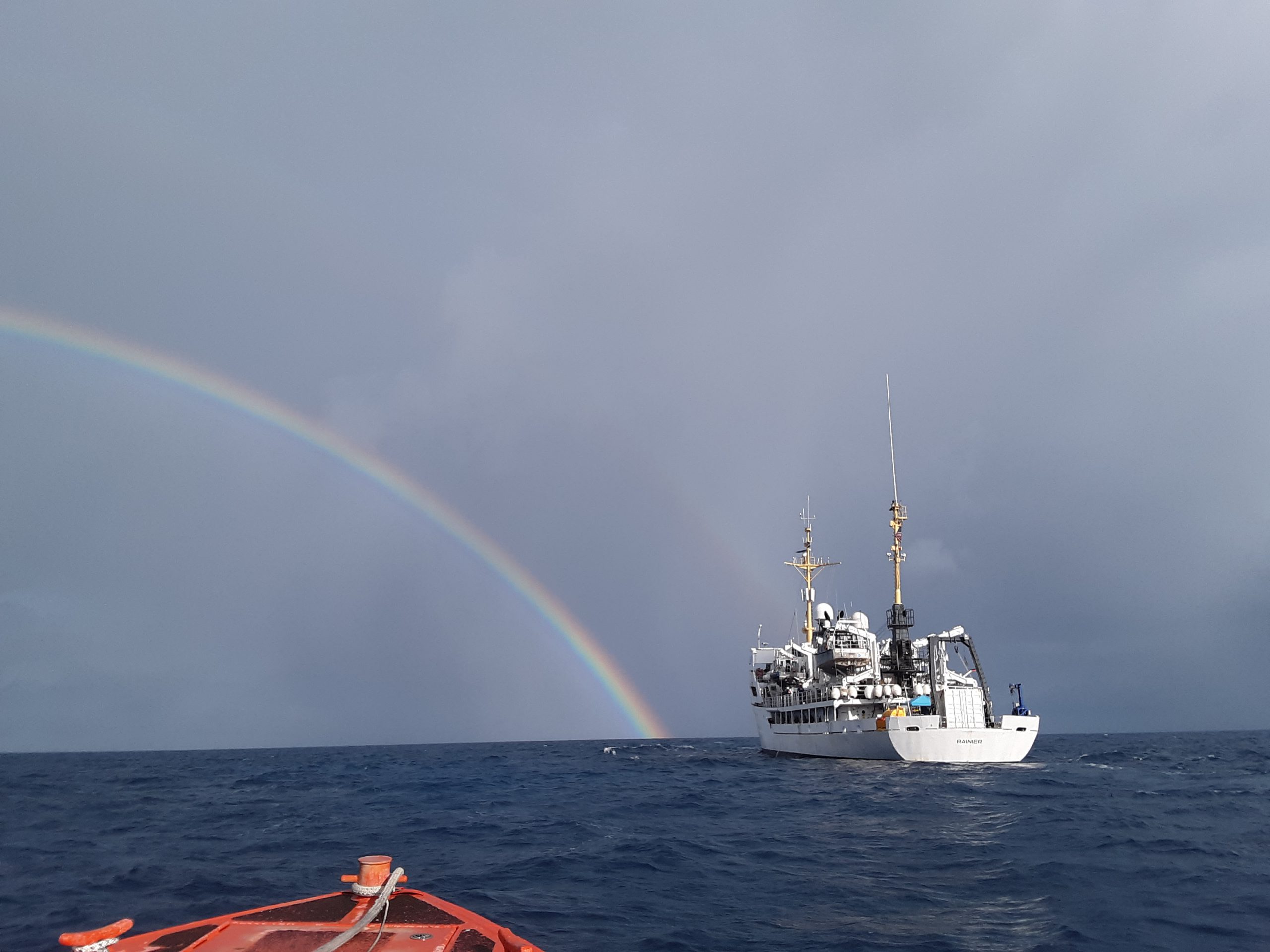
In three weeks, NOAA Ship Rainier will depart on the farthest journey of its 52-year history as it embarks on a multidisciplinary mapping trip to the Western Pacific. Rainier and a diverse team of scientists on board will map the waters from shore to almost 2000 meters deep around Guam and the Commonwealth of the Northern Mariana Islands including Saipan, Rota, and Tinian. The data and observations collected will support safe navigation, coral habitat and fisheries conservation, and storm surge and tsunamis modeling. The data will also be made available to those at the local level and contribute to the larger national and global initiatives regarding comprehensive seafloor mapping.

Continue reading “NOAA ship readies for historic deployment to the Western Pacific to map the oceans”

NOAA releases 2020 hydrographic survey season plans

NOAA 2020 Hydrographic Survey Season Story Map Cover

NOAA hydrographic survey ships and contractors are preparing for the 2020 hydrographic survey season. The ships collect bathymetric data (i.e. map the seafloor) to support nautical charting, modeling, and research, but also collect other environmental data to support a variety of ecosystem sciences. NOAA considers hydrographic survey requests from stakeholders such as marine pilots, local port authorities, the Coast Guard, and the boating community, and also consider other hydrographic  and NOAA science priorities in determining where to survey and when. Visit our “living” story map to find out more about our mapping projects and if a hydrographic vessel will be in your area this year!

Continue reading “NOAA releases 2020 hydrographic survey season plans”

NOAA supports safe ferry transit in Puget Sound

NRT-Seattle with the F/V Salish.

By Lt. j.g. Michelle Levano

If you have spent time on the water in Puget Sound, you have probably seen the large, distinct green and white vessels. These vessels move passengers, vehicles, and cargo across Puget Sound to the San Juan Islands and to Victoria, Canada, year round. They are a part of the Washington State Department of Transportation ferry system. The state has been operating ferries since 1951, and intended to run the ferry service until cross Sound bridges could be built.  These bridges were never built, and the state continues to operate the ferries to this day. As of last July, there are 22 state-operated ferries on Puget Sound, with the largest vessel able to carry 2500 passengers and 202 vehicles. 

Continue reading “NOAA supports safe ferry transit in Puget Sound”

Hawaiian island surveys will update nautical charts and support habitat mapping efforts

Three of Rainier’s hydrographic survey launches moored in Kahului Harbor, Maui.

By Ens. Lyle I. Robbins

For more than 50 years, NOAA Ship Rainier and its hydrographic survey launches have surveyed the Pacific seafloor. During this time, Rainier sailed thousands of miles, including the entire U.S. west coast, Alaska, and Hawaii. This year, Rainier expands on its traditional role of hydrographic survey and is supporting dive operations in the Northwest Hawaiian Islands and in the Papahānaumokuākea Marine National Monument. While Rainier is sailing these remote coral atolls, the survey launches — that are usually in its davits and deployed directly from the ship — are tasked to their own surveys around the islands of Maui, Moloka’i, and O’ahu.

Continue reading “Hawaiian island surveys will update nautical charts and support habitat mapping efforts”

NOAA completes hydrographic surveys following Hurricane Barry

Lt. j.g. Patrick Lawler and Lt. j.g. Michelle Levano remove the side scan sonar from the water.

By Lt. j.g. Michelle Levano

Seven tropical cyclones in the Atlantic Ocean have been named Barry, with the first storm making landfall in 1983. In 2019, Hurricane Barry reached Category 1 status on July 13, becoming the first hurricane of the 2019 season. 

On July 11, Office of Coast Survey’s Gulf Coast Navigation Manager, Tim Osborn, received requests from U.S. Coast Guard, U.S. Army Corps of Engineers, and local ports for resources to confirm navigational depths in Louisiana waters. Once a navigation manager receives requests for hydrographic surveys, Coast Survey formulates logistics to complete these requests. In the case of Hurricane Barry, Coast Survey’s navigation response team (NRT)- Stennis mobilized to respond to Port Fourchon, Louisiana’s southernmost port. Port Fourchon supports significant petroleum industry traffic coming in from the Gulf of Mexico, furnishing about 18% of the U.S. oil supply

Continue reading “NOAA completes hydrographic surveys following Hurricane Barry”

NOAA releases 2019 hydrographic survey plans

NOAA Hydrographic Survey Projects 2019 story map cover

NOAA’s Office of Coast Survey is the nation’s nautical chartmaker, and maintains a suite of more than a thousand nautical charts. Coast Survey is responsible for charting U.S. waters and Great Lakes covering 3.4 million square nautical miles (SNM) of water and 95,000 miles of coastline.

NOAA’s hydrographic survey ships along with hydrographic contractor vessels, recently kicked off the 2019 hydrographic survey season. These surveys not only update the suite of nautical charts, but also help to maintain the safety of maritime commerce, recreational boaters, natural ecosystems, and much more. Operations are scheduled for maritime priority areas around the country and are outlined in Coast Survey’s “living” story map. Here is a list of where they are headed this year:

Continue reading “NOAA releases 2019 hydrographic survey plans”

Seismic inter-agency collaborations on NOAA Ship Rainier

Rainier crew practice deploying the Edgetech Sub-bottom 512 Chirp profiler

By Ensign Airlie Pickett, NOAA

NOAA Ship Rainier spent September completing a multi-leg, joint collaboration project investigating deep offshore areas of the southern California coast. The U.S. Geological Survey (USGS) and Bureau of Ocean Energy Management (BOEM) partnered with NOAA to support a month-long mission to collect geophysical data along the outer continental shelf of California where the area in question features a number of different geologic structures and processes. Continue reading “Seismic inter-agency collaborations on NOAA Ship Rainier”

Coast Survey prepares to serve nation during 2018 hurricane season

“But, sir, what does the country want in the coast survey? They want a very useful work done, a very important work done, and they want it done in the best manner.” U.S. Senator John Davis (MA), 1849, explaining the importance of the coast survey to safety and the U.S. economy during the 30th Congress, 2nd Session
As the nation’s nautical chartmaker, NOAA Coast Survey provides critical emergency response information to coastal communities and waterways. Each year, Coast Survey prepares for hurricane season in order to perform the work in—as the late Senator Davis put it—“the best manner.” Last year’s string of powerful hurricanes underscored the importance of coordinated efforts for storm preparation, response, and recovery. With the official start of the 2018 hurricane season just around the corner, Coast Survey’s regional navigation managers spent the large part of April and May meeting with U.S. Coast Guard (USCG), port authorities, NOAA National Weather Service, and communities to prepare emergency response capabilities. Continue reading “Coast Survey prepares to serve nation during 2018 hurricane season”

NOAA adds grid overlay to chart anchorage areas in Port of New York and New Jersey

A grid overlay of anchorage grounds in the updated Port of New York and New Jersey ENCs, US5NY19M and US5NY1CM

NOAA Coast Survey recently released updates for two NOAA electronic navigational charts (NOAA ENC®) in the Port of New York and New Jersey, which added a permanent grid system overlay to anchorages in Bay Ridge, Graves End, and Stapleton. Coast Survey performed the update at the request of the Harbor Operations Steering Committee and collaborated with the Sandy Hook Pilots Association and U.S. Coast Guard (USCG) Sector New York’s Vessel Traffic Services (VTS). 
Continue reading “NOAA adds grid overlay to chart anchorage areas in Port of New York and New Jersey”