Coast Survey’s mobile integrated survey team goes to Antarctica

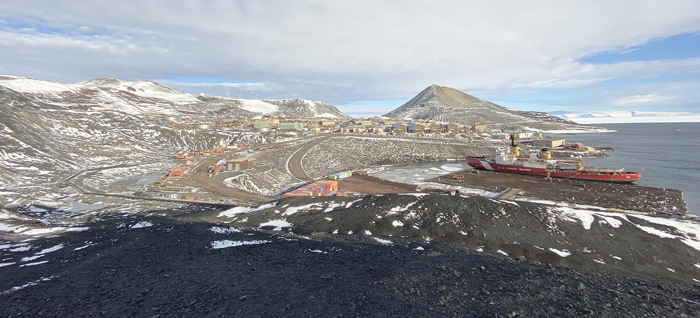
An image of the United States Coast Guard cutter Polar Star docked at McMurdo Station ice pier on a relatively ice free day for Winter Quarters Bay.
By, Annie Raymond

In 1959, following the International Geophysical Year of 1957-58, scientists from twelve nations conducting active research in Antarctica came together and signed the Antarctic Treaty. In the years following, 42 additional countries acceded to the treaty. The treaty preserves the entire continent and surrounding waters solely for purposes of peaceful scientific collaboration and bans resource extraction and military activity. McMurdo Station on Ross Island, operated by the United States through the United States Antarctic Program, a branch of the National Science Foundation (NSF), has emerged as the largest year-round station and primary logistics hub for the region. The first U.S. Operation Deep Freeze happened prior to and in support of the International Geophysical Year of 1957-58. Since then, Operation Deep Freeze has continued annually and has become the name for supply sealift missions to McMurdo, delivering fuel, food, and supplies to scientists in Antarctica.

Continue reading “Coast Survey’s mobile integrated survey team goes to Antarctica”
Aid to navigation recovery operations with NOAA’s Navigation Response Branch and the U.S. Coast Guard

Flushing Bay Channel Lighted Buoy 3 was struck by a tug and barge in late July, and was reported sunk immediately following the strike. The buoy marks the entrance to a channel frequented by commercial barge traffic, specifically, loaded fuel barges bound for LaGuardia International Airport. The Navigation Response Branch (NRB) was called upon in early August to assist United States Coast Guard (USCG) Sector New York in locating the sunken buoy in Flushing Bay, New York.

Continue reading “Aid to navigation recovery operations with NOAA’s Navigation Response Branch and the U.S. Coast Guard”

By the Numbers: Coast Survey’s 2020 Atlantic Hurricane Season

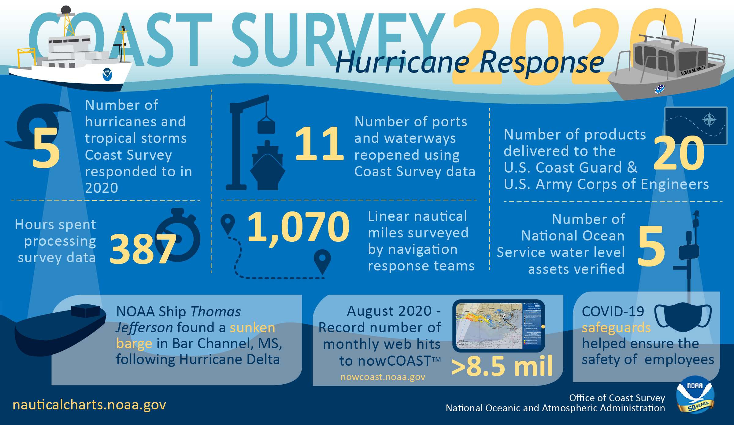
NOAA Office of Coast Survey 2020 hurricane season infographic

As the 2020 Atlantic hurricane season came to a close on November 30, NOAA’s Office of Coast Survey tallied a few numbers to see what the combined response effort of the navigation response teams, NOAA Ship Thomas Jefferson, and hydrographic survey contractor David Evans & Associates, Inc., looked like.  

Continue reading “By the Numbers: Coast Survey’s 2020 Atlantic Hurricane Season”

NOAA concludes hydrographic survey response following Hurricane Delta

NOAA Ship Thomas Jefferson Launch 2904 surveying the Bar Channel, Calcasieu, Louisiana Approach.

This week NOAA’s Office of Coast Survey concluded its hydrographic survey response following Hurricane Delta. At the immediate request of the U.S. Army Corps of Engineers (USACE), NOAA’s navigation response teams (NRTs) and NOAA Ship Thomas Jefferson surveyed areas within the Gulf Intracoastal Waterway (GIWW), Calcasieu Ship Channel, and the entrance to the channel. With lessons learned from the response to Hurricane Laura — the first major hurricane of the 2020 season and the first hurricane response during a pandemic — the teams and Thomas Jefferson successfully collected, processed, and delivered data to the USACE, identifying significant hazards to navigation and helping to ensure the timely reopening of waterways.

Continue reading “NOAA concludes hydrographic survey response following Hurricane Delta”

NOAA navigation response teams complete hydrographic surveys following Hurricane Laura

Lt. John Kidd operates the NRT-Stennis vessel in Devil's Elbow.

Hurricane Laura, the first major hurricane of the 2020 Atlantic Hurricane Season, made landfall over Louisiana in the early morning hours of Thursday, August 27. As a Category 4 storm and with maximum sustained winds reaching 150 miles per hour, it caused significant damage along the Gulf coasts of Louisiana and southeastern Texas. For NOAA’s Office of Coast Survey –  whose job it is to identify dangers to navigation and help speed the reopening of ports and waterways following severe storms – this marked the first hydrographic survey response effort of the hurricane season.

Continue reading “NOAA navigation response teams complete hydrographic surveys following Hurricane Laura”

NOAA Coast Survey’s new strategy supports charting mandates and broader seafloor mapping

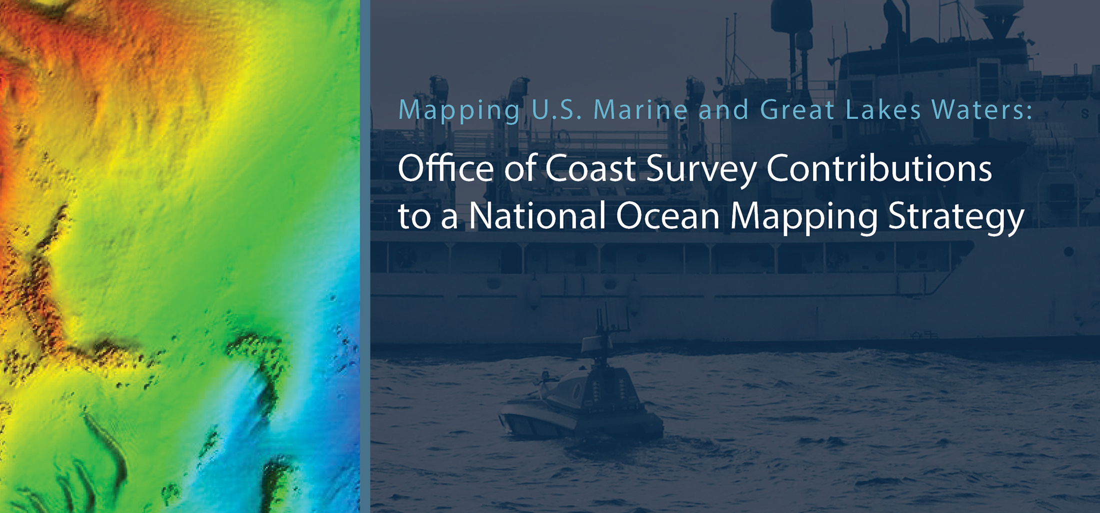
This week, NOAA’s Office of Coast Survey released the Mapping U.S. Marine and Great Lakes Waters: Office of Coast Survey Contributions to a National Ocean Mapping Strategy. This report is part of NOAA’s ongoing commitment to meet core surveying and nautical charting mandates while supporting broader needs to fill gaps in seafloor mapping and environmental sciences.

Continue reading “NOAA Coast Survey’s new strategy supports charting mandates and broader seafloor mapping”

NOAA joins federal and state partners in signing MOU on emergency maritime response in Hawaii

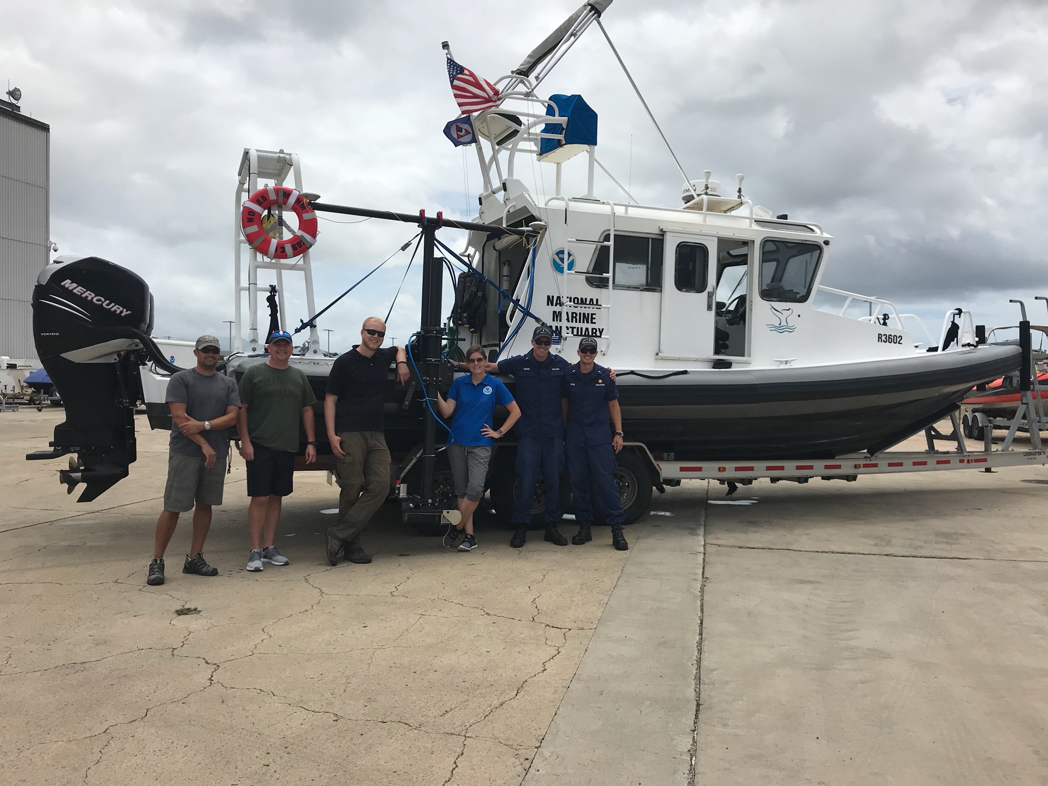
Coast Survey’s hydrographic survey experts along with the Office of National Marine Sanctuary staff are ready to survey Honolulu Channel following Hurricane Lane.

NOAA’s Office of Coast Survey, United States Coast Guard (USCG) Sector Honolulu, State of Hawaii Department of Transportation and United States Army Corps of Engineers (USACE) Honolulu Division established a memorandum of understanding (MOU) outlining each signatory’s area of responsibility in the event of a disaster in the Hawaii region. The intent of the MOU is to improve the efficiency and effectiveness of response efforts and speed the reopening of the ports and waterways following an emergency. 

Continue reading “NOAA joins federal and state partners in signing MOU on emergency maritime response in Hawaii”

NOAA hydrographic community prepares for field season at annual workshop

Attendees of the NOAA 2020 Field Procedures Workshop.

The field of hydrography, like most sciences, is comprised of experts honing their craft, improving their tools, building upon the successes of previous years, and learning from their mistakes. Hydrographers typically accomplish this iterative process in the field, publishing papers, presenting at industry conferences, and often through discussions over the phone or via email. However, once a year, the NOAA hydrographic community — those who measure and describe the features of the seafloor to update nautical charts and support a variety of sciences — meets at the Field Procedures Workshop to not only share information, but have frank discussions about their challenges and the path forward in preparation for the upcoming hydrographic field season.

Continue reading “NOAA hydrographic community prepares for field season at annual workshop”

NOAA responds to bridge damage near Houston following Tropical Depression Imelda

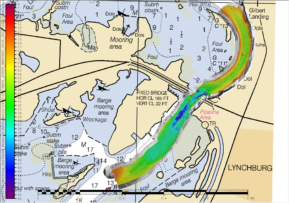
Overview of multibeam and side scan sonar data overlaid on chart 11329.

While many are aware that hurricanes can inflict costly damage when they make landfall, tropical storms and depressions are not to be underestimated. Tropical Depression Imelda moved over the Texas coast in mid-September producing heavy rain and causing extensive flooding. Nine barges broke free from their mooring on the San Jacinto River and two of these barges hit the Interstate 10 bridge in Lynchburg, Texas. At the request of the U.S. Coast Guard Captain of the Port Houston-Galveston, NOAA’s Navigation Response Team (NRT)- Stennis was called in for rapid hydrographic survey response.

Continue reading “NOAA responds to bridge damage near Houston following Tropical Depression Imelda”

NOAA supports safe ferry transit in Puget Sound

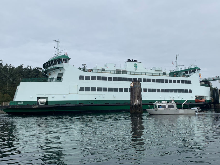
NRT-Seattle with the F/V Salish.

By Lt. j.g. Michelle Levano

If you have spent time on the water in Puget Sound, you have probably seen the large, distinct green and white vessels. These vessels move passengers, vehicles, and cargo across Puget Sound to the San Juan Islands and to Victoria, Canada, year round. They are a part of the Washington State Department of Transportation ferry system. The state has been operating ferries since 1951, and intended to run the ferry service until cross Sound bridges could be built.  These bridges were never built, and the state continues to operate the ferries to this day. As of last July, there are 22 state-operated ferries on Puget Sound, with the largest vessel able to carry 2500 passengers and 202 vehicles. 

Continue reading “NOAA supports safe ferry transit in Puget Sound”