Coast Survey Spotlight: MaryRose Sheldon

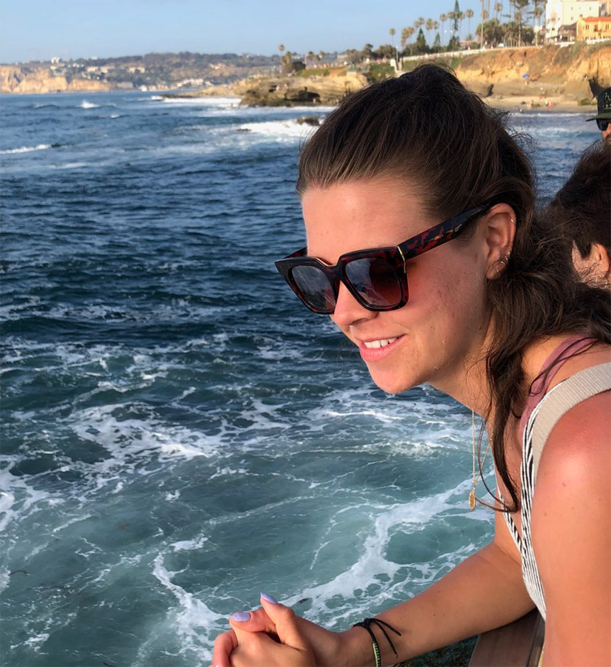
MaryRose Sheldon became attached to the idea of working for NOAA while in college, because the mission and work aligned with her values and passions.

Ever wonder what it’s like to be a member of the NOAA Coast Survey team? We use the Coast Survey spotlight blog series as a way to periodically share the experiences of Coast Survey employees as they discuss their work, background, and advice.


MaryRose Sheldon, marine cartographer

“Mariners use our products to pilot our nation’s waters, and they rely on us to bring attention to obstacles to navigation.”

Continue reading “Coast Survey Spotlight: MaryRose Sheldon”

NOAA ship readies for historic deployment to the Western Pacific to map the oceans

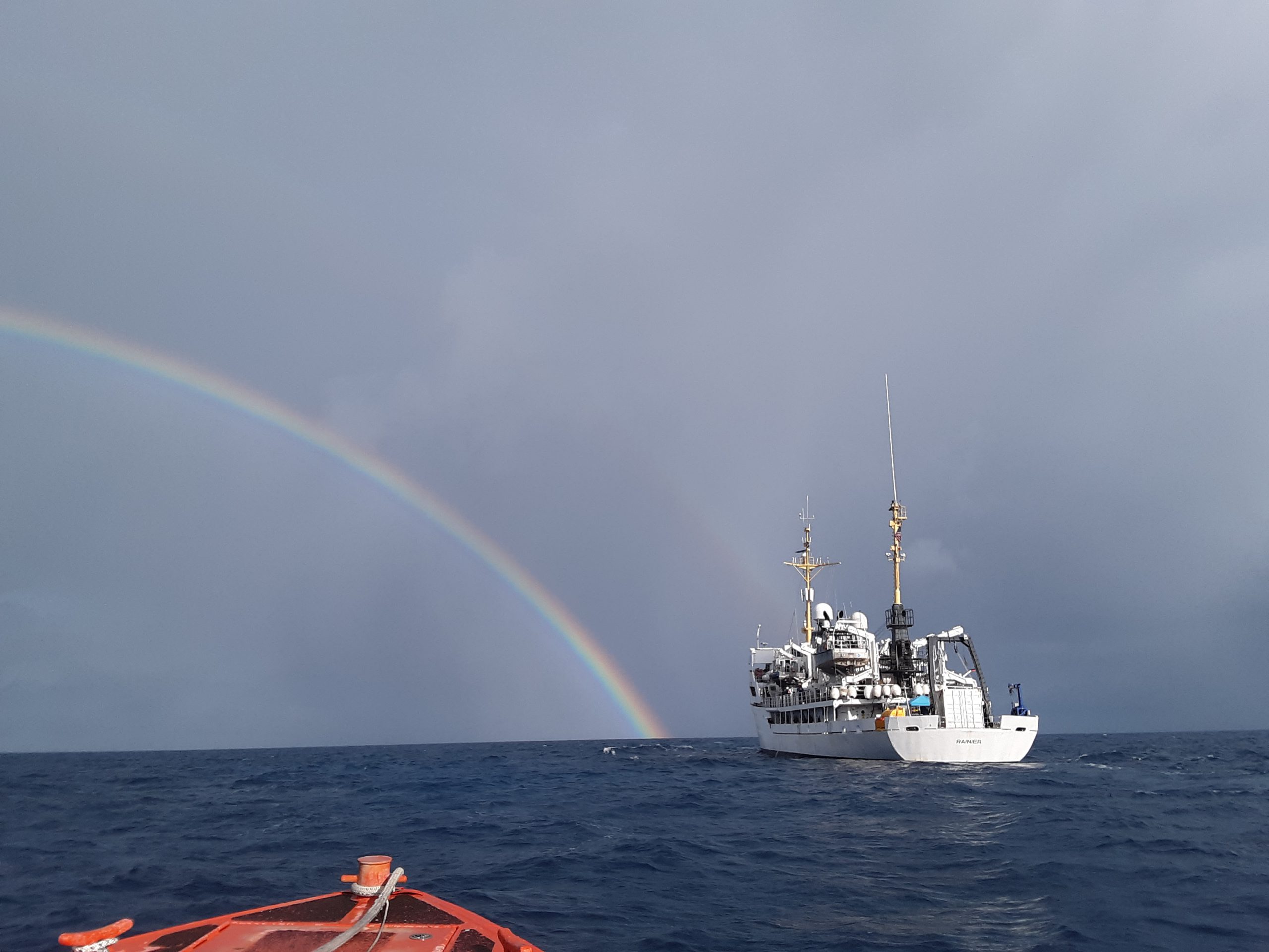
NOAA Ship Rainier in the Papahānaumokuākea Marine National Monument.

In three weeks, NOAA Ship Rainier will depart on the farthest journey of its 52-year history as it embarks on a multidisciplinary mapping trip to the Western Pacific. Rainier and a diverse team of scientists on board will map the waters from shore to almost 2000 meters deep around Guam and the Commonwealth of the Northern Mariana Islands including Saipan, Rota, and Tinian. The data and observations collected will support safe navigation, coral habitat and fisheries conservation, and storm surge and tsunamis modeling. The data will also be made available to those at the local level and contribute to the larger national and global initiatives regarding comprehensive seafloor mapping.

Continue reading “NOAA ship readies for historic deployment to the Western Pacific to map the oceans”

NOAA hydrographic community prepares for field season at annual workshop

Attendees of the NOAA 2020 Field Procedures Workshop.

The field of hydrography, like most sciences, is comprised of experts honing their craft, improving their tools, building upon the successes of previous years, and learning from their mistakes. Hydrographers typically accomplish this iterative process in the field, publishing papers, presenting at industry conferences, and often through discussions over the phone or via email. However, once a year, the NOAA hydrographic community — those who measure and describe the features of the seafloor to update nautical charts and support a variety of sciences — meets at the Field Procedures Workshop to not only share information, but have frank discussions about their challenges and the path forward in preparation for the upcoming hydrographic field season.

Continue reading “NOAA hydrographic community prepares for field season at annual workshop”

NOAA releases 2020 hydrographic survey season plans

NOAA 2020 Hydrographic Survey Season Story Map Cover

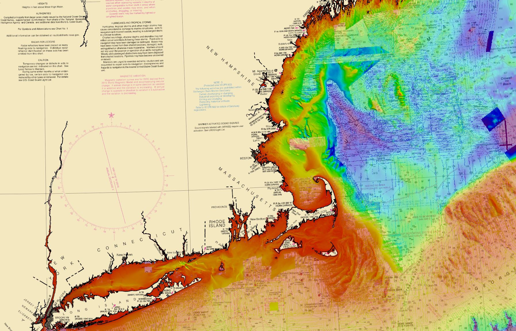
NOAA hydrographic survey ships and contractors are preparing for the 2020 hydrographic survey season. The ships collect bathymetric data (i.e. map the seafloor) to support nautical charting, modeling, and research, but also collect other environmental data to support a variety of ecosystem sciences. NOAA considers hydrographic survey requests from stakeholders such as marine pilots, local port authorities, the Coast Guard, and the boating community, and also consider other hydrographic  and NOAA science priorities in determining where to survey and when. Visit our “living” story map to find out more about our mapping projects and if a hydrographic vessel will be in your area this year!

Continue reading “NOAA releases 2020 hydrographic survey season plans”

NOAA in the Great Lakes supports inter-agency search for WWII aircraft

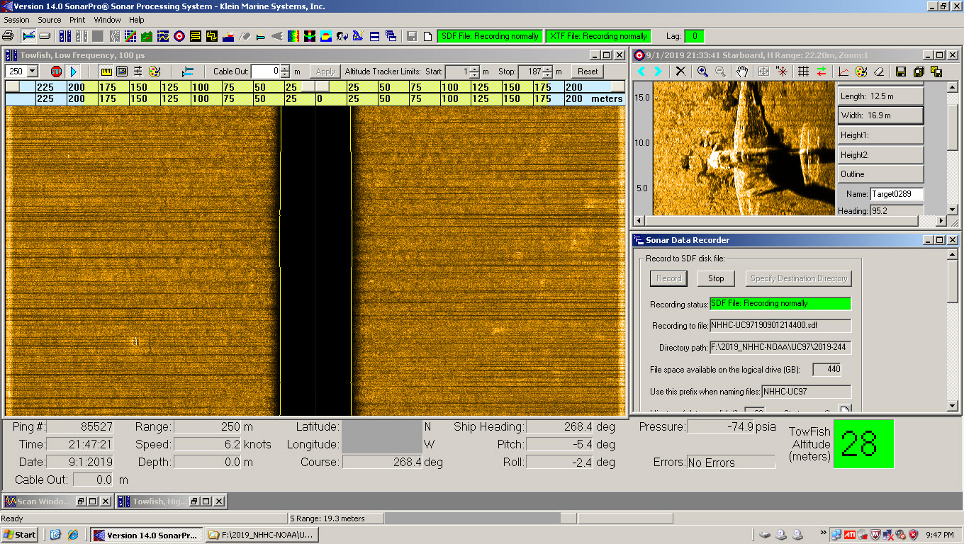
This screenshot of the side scan sonar shows what appears to be the outline of a plane. This target is not yet confirmed by divers.

Did you know that there are about 120 World War II era aircraft lying at the bottom of Lake Michigan? The Navy used these aircraft to train and certify pilots to take off and land from aircraft carriers during World War II. U.S. Naval operations along Lake Michigan, one of the Great Lakes, began in 1923. Between 1923 and 1942, operations expanded as the Navy built hangars, airfields, and landing strips across the village of Glenview, Illinois. By 1942, the Navy had a robust presence on the shores of Lake Michigan. With the U.S. entrance into World War II, the Navy needed a location to train carrier pilots. The growing threat of enemy vessels and mines along the Pacific and Atlantic coastlines and an already strong Naval presence in the area made Lake Michigan the safest location for carrier training. 

Continue reading “NOAA in the Great Lakes supports inter-agency search for WWII aircraft”

Register for NOAA Nav-cast webinar: How to obtain NOAA ENC-based paper nautical charts

Join us for our next NOAA Nav-cast, a quarterly webinar series that highlights the tools and trends of NOAA navigation services.

How to obtain NOAA ENC-based paper nautical charts after NOAA ends production of traditional paper charts

Recently, NOAA announced the start of a five-year process to end traditional paper nautical chart production.  While NOAA is sunsetting its traditional nautical chart products, it is undertaking a major effort to improve the data consistency and provide larger scale coverage within its electronic navigational chart (NOAA ENC®) product suite. Over the next five years, NOAA will work to ease the transition to ENC-based products, such as providing access to paper chart products based on ENC data. The online NOAA Custom Chart prototype application enables users to create their own charts from the latest NOAA ENC data. Users may define the scale and paper size of custom-made nautical charts centered on a position of their choosing. Users may then download, view, and print the output. The application is an easy way to create a paper or digital backup for electronic chart systems.

This webcast will provide an overview of the sunsetting process and a live demonstration of the NOAA Custom Chart prototype, including a discussion of the improvements that are planned for the prototype.

Date and time: Thursday, January 9, 2020, at 2 p.m. (EST)
How to register:  https://attendee.gotowebinar.com/register/7410207397804043779

Coast Survey Spotlight: Meet Rick Powell


Ever wonder what it’s like to be a member of the NOAA Coast Survey team? We use the Coast Survey spotlight blog series as a way to periodically share the experiences of Coast Survey employees as they discuss their work, background, and advice.


Rick Powell, cartographer

“The Coast Pilot is a supplement to the chart, and eventually the electronic navigational chart… This helps ensure that our knowledge of the subject is transferred to the navigator/mariners with little effort.”

Continue reading “Coast Survey Spotlight: Meet Rick Powell”

Do you believe in miracles? New exhibit highlights National Weather Service support of 1980 Winter Olympic Games

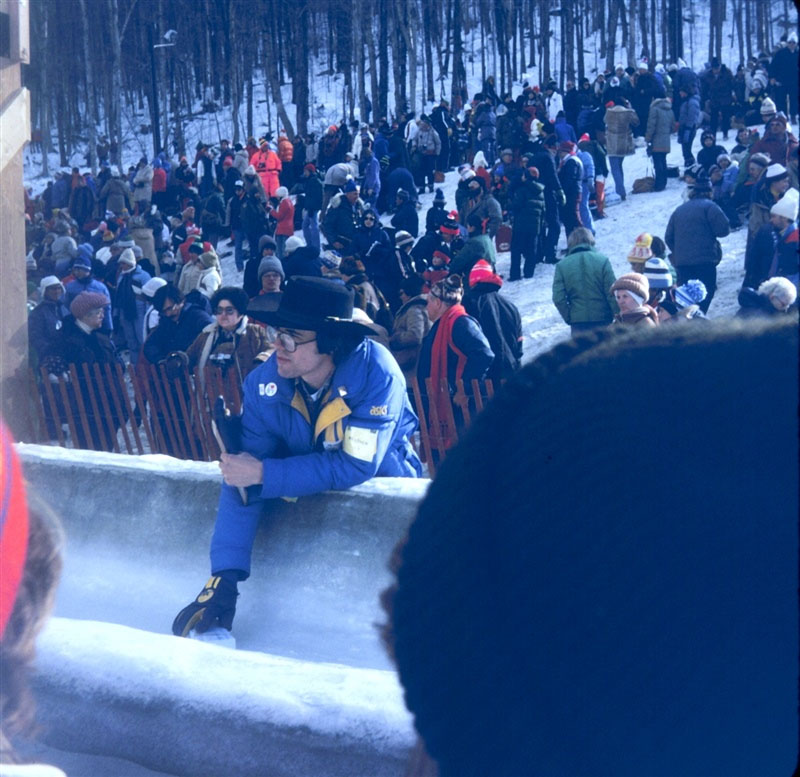
This week, as part of the 40th anniversary of the XIII Olympic Winter Games in 1980, the Lake Placid Olympic Museum launched the exhibit, Foretelling the Future – The National Weather Service at the 1980 Olympic Winter Games. These Olympic Games stand out in our collective memory as the venue for the “miracle on ice,” when the U.S. hockey team beat the 4-time Olympic champions, the Soviet Union. Little do most people know, however, another kind of team was pulling off a small miracle of their own at these games. 

Meteorologist Jack May taking the ice temperature of the bobsled/luge track prior to the start of competition.
Continue reading “Do you believe in miracles? New exhibit highlights National Weather Service support of 1980 Winter Olympic Games”