By Rear Adm. Shepard M. Smith
When I traveled around Europe as a young man, my first stop upon leaving the train station in a new city was at the tourist bureau kiosk for a paper city map. On a recent trip to Malaysia, I used my phone to find walking instructions to a street market across town. When I arrived, I described my route to my host, who said that the pedestrian bridge I had used only opened the week before.
Map services make seamless updates to our computers and on our phones, support integration with other relevant information, and are used across many sectors for efficient navigation-on the 29% of the world covered by dry land. For the 71% covered by water, these services are also needed.
The paper chart system that all mariners today grew up using—numbered charts with new editions periodically, corrected via Notices to Mariners weekly—looks increasingly antiquated. Last fall, my office announced that we are beginning the process of sun-setting the production of traditional paper charts. This is not an easy decision, but it is the right one.
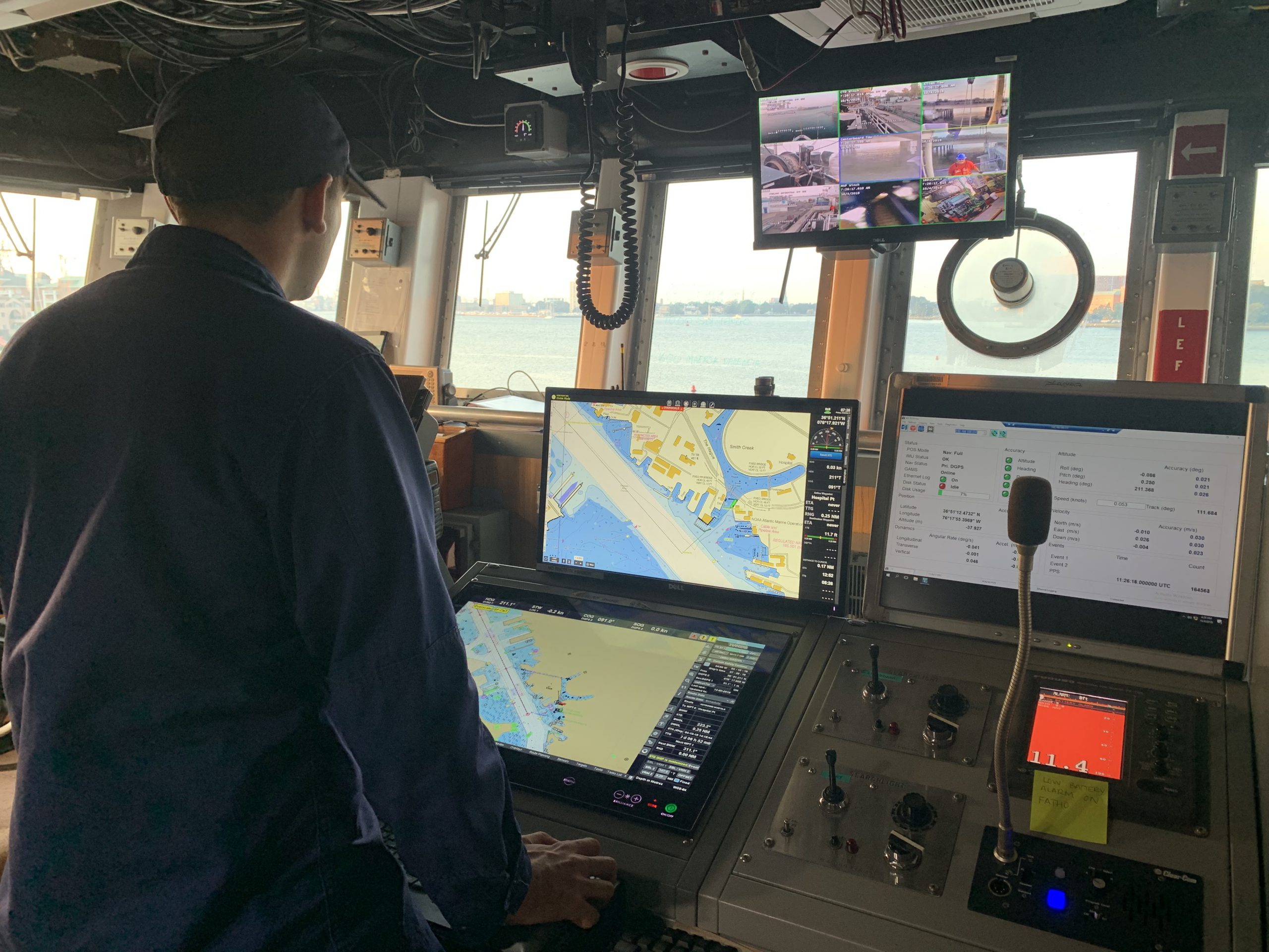
Rich navigation services in the marine environment are increasingly available in pockets around the world. In ports, for instance, large ships are often guided by pilots using high resolution bathymetry updated from the latest channel surveys, real time tide and air gap sensors, wave buoys, and high resolution oceanographic and weather forecasts. Some recreational boats are now equipped with “Auto Routing” capabilities, that allow their chart plotter to provide the same type of service we use in our cars-punch in a destination and push “Start”. Dozens of apps available on mobile phones update their locally-cached charts weekly when chart updates are issued. In the coming years, services will be available that provide standardized weather and tidal current maps compatible with marine navigation systems. All of these systems rely on constantly updated digital charts.
My office produces all of the nautical charts for the United States. We have been gradually changing our workflows and technology over the past decade—we now have the ability to update all charts weekly as new information becomes available, and to make those changes available to millions of users quickly through our Electronic Navigational Chart (ENC) suite. We don’t have the ability to keep the paper chart suite updated at the same rate. It is really the difference between a web page and a paper book. The web page is designed from the ground up to serve up dynamic content that can change by the minute. The paper book assumes static content.
We pay close attention to the actions of our users. Over the past two decades, we have seen a double digit drop in paper chart sales annually. The current projections are that there will be very few paper chart sales in five years—certainly not enough to justify the significant public expense of maintaining them. On the other hand, commercial sales and use of our ENCs have been climbing quickly, used in ECDIS systems as well as chart plotters and mobile apps.
We hear two things consistently from our electronic chart users—they want more detail, and they want them updated quickly with changes on the coasts, waterways, and hazards. We are building the system to do exactly that. In ten years, we plan to increase the number of ENC cells (a unit of content) from around 1000 to around 9000. On average, this will support 4 times the level of detail in any particular area, as well as providing the orderly progression of chart scales needed to support digital chart systems. This is the chart suite that America needs and deserves.
We recognize that many chart users consider a paper suite as an important backup to the electronic systems they use as their primary navigation tool. To support this, we are refining a system to automatically create printable charts from the ENC suite. We will make them look as similar as possible to our paper suite, but they will not have the hand-worked feel. Title blocks, scale bars, and notes will be in the margins. We will no longer support hand correction of paper charts. Instead, they will be labeled with an expiration date, one year after printing, for instance, for an offshore chart. They will be considered suitable for backup use only.
In the U.S., we have a robust commercial paper chart sales system, both for full size traditional print on demand charts as well as chart books. We are working with these companies to ensure they can continue to provide these paper products, derived from our ENCs, as long as there is demand. Along with lighthouses and anchors, charts are iconic of coastal America. One quarter of the paper charts we sell today are intended for decoration. NOAA is proud of that heritage, and will support the continued use of our historic chart collection for the thriving “chart art” industry.
Fully realized digital navigation has huge potential for safety and efficiency improvements in maritime shipping. Chart updates, navigation warnings and hazards are propagated and made readily and accurately available to mariners to improve safety. Weather and surface currents seamlessly integrated into route planning and monitoring will reduce fuel use and confidence in arrival times. Water levels, wave conditions, and detailed channel depths allow loads to maximized in ports. Next generation electronic charts are the foundation of all these improvements.
I chose to work for NOAA, 27 years ago, in part because of my love of paper charts, so it is with heavy heart that I am the one to preside over their sunset. However, I am even more excited by the future of digital marine navigation, for ease of use, safety and efficiency.
This op-ed appeared in Marine Executive on March 10, 2020.