A rapid maritime response by NOAA’s Office of Coast Survey will likely pay dividends to the U.S. economy, as a high-tech survey team today began surveying the channels of Port Fourchon, the “Gulf’s Energy Connection,” to search for dangers to navigation caused by Hurricane Isaac.

“Time literally means money for U.S. consumers when it comes to navigation through many of the Gulf of Mexico ports,” said Rear Adm. Gerd Glang, Office of Coast Survey director. “In this case, when a port can’t service offshore oil rigs, everyone — and most especially consumers — gets hit in the wallet.”
To help speed the resumption of maritime commerce following hurricanes and other disasters, Coast Survey deploys hydrographic survey assets for high priority port areas that need emergency assistance. Port Fourchon services about 90 percent of all deepwater oil rigs and platforms in the Gulf of Mexico. It is also the host for the Louisiana Offshore Oil Port (LOOP), which is the only port in the United States capable of handling Ultra Large Crude Carriers and Very Large Crude Carriers.
The Morgan City Captain of the Port, who has jurisdiction over Port Fourchon, anticipated they would need NOAA’s rapid maritime response as soon as conditions allowed boats in the water.
Hydrographic survey response priorities are set by U.S. Coast Guard Captains of the Port, coordinating with NOAA navigation managers who are working post-storm at Port Fourchon and NOAA’s new Disaster Response Center in Mobile. While NOAA hydrographers measure depths and look for underwater debris and other dangers to navigation, survey technicians process the data and send the information to the U.S. Coast Guard, who uses the information to make critical decisions on resuming port operations. After the Coast Survey navigation response team informs the Captain that no hidden dangers exist, the port can safely begin to resume shipping operations.
Barring any unforeseen circumstances, the Port Fourchon surveys should take about two days.
Days before Hurricane Isaac hit the U.S., Coast Survey mobilized assets and personnel, getting ready to respond to navigational needs of the ports slammed by the slow-moving, and drenching, hurricane. Navigation response teams, who normally survey ports and coastal areas to acquire modern data for updating nautical charts, were moved to Louisiana and Florida’s panhandle, so they could hit the water as soon as sea conditions allowed.

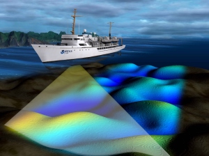
The experienced 3-person navigation response team (team lead Nick Forfinski, with Luke Pavilonis and David McIntire) is using specially designed sonar equipment to conduct the surveys: the side scan sonar uses sound to “see” debris in the waterways, and the multibeam echo sounder uses high-resolution depth information to detect shoaling.
Ports are critical arteries for American commerce, with the maritime transportation system contributing more than $1 trillion to the national economy and providing employment for more than 13 million people. Just as a car accident can snarl traffic for miles, shipping delays can snarl both the maritime system and land-based shipping that feeds into the ports.

Port Fourchon, LA map area with incident and hazard information (live) can be found here: http://bit.ly/S2TS8X