By ENS Peter Siegenthaler
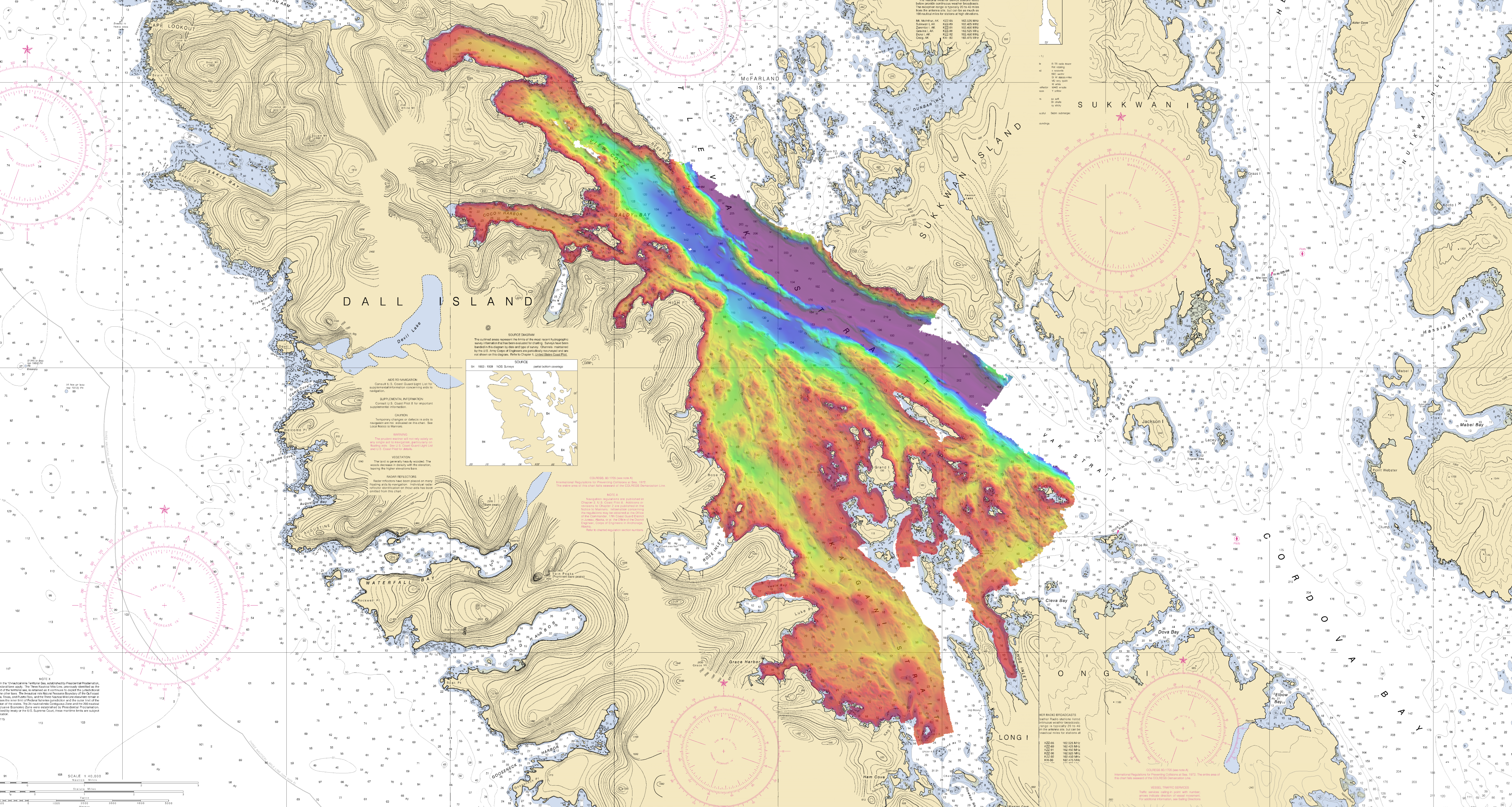
Following the scheduled winter repair period, Fairweather is kicking off the 2017 field season in Tlevak Strait; the waterway between Dall Island and Prince of Wales Island in Southeast Alaska. This area was last surveyed between 1900 and 1939, and the lead-lines used at the time to determine depths were susceptible to omission of rocks and other features in an area. Using the latest innovations in hydrographic technology, Fairweather will be resurveying these areas with complete coverage multibeam echo sounder bathymetry. This allows Fairweather to identify any rocks or shoal features missed in prior surveys, increasing the safety for local communities, whose economies and livelihoods are dependent on maritime transportation of goods.
One of the new developments Fairweather’s survey department in particular is excited about is a new software program affectionately named “Charlene.” Charlene was developed by PS Eric Younkin at Coast Survey’s Hydrographic Systems and Technologies Branch (HSTB) to automate the night processing workflow. This simplifies hours spent each night converting and correcting raw sonar data into an automated script which takes in raw data at one end and generates products at the other. Initial results are promising, and the ship is looking forward to fully integrating Charlene into the processing workflow.
Another new development for the 2017 field season is new multibeam sonars for the ship’s survey launches, which were installed during the winter repair period. The preliminary data acquired by these sonars has shown vast improvement over their predecessors’ data, which will go a long way towards reducing data processing timelines. The new sonars do this by automating most of the acquisition parameters in real-time, far faster and more effectively than could be achieved manually. They also take advantage of a multitude of hardware and software advances that have taken place over the past several years, resulting in systems that are quieter, smaller, and easier to operate.
Fairweather is continuing to use and develop the launch-mounted lidar systems (lasers) for the acquisition of shoreline data. This was another HSTB-developed process that was validated during the 2016 field season. This year, Fairweather is using those lessons learned in order to further improve our acquisition workflow. These systems create accurate real-time point clouds of features above the waterline and have revolutionized the way hazards to navigation are documented. Before the use of lasers, shoreline verification frequently required physically touching rocks and obstructions above the water surface for accurate measurement and placement. This process involved increased risk, took more time, and produced less accurate data. The new laser workflow addresses all these limitations. By scanning the shoreline at a distance with calibrated equipment, efficiency, accuracy, and safety are all greatly improved.
Overall, Fairweather is enthusiastic about being back at work in Alaska. With her new software, sonar systems, and dedicated crew, the stage is set for and productive field season!
