Paper nautical charts hold a special spot in a sailor’s heart – and in the chart table. The October announcement that the federal government will stop bulk lithographic printing of nautical charts brought some understandable angst to boaters – but fear not! NOAA may be changing the chart production process but we will NOT stop the production of paper charts. We are working with private companies to make them better: printed in brighter colors and available for fast delivery to your door. Most importantly, they are up-to-date to the moment you order it. These improved paper charts are NOAA-certified print-on-demand (POD) nautical charts, created by NOAA Coast Survey cartographers.
While the lithographic paper charts will go away in 2014, anyone can order almost* any printed NOAA chart any time, from the comfort of your home, office, or boat. Just bookmark nauticalcharts.noaa.gov/pod to find the NOAA-certified chart seller who will print your chart “on demand” and ship it to you.
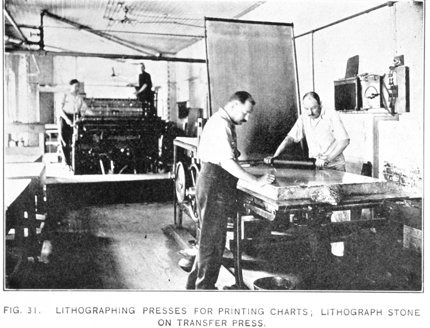
The great lithographic chart tradition answered a country’s need
For more than 150 years, the traditional paper chart that we all know and love has been printed in bulk on government printing presses, using the lithographic process. Lithographs were the latest and greatest technological achievement in the early 1850s, when Coast Survey superintendent Alexander Bache ordered Coast Survey personnel to explore the potential applications of lithography for printing maps cheaply and easily. Since the charts could be printed on cheaper and far thinner paper, lithographic copies could be folded, which was strategically important as the nation prepared for Civil War.
The new lithography helped the federal government speed the production of the thousands of charts needed for the war effort. According to contemporary reports, Coast Survey organized the “lithographing” division in 1861 “in order to aid the regular copper plate printing department in supplying speedily charts for the great demand made upon the office by the existing exigencies of the naval service, and also to afford the means of printing (under due supervision) a set of descriptive memoirs and sailing directions for the coast, for the use of the naval and military commands.”
Two lithographic presses were set up in the Coast Survey office and, according to Bache in his annual report, “an aggregate of more than two thousand copies of maps and charts were printed from them” in the first year of operation. The presses were set up, Bache says, “in order to meet the call for charts from the Naval Observatory to supply national vessels.”
The impact that lithographic printing process had on chart production is measurable. In 1844, before lithography, Coast Survey made 169 copies of its nautical charts. By the end of the Civil War in 1865, we were churning out more than 50,000 copies annually, and by 1900 we had amped up to 100,000 copies a year. With 20th century improvements in the lithographic presses and processes, Coast Survey produced over 100 million maps and charts for the Allied Forces in World War II.

Today’s digitally-produced paper chart reduces risk for maritime commerce, fishing, and recreational navigation
Coast Survey cartographers apply tens of thousands of changes to NOAA charts every year. Some changes are minor, but many are critical to safe navigation. While lithography was valuable in its day, it can take years before a new chart edition is printed with those updates. Advances in digital technology can now deliver charts that have been updated within the week.
Much of NOAA’s chart information is now delivered electronically to chart display systems, as either NOAA RNC® or NOAA ENC®, but we can also harness digital images for mariners who prefer to keep a paper chart, for primary use or for backup. This digital process gives boaters ready access to updated NOAA-certified paper charts that are printed on demand.
As of today, NOAA has agreements with two companies – OceanGrafix and East View Geospatial, with their local partners – to print and deliver paper print-on-demand nautical charts. We are working with a dozen other companies that have expressed an interest in becoming a NOAA-certified POD partner, and we will keep the vendor list updated at nauticalcharts.noaa.gov/pod.
Commercial mariners can be assured that NOAA-certified POD charts meet the requirements for the mandatory carriage of nautical charts.
Whether the paper charts are printed using lithographic printing presses or after transmission of digital images, Coast Survey’s mission is and remains the same: to produce the nautical charts that protect life and property. That is a mission that never needs to be updated.
(*”Chart books” of some areas in the Great Lakes are not yet available as POD charts. Watch nauticalcharts.noaa.gov/pod for updates.)
News and Updates
3 Replies to “NOAA’s paper nautical charts get a needed update – literally”
Comments are closed.