Office of Coast Survey
National Oceanic and Atmospheric Administration
U.S. Department of Commerce
Office of Coast Survey
National Oceanic and Atmospheric Administration
U.S. Department of Commerce
What is BlueTopo™?
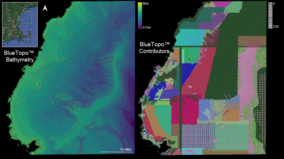 BlueTopo bathymetry displayed on the left and the associated BlueTopo contributing sources
displayed on the right.
BlueTopo bathymetry displayed on the left and the associated BlueTopo contributing sources
displayed on the right.
BlueTopo is a compilation of the nation's best available bathymetric data. In the same way that topographic map details the height of land, BlueTopo details the depth of lake beds and seafloor beneath navigationally significant U.S. waters. Created as an extension of the Office of Coast Survey's nautical charting mission and the National Bathymetric Source program, BlueTopo is curated bathymetric source data that provide a definitive nationwide model of the seafloor and navigational lakes.
Though the Office of Coast Survey's primary goal is to support marine navigation, bathymetric data are essential to virtually all forms of ocean science and engineering. BlueTopo will help to enhance the growth of the Blue Economy by aiding in the selection of alternative energy sites and identifying geologic features and hazards. Further, BlueTopo will support coastal resilience by enabling simulations of sea level effects on coastal ecosystems, helping to identify sensitive marine habitats. BlueTopo will provide critical bathymetric data for new National Ocean Service operational numerical oceanographic forecast modeling systems. These real-time modeling systems provide short-term forecast guidance of water levels, currents, water temperature, and salinity to mariners. As a publicly available resource, BlueTopo enables a more complete understanding of bathymetry in numerous applications.
How is BlueTopo unique?
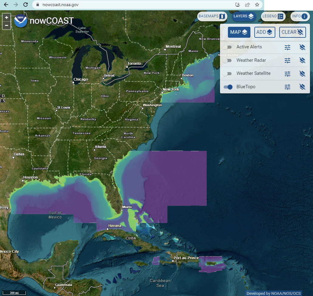 BlueTopo is hosted by NOAA's nowCOAST™. Bathymetry,
or underwater topography, is updated as new
measurements of water depths become available.
BlueTopo is hosted by NOAA's nowCOAST™. Bathymetry,
or underwater topography, is updated as new
measurements of water depths become available.
BlueTopo is unique in its delivery of consistently formatted bathymetry, transparency of metadata, and method of compilation according to data quality metrics. The design and implementation of the National Bathymetric Source project and BlueTopo also involves the intentional use of open source software and code to ensure flexibility.
Though other compilations of bathymetry exist, BlueTopo is the first of its kind that will account for changes in data quality over time. BlueTopo will be updated on a weekly to monthly basis, according to regional rates of coastal change and availability of new source data.
How do I access BlueTopo?
BlueTopo is available to view and access through nowCOAST™. You can also find the BlueTopo available through NOAA's Open Data Dissemination Program.
We look forward to hearing from you! Let us know how you are using BlueTopo and how it has impacted your work. Please visit the FAQs page prior to contacting us with questions using the Office of Coast Survey ASSIST webpage.