Surveying the Pribilof Islands, from Pathfinder to Fairweather

Two images of Pathfinder and Fairweather lined up side by side.

By Lt. Taylor Krabiel

In the 1950s, U.S. Coast and Geodetic Survey (USC&GS) Pathfinder surveyed the Pribilof Islands with the latest technologies to chart previously unsurveyed waters and bring the islands into a common datum with the mainland. Fast forward 71 years and NOAA Ship Fairweather continues this work. Despite the decades and technologies that separate the two ships, they share many commonalities in their mission and their surveying techniques.

Continue reading “Surveying the Pribilof Islands, from Pathfinder to Fairweather”

NOAA Ship Fairweather surveys the remote Pribilof Islands

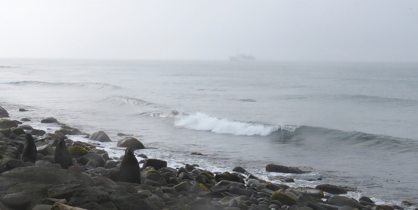
Northern Fur Seals on the beach of St. George as Fairweather navigates the thick fog in the background.

By Lt. Taylor Krabiel

The Pribilof Islands are remote and isolated, located in the Bering Sea roughly 280 nautical miles north of Dutch Harbor Alaska. The economy and community are reliant on the surrounding ocean, while the islands themselves provide shelter for vessels working in the Bering Sea. Accurate nautical charts are not only integral to safe navigation and delivery of goods and services for the community, but also to commercial fishing and crabbing. The last major survey of the area was conducted from 1951 to 1954 by the U.S. Coast and Geodetic Survey vessel Pathfinder. However, much of the shoreline around St. George remained uncharted. The Fairweather’s surveys of the islands will provide modern bathymetric data for updating NOAA’s charting products in support of navigation safety.

Continue reading “NOAA Ship Fairweather surveys the remote Pribilof Islands”

Deep fiords and hydrographic history in Glacier Bay National Park

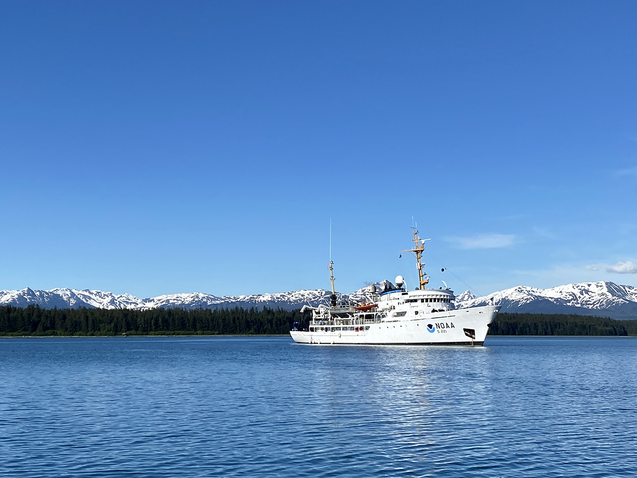
NOAA Ship Rainier at anchor in Bartlett Cove, Glacier Bay National Park.
By Ensign Alice Beittel and Ensign Karl Wagner

Throughout the spring and summer of 2021, NOAA Ship Rainier surveyed numerous bays and inlets of Alaska’s Glacier Bay National Park and Preserve. As one of the largest national wilderness systems and a United Nations designated World Heritage Site, Glacier Bay National Park includes over 2.7 million acres of marine, terrestrial, and freshwater ecosystems. This dynamic landscape is a living example of a never-ending cycle of geological and ecological change and adaptation. With up to 20-foot tide ranges, seasonal migrations of humpback whales and salmon, and glaciers in flux, the resilient ecosystem attracts millions of visitors each year. This year, Rainier surveyed the Beardslee Islands, Geikie Inlet, Berg Bay, Muir Inlet, Bartlett Cove, Pleasant Island, Taylor Bay, and Dundas Bay. Each survey area revealing several changes in seafloor bathymetry and bottom type. High-resolution seafloor bathymetry will be used to update nautical charts for safe navigation and serve as baseline data to support further research of this culturally and ecologically significant marine environment.

Continue reading “Deep fiords and hydrographic history in Glacier Bay National Park”

Nautical Chart Manual guides cartographers for 100 years

By John Macek

This July marks the 100th anniversary of the Office of Coast Survey’s Nautical Chart Manual. First published on July 10, 1920, as Special Publication No. 66, under the title “RULES AND PRACTICE RELATING TO CONSTRUCTION OF NAUTICAL CHARTS”, the 34- page pamphlet codified the essential guidelines to be used by cartographers of the U.S. Coast and Geodetic Survey.

Continue reading “Nautical Chart Manual guides cartographers for 100 years”

Do you believe in miracles? New exhibit highlights National Weather Service support of 1980 Winter Olympic Games

This week, as part of the 40th anniversary of the XIII Olympic Winter Games in 1980, the Lake Placid Olympic Museum launched the exhibit, Foretelling the Future – The National Weather Service at the 1980 Olympic Winter Games. These Olympic Games stand out in our collective memory as the venue for the “miracle on ice,” when the U.S. hockey team beat the 4-time Olympic champions, the Soviet Union. Little do most people know, however, another kind of team was pulling off a small miracle of their own at these games. 

Meteorologist Jack May taking the ice temperature of the bobsled/luge track prior to the start of competition.
Continue reading “Do you believe in miracles? New exhibit highlights National Weather Service support of 1980 Winter Olympic Games”

NOAA preserves history of Washington, DC, with reproduced L’Enfant maps

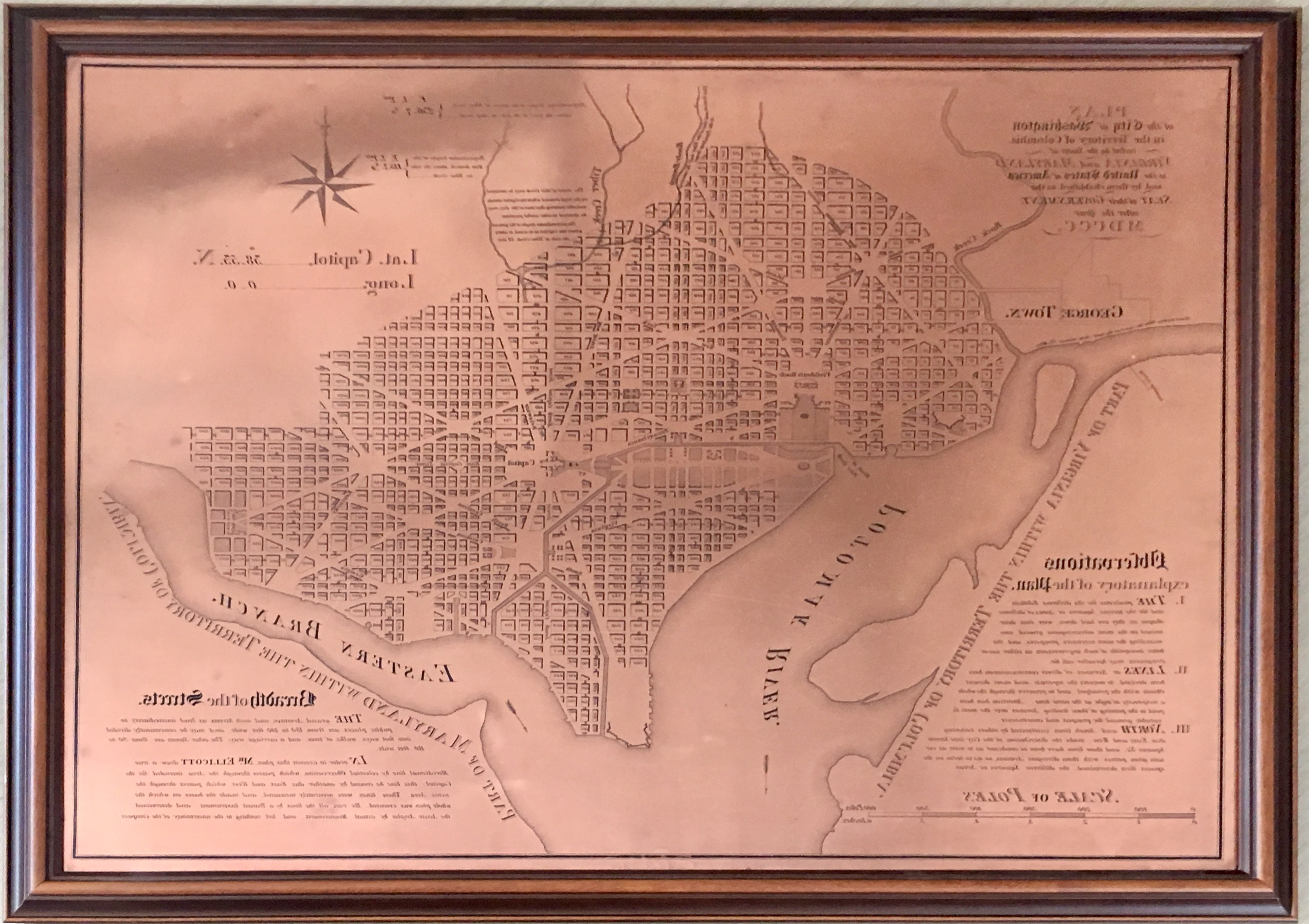
This copper plate, named No. 3043 PRICE 45 CENTS, is one of the 3000 series of special products produced by Coast Survey’s predecessor, the Coast and Geodetic Survey. The Coast and Geodetic Survey primarily made nautical charts, but a number of maps in the 3000 series were instead maps of some thematic factor of interest (i.e., the Slaver Map, No. 3033; Glacier Bay, Alaska, No. 3095).

By Capt. Albert “Skip” Theberge (NOAA, ret.)

Research conducted by the NOAA Central Library uncovered a little known fact that NOAA Coast Survey’s skill in reproducing maps helped ensure that early maps of Washington, DC, and an interesting piece of history, weren’t lost. Coast Survey reproduced three historically significant maps from a copper plate engraving of Washington, DC, as surveyed by Pierre L’Enfant and Andrew Ellicott.
Continue reading “NOAA preserves history of Washington, DC, with reproduced L’Enfant maps”

Navigating waters before GPS: Why some mariners still refer to Loran-C

by Nick Perugini
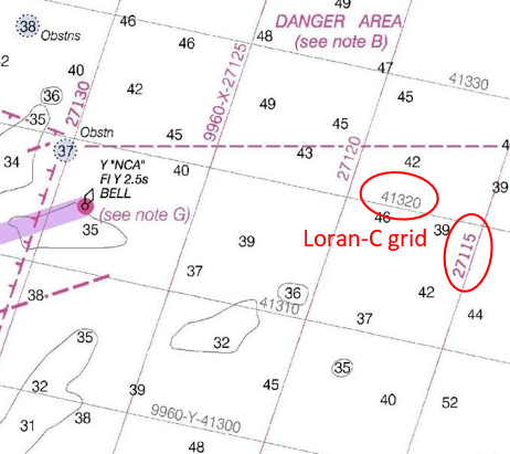
One of the most popular recurring questions received by NOAA’s Office of Coast Survey involves customers – typically fishermen – wanting to obtain a chart with a Loran-C navigation grid on it. Here are a few inquiries from NOAA’s Nautical Inquiry & Comment System:

  • Hello, I was wondering if it is still possible to purchase or locate older editions of Lake Huron charts (14862-3-4) with the LORAN-C overlay. Many older wrecks and reported snags are still in Loran and have not been converted to GPS. Artificial algorithms are difficult to use when plotting grids. Any help you can give me is much appreciated.
  • Is it possible to access Loran-C charts of New England from prior to 2009 when NOAA stopped published with the LORAN-C lines? THANKS!
  • I was wondering if there was a way for me to buy a chart that has LORAN lines and notes on it? I understand that all of the new charts no longer have this information on them. I am most interested in Chart 11520, Cape Hatteras to Charleston. I didn’t know if there might be an archived form of this chart that shows the LORAN features. Any help in finding a chart like this would be greatly appreciated.

Continue reading “Navigating waters before GPS: Why some mariners still refer to Loran-C”

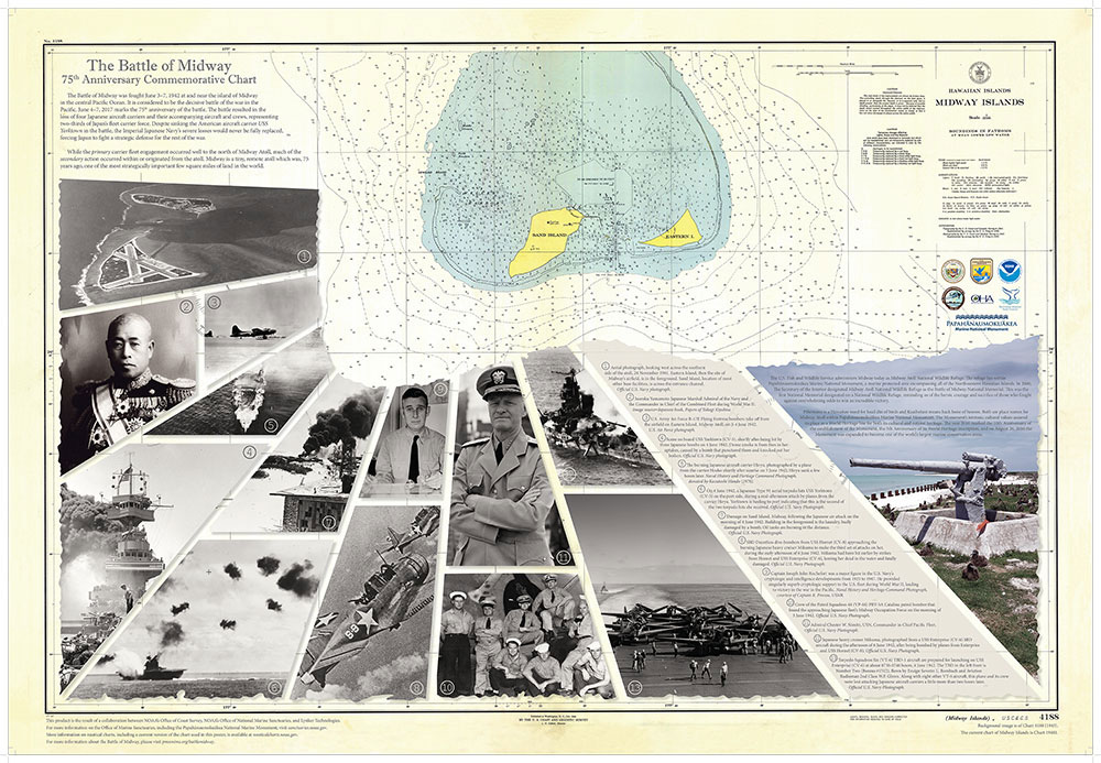
New commemorative chart marks the Battle of Midway’s 75th anniversary

NOAA’s Office of Coast Survey and Office of National Marine Sanctuaries created a commemorative nautical chart for the Battle of Midway’s 75th anniversary. This nautical chart was first published in 1943, and the commemorative chart includes the original depth soundings surrounding the islands overlaid with historical photos from the battle.
Continue reading “New commemorative chart marks the Battle of Midway’s 75th anniversary”

Coast Survey in World War 1: “an instant and eager response to the country’s call for help”

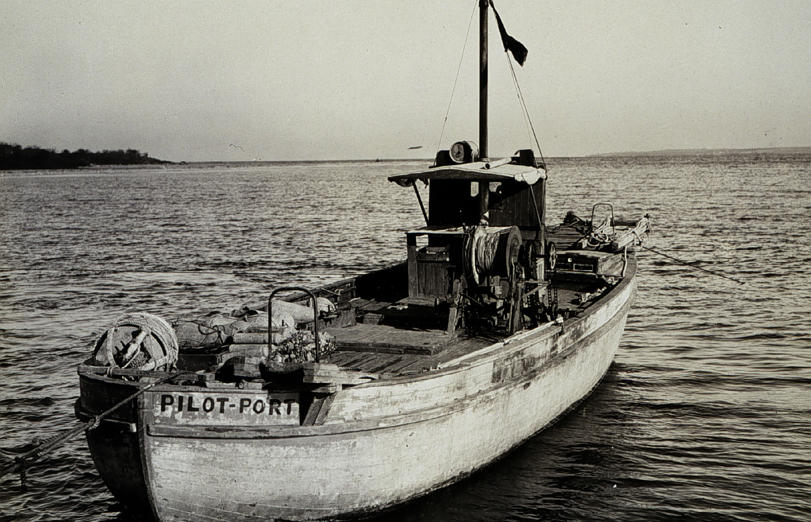
Wire drag 1917

On April 6, 1917, the United States declared war on Germany, in the World War that began three years earlier, when Archduke Franz Ferdinand was assassinated. By 1918, over 30 percent of Coast and Geodetic Survey personnel were on active duty with the Army and Navy. With 272 members of the C&GS in active military service, and 5 survey vessels transferred into naval service, the Survey curtailed much of their regularly scheduled hydrographic work. Instead, personnel directed most of their energies to the assistance of the military branches, with the remaining hydrographic parties conducting special confidential surveys for the Navy Department. Continue reading “Coast Survey in World War 1: “an instant and eager response to the country’s call for help””