 An
official website of the United States government.
Here's how you know we're official.
An
official website of the United States government.
Here's how you know we're official.
An
official website of the United States government.
Here's how you know we're official.
An
official website of the United States government.
Here's how you know we're official.
Coast Survey Celebrates World Hydrography Day
You may be surprised to learn how much hydrography matters in our everyday lives. Over a billion metric tons of cargo move in and out of our nation's ports annually. How do we keep our nation's marine transportation system functioning in a safe, efficient, and environmentally sound manner? Hydrography. Hydrography underpins marine activities, including economic development, security and defense, scientific research, and environmental protection.
The International Hydrographic Bureau was established in 1921, later becoming the International Hydrographic Organization. In 2005, the United Nations General Assembly adopted Resolution A/60/30, recognizing the establishment of World Hydrography Day by the International Hydrographic Organization. This day provides Coast Survey the opportunity to recognize the great work that hydrographers in NOAA and other organizations do to keep our nation's waterways safe, our economy strong, and our communities resilient.
World Hydrography Day 2025
This year's theme: Seabed Mapping: Enabling Ocean Action. From the International Hydrographic Organization:
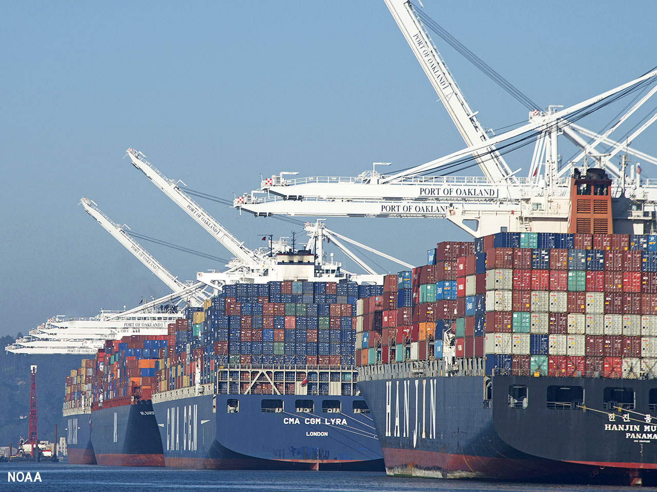 (The Port of Oakland
in California, Credit: NOAA)
(The Port of Oakland
in California, Credit: NOAA)
U.S. marine economy continues to empower American prosperity
As container ships continue to grow in size and ports grow more congested by the year, NOAA plays an increasingly critical role in U.S. marine transportation. NOAA services and products improve the efficiency of ports and harbors, promote safety, and help to ensure the protection of coastal marine resources. The marine economy contributed a total of $511 billion to the nation's gross domestic product (GDP) in 2023 (5.9% growth since 2022). It generated $827 billion in sales (4.5% growth since 2022) and supported 2.6 million jobs. These updated statistics include all economic activities related to the ocean and U.S. coastal regions.
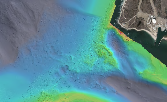 (Bathymetry collected
overlaid on satellite imagery of the survey area. Credit: Ocean Surveys, Inc)
(Bathymetry collected
overlaid on satellite imagery of the survey area. Credit: Ocean Surveys, Inc)
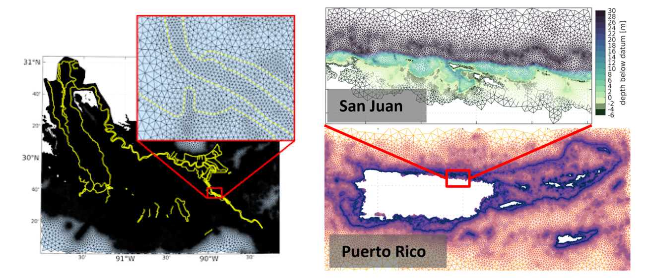
Long Island Sound survey data supports electric power cable planning
The Long Island Sound Seafloor Habitat Mapping Initiative, consisting of Federal, state, and academic partners from Connecticut and New York, will use this data to support domestic energy development and production and the routing of electric transmission cables through Long Island Sound. And in accordance with our Map Once, Use Many Times goal, NOAA will use the data to support maritime commerce and other interests by improving nautical charts and other mapping products. This survey is the result of NOAA's Brennan Ocean Mapping Fund opportunity, a program that allows non-federal organizations to co-fund projects of mutual interest utilizing NOAA's contracting and data management expertise.
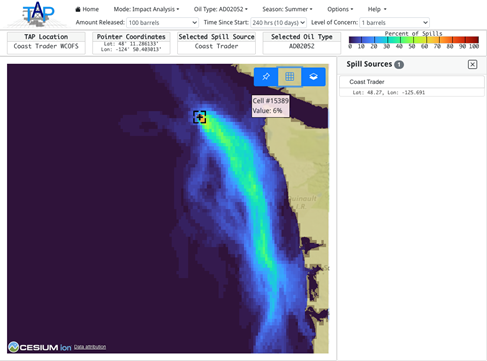 (Screenshot of the
Trajectory Analysis Planner, or TAP, where you can toggle through different scenarios to visualize a projected
spill)
(Screenshot of the
Trajectory Analysis Planner, or TAP, where you can toggle through different scenarios to visualize a projected
spill)
Coast Survey's Operational Forecast System informs shipwreck oil spill scenarios
Resting almost 500 feet below the surface, the sunken Coast Trader has an estimated 542 tons of heavy fuel oil remaining in the fuel tanks. In collaboration with Fisheries and Oceans Canada (DFO), NOAA's Office of Response and Restoration (OR&R) began a comprehensive assessment of potential impacts from the Coast Trader's fuel in the event that corrosion leads to a release of oil. As part of this assessment, the team used NOAA's GNOME trajectory model for modeling potential spill paths and impacts to the coastline, as well as NOAA Office of Coast Survey's West Coast Operational Forecast System, which provides water level, current, temperature, and salinity nowcast and forecast guidance.
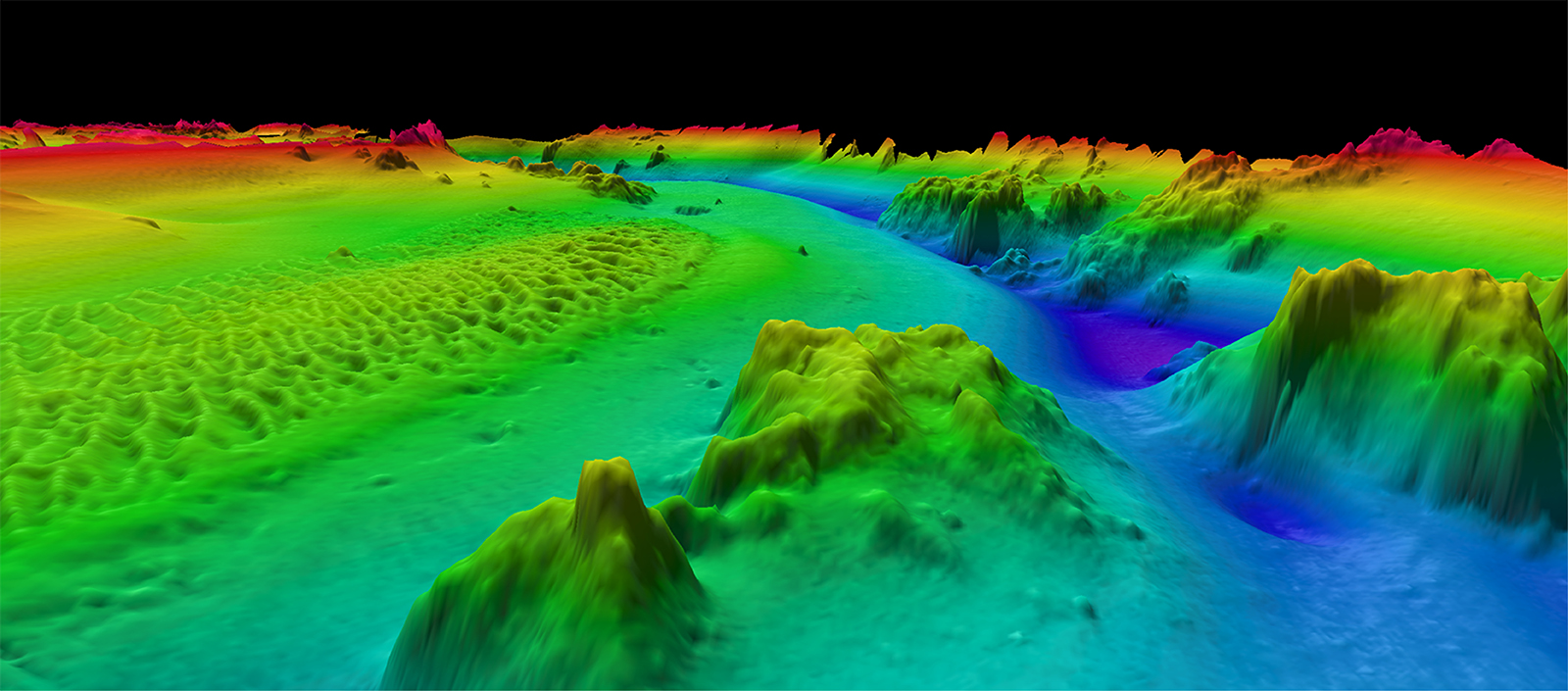
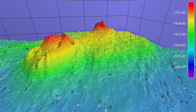 (Bathymetric data of volcano-like features discovered on the continental slope along the north slope of Alaska during the mapping mission. Credit: NOAA)
Interagency science team collects ocean and weather data in the Arctic
NOAA's Office of Coast Survey collaborated with the University of New Hampshire, U.S. National Science Foundation, and U.S. Coast Guard partnered on a coordinated mapping mission along the north slope of Alaska. The mission acquired depth data in uncharted waters along the Coast Guard-proposed Arctic shipping route, deployed a series of oceanographic buoys, and provided at sea training on interdisciplinary scientific expeditions for junior scientists. As the Arctic warms at nearly four times the global rate, ice-free waters will make commercial shipping more attractive. Safe passage through this region is vital, and mapping data acquired along the proposed Arctic Port Access Route Study corridor will be instrumental as the Coast Guard finalizes their proposal for the route's formal designation.
World Hydrography Day 2024
This year's theme: Hydrographic Information - Enhancing Safety, Efficiency and Sustainability in Marine Activities
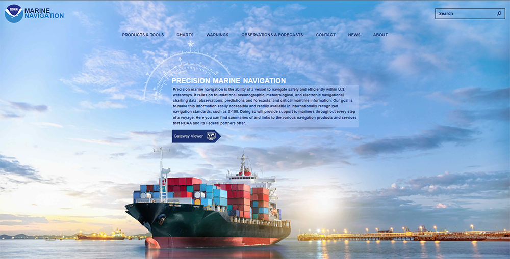
International standards and the link to Precision Marine Navigation
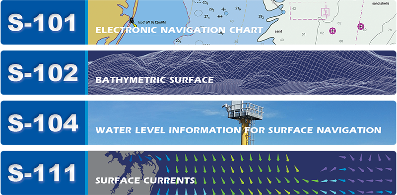
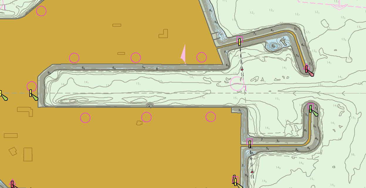
Precision marine navigation is the ability of a vessel to safely and efficiently navigate and operate in close proximity to the seafloor, narrow channels, or other hazards. NOAA's Precision Marine Navigation program supports a one-stop-shop for marine navigation data. This includes forecasts, real-time observations, warnings/advisories, and high resolution bathymetry. The program is built on the foundation of the International Hydrographic Organization's S-100 Universal Hydrographic Data Model which provides a framework of components that enables the building of standardized product specifications for hydrographic data modeling, thus providing true interoperability between varying data standards and systems. Coast Survey is actively engaged in the work of the IHO's technical program under the Hydrographic Services and Standards Committee, including chairing the S-100 working group. This year represents an important year for the IHO in the finalization of several S-100 based product specifications for electronic navigational charts, bathymetric surface, water level information for surface navigation, and surface currents. In parallel, Coast Survey is also working on building test and development products within the suite of S-100 based products and releases them via our precision marine navigation website. Read more
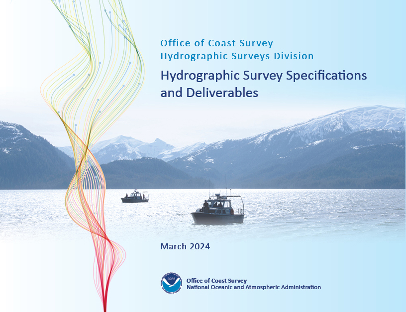
NOAA implements new standards for hydrographic survey and product specifications
The Hydrographic Survey Specifications and Deliverables document contains the technical specifications for hydrographic survey data submitted to the Office of Coast Survey. It represents NOAA's implementation of the International Hydrographic Organization standards for hydrographic survey and product specifications. Coast Survey is proud to announce the launch of the new Hydrographic Survey Specifications and Deliverables for 2024, the largest overhaul of the document in more than 20 years. Read more
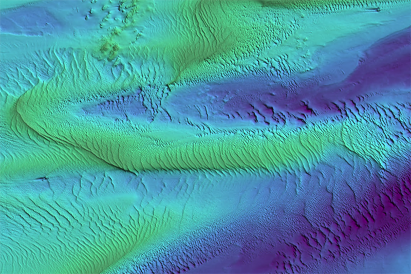
Building areas of seamless, high-resolution bathymetric data
The National Bathymetric Source program creates and maintains high-resolution bathymetry composed of the best available data. This program enables the creation of next-generation nautical charts while also providing support for modeling, industry, science, regulation, and public curiosity. Read more
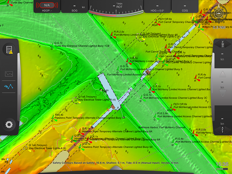
Vessel pilots use data layer to assist with navigation
NOAA's Precision Marine Navigation program aims to seamlessly integrate high-resolution bathymetry and high accuracy positioning and shoreline data with the forecast data of water levels, currents, waves, and weather forecasts. This information can be easily accessed and integrated into maritime electronic charting systems and other decision support tools so mariners can plan their transits and make decisions while at sea and coming to and from port. A key component of this program is providing vessel pilots with detailed depth information to ensure safety of vessel transits and that critical under keel clearance safety margins are maintained.
In April 2024, the cargo vessel M/V Dali allided with the Francis Scott Key Bridge resulting in the collapse of several sections of the bridge into the main channel leading into Baltimore Harbor. As multiple salvage and survey operations occurred the following month, NOAA was able to provide the bathymetric data layer at the request of the Baltimore Pilots for situational awareness. This data proved crucial to local pilots navigating within the main and temporary channels through the site, and was made available to the public—the bathymetry layer, or BlueTopo, is available on nowCoast, and the bathymetric surface data is available on the AWS S3 Explorer here and here.
New ocean mapping center expands NOAA, University of New Hampshire partnership
NOAA and the University of New Hampshire are expanding a 24-year ocean and Great Lakes mapping partnership through the creation of a new Center of Excellence for Operational Ocean and Great Lakes Mapping. The Center of Excellence will focus on the following priorities:
Ocean mapping data is the basis for researching, exploring and characterizing our nation's ocean, coasts and Great Lakes in order to support maritime commerce, transportation and emergency response activities. Ocean and Great Lakes mapping provides foundational data for a wide range of key NOAA priorities, including modeling and forecasting water levels, currents, storm surge and tsunami inundation; fisheries habitat identification; marine protected area site selection and management; and environmentally sound offshore energy development. Read more
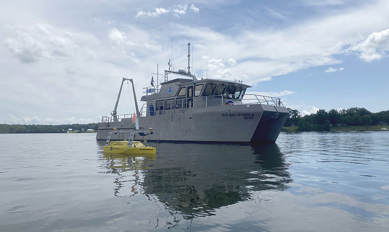
Chesapeake Bay and Albemarle Sound surveys collect data with multiple uses
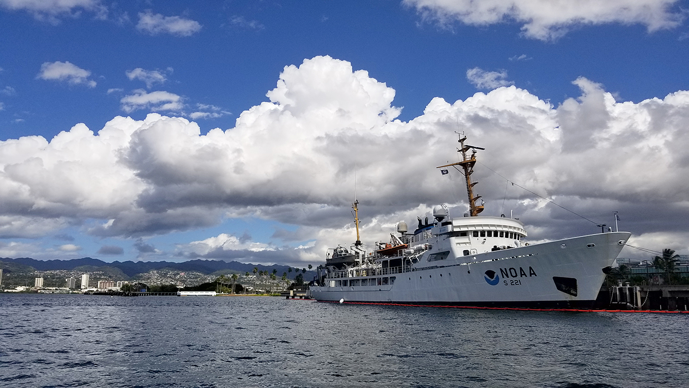
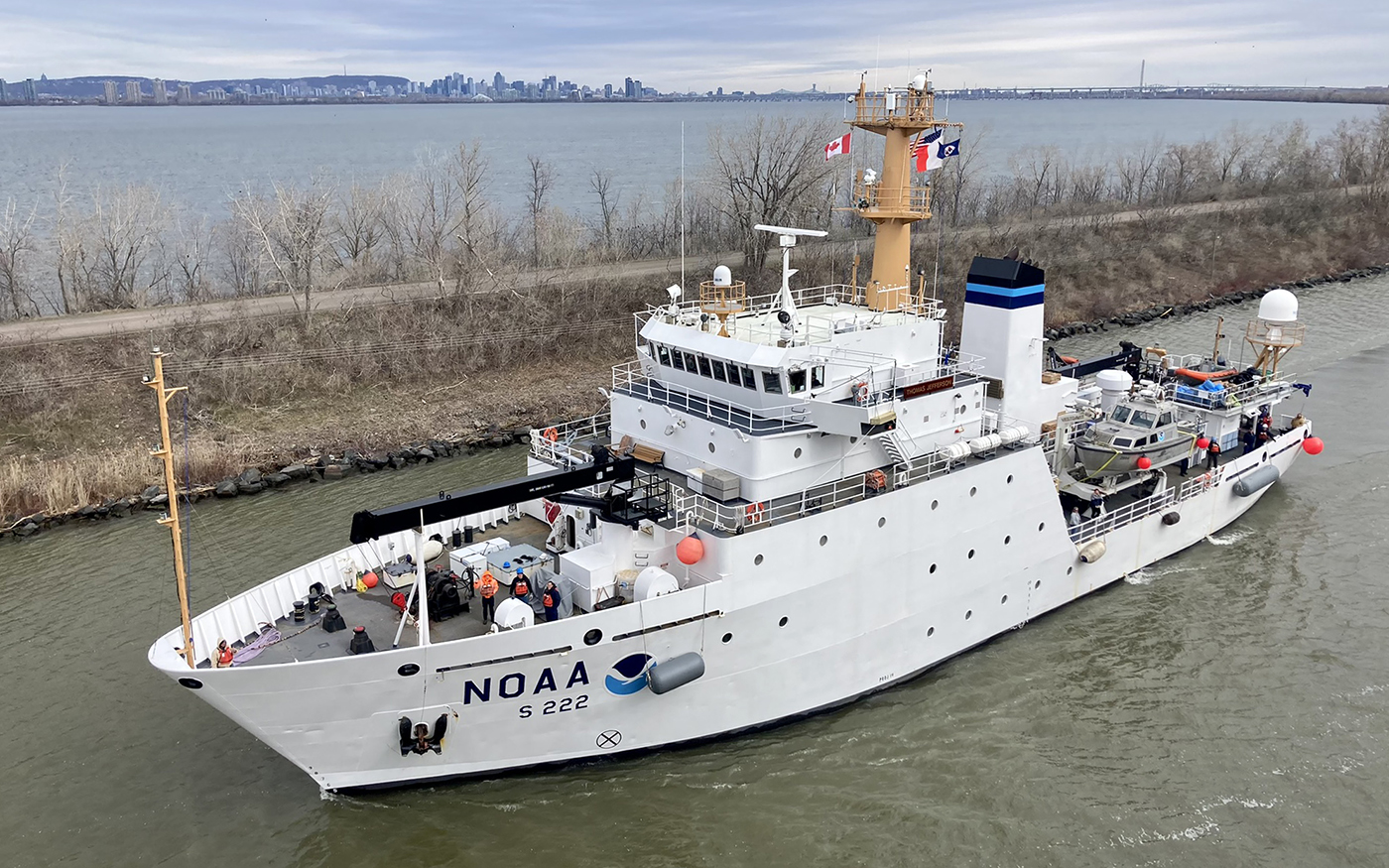
The southwestern Chesapeake Bay watershed which includes the Potomac, Rappahannock, James, and York Rivers, is home to millions of people living in a range of environments from rural farmland to heavily populated regions such as the District of Columbia and Hampton Roads, Virginia. These rivers support diverse commercial and recreational interests ranging from recreational boating and fishing to industries such as aquaculture and commercial fishing, water treatment plants, and major port facilities. During NOAA's 2023 field survey season, NOAA's navigation response teams including R/V BayHydro II, NOAA Ship Thomas Jefferson and survey contractors eTrac and Geodynamics, performed hydrographic surveys throughout southwestern Chesapeake Bay and Albemarle Sound in North Carolina.
These surveys, funded by the Bipartisan Infrastructure Law, are primarily intended to support high resolution models for storm surge inundation and flooding. However, the data collected from these surveys will serve many purposes. It will be used to update nautical charts and products, and will provide forecasters at NOAA's National Water Center with bathymetric data for critical hydrodynamic modeling. It will be used to update NOAA National Ocean Service charts and products, and will provide forecasters at NOAA's National Water Center with bathymetric data for critical hydrodynamic modeling necessary to understand timing and impact of rapid river stage increases and decreases, the duration of high water, inundation, or drought. The data will also be used to characterize seabed habitat to help manage a healthy and sustainable seafood industry, and will inform best preservation practices for the operating and conserving maritime historic and cultural resources of the Mallows Bay-Potomac River National Marine Sanctuary.
World Hydrography Day 2023
This year's theme: Hydrography - Underpinning the Digital Twin of the Ocean
NOAA Releases 2023 hydrographic survey season plans
NOAA hydrographic survey ships, navigation response teams, and contractors are preparing for the 2023 hydrographic survey season. The ships and survey vessels collect bathymetric data (i.e. map the seafloor) to support nautical charting, modeling, and research, but also collect other environmental data to support a variety of ecosystem sciences. NOAA considers hydrographic survey requests from stakeholders such as marine pilots, local port authorities, the Coast Guard, and the boating community, and also considers other hydrographic and NOAA science priorities in determining where to survey and when. Visit our "living" ArcGIS StoryMap to find out more about our mapping projects and if a hydrographic vessel will be in your area this year! Read more
3D Nation Study report, website, and StoryMap now available
A new StoryMap on the 3D Nation Elevation Requirements and Benefits Study, which was published in September 2022, is now available. Sponsored by the National Oceanic and Atmospheric Administration (NOAA) and the U.S. Geological Survey (USGS), and conducted by Dewberry, the 3D Nation Study documents nationwide requirements and benefits of 3D elevation data both on land and under water. The study also estimates the costs associated with meeting these requirements and evaluates multiple scenarios for enhancing national elevation mapping programs. Read more
The Interagency Working Group on Ocean and Coastal Mapping announces progress report on mapping U.S. ocean, coastal, and Great Lakes waters
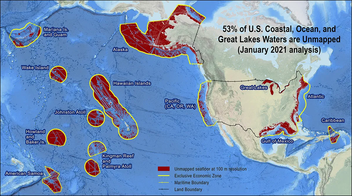
The federal Interagency Working Group on Ocean and Coastal Mapping (IWG-OCM) has released the fourth annual report on progress made in mapping U.S. ocean, coastal, and Great Lakes waters. Knowledge of the depth, shape, and composition of the seafloor has far-reaching benefits, including safer navigation, hazard mitigation for coastal resilience, preservation of marine habitats and heritage, and a deeper understanding of natural resources for sustainable ocean economies. The 2020 National Strategy for Mapping, Exploring, and Characterizing the United States Exclusive Economic Zone (NOMEC) and the Nippon Foundation-GEBCO Seabed 2030 Project make comprehensive ocean mapping a priority for the coming decade. The Unmapped U.S. Waters report tracks progress toward these important goals. Read more
Surveying beyond navigation
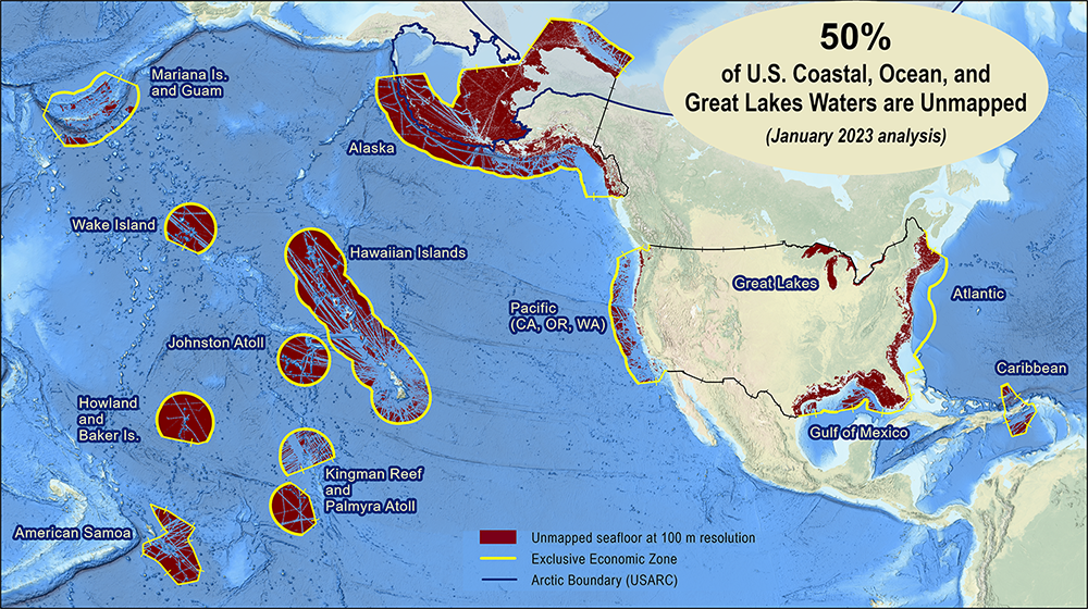
Hydro International interviewed RDML Benjamin Evans, director of NOAA's Office of Coast Survey. Evans is responsible for overseeing the mapping and charting of all US coastal waters, as well as representing the US in international hydrographic activities. Evans talked to Hydro International about staff shortages, challenges in surveying remote parts of the US and deploying new technology: "The sheer scale of the task before us to survey US waters to modern standards is absolutely enormous. The US EEZ is almost four million square miles and we have mapped approximately half of that to modern standards, so we have a long way to go." Read more
Empowering women in hydrography through at-sea experience
The Empowering Women in Hydrography project is a global effort led by the International Hydrographic Organization and Canada that seeks to initiate, organize and track a series of activities and initiatives which will enable more women to participate equitably in the field of hydrography and to assume leadership roles within the hydrographic community. NOAA is contributing to the project via an 'at-sea experience' on NOAA hydrographic ships for three women each year over the four year lifespan of the project. After a global call for nominations, three women were selected to join NOAA ships for the 2022 survey season. Part one Part two Part three
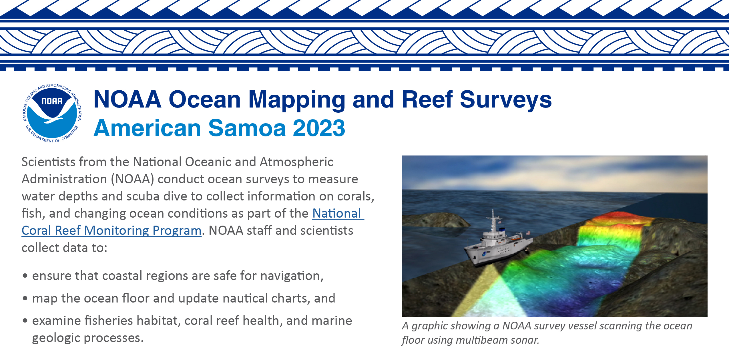
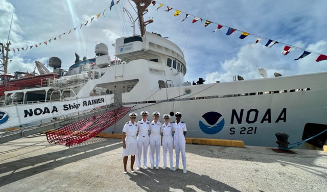
NOAA ocean mapping and reef surveys in American Samoa and Pacific Remote Islands
World Hydrography Day 2022
This year's theme: Hydrography - contributing to the United Nations Ocean Decade
New NOAA website provides marine navigation resources in a central location
NOAA's Precision Marine Navigation program website will improve the use and accessibility of NOAA's marine navigation products and services. The website includes links and short descriptions to NOAA's various navigation resources, providing a one-stop shop that mariners can visit to get the data they need. Designed for shipping professionals and recreational boaters alike, the program hopes the website will become a valuable tool to support all mariners in their navigation planning and decision making processes. Read More
NOAA ocean mapping and reef surveys in the Mariana Islands
On March 26, 2022, NOAA Ship Rainier set sail from Honolulu, Hawaii on a 3,307-nautical mile expedition to the Western Pacific. This collaborative mission between NOAA's National Ocean Service and National Marine Fisheries Service will deliver high-quality data, data products, and tools to the region including a seamless map linking hilltops to underwater depths and integrated data on the surrounding coral reef ecosystems. Read more
Model Upgrade: Global Extratropical Surge and Tide Operational Forecast System Upgraded to Version Two
In late July 2021, the Global Extratropical Surge and Tide Operational Forecast System (Global ESTOFS) upgrade to version two was implemented into operations. The modeling system provides forecast guidance for combined water levels caused by storm surge and tides globally. The forecast guidance from the model is used by forecasters at NWS Weather Forecast Offices (WFO) and the Ocean Prediction Center to generate their storm surge and flood forecasts during storms, including Nor'easters along the U.S. East Coast. Read more
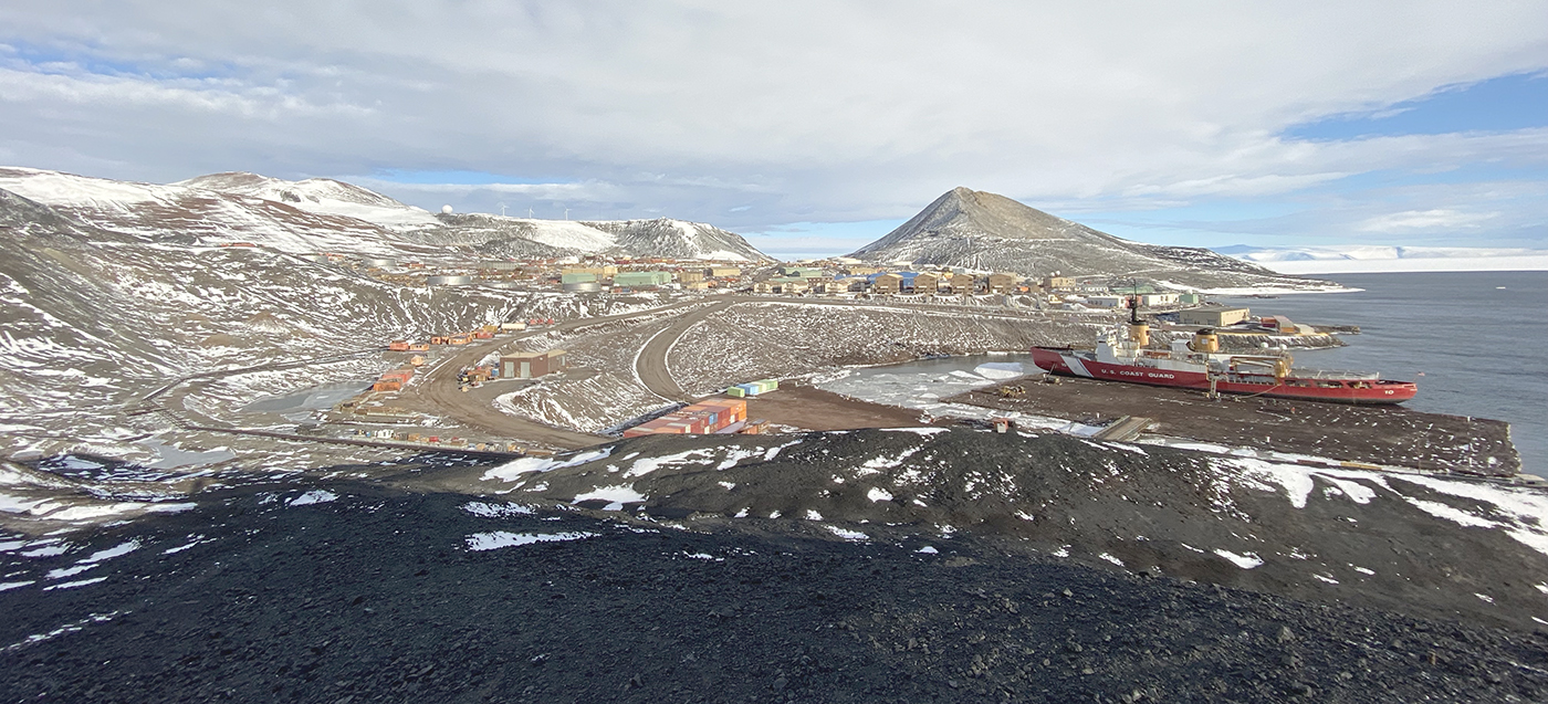
Coast Survey's mobile integrated survey team goes to
Antarctica
By, Annie Raymond
From November 25, 2021 to February 11, 2022, the Office of Coast Survey, Navigation Response Branch team members traveled aboard the U.S. Coast Guard heavy icebreaker Polar Star to McMurdo Station on Ross Island, Antarctica. The Polar Star's primary mission involves cutting a channel through the ice and clearing the way for supply vessels to reach McMurdo Station. The Coast Survey team joined the regular mission in order to conduct a hydrographic survey of Winter Quarters Bay at McMurdo in support of the National Science Foundation's Antarctic Infrastructure Modernization for Science project. Read more
NOAA focuses on the Great Lakes for the 2022 field season
In 2022, NOAA's Office of Coast Survey and National Ocean Service scientists will be conducting multiple hydrographic mapping missions in the Great Lakes aboard NOAA Ship Thomas Jefferson. These missions, along with the navigation response teams and contracted assets, will support critical updates to marine navigation products and services, and provide modern data to the scientific and benthic mapping communities. Read more
BlueTopo™ webpage is now live
The Office of Coast Survey's new BlueTopo webpage provides information and access to a compilation of the nation's best available bathymetric data. BlueTopo is unique in its acute attention to datum control, ability to account for changes in data quality over time, and method of compilation according to data quality metrics. Primary sources of bathymetry include NOAA and U.S. Army Corps of Engineers hydrographic surveys and topographic bathymetric (topo-bathy) LiDAR (light detection and ranging) data. Read more
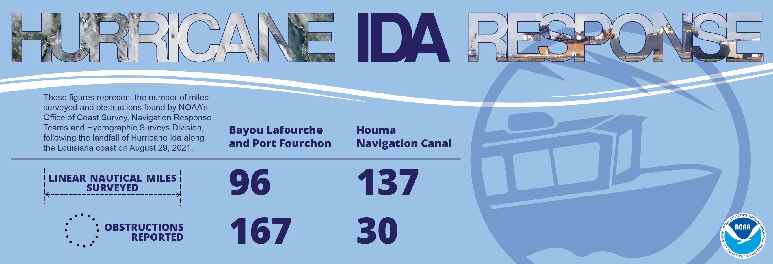
Coast Survey's Hurricane Ida response
World Hydrography Day 2021
This year's theme: One-hundred years of international cooperation in hydrography
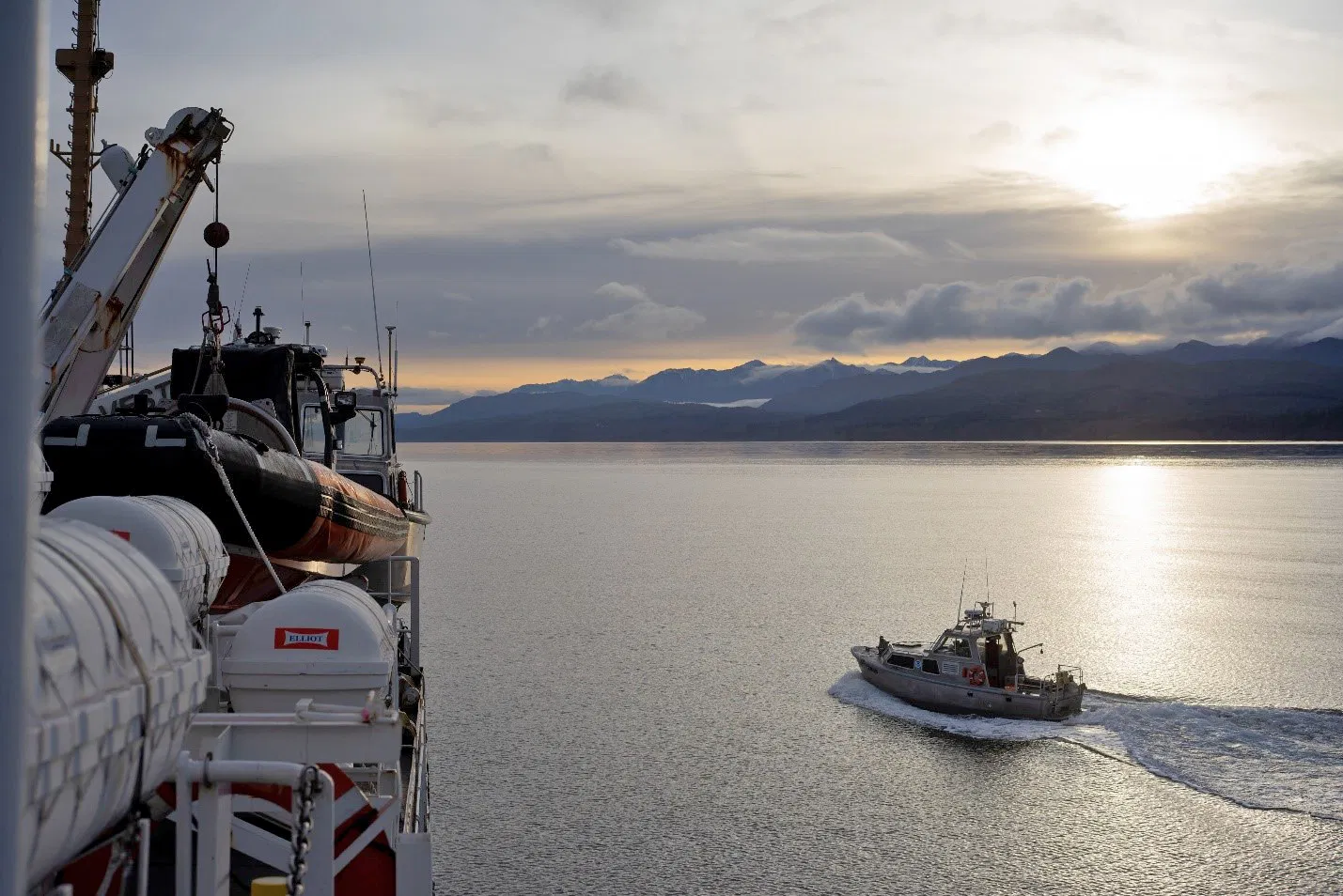
Surveying in the Strait of Juan de Fuca during a global
pandemic
By Ensign Jessie Spruill and Hydrographic Senior Survey
Technician Simon Swart, NOAA Ship Fairweather
Last Thanksgiving, the crew of NOAA Ship Fairweather were busy surveying in one of the country's busiest waterways. A global maritime entryway to the Pacific Northwest, the Strait of Juan de Fuca sees over 8,000 transits of deep-draft container ships, cargo and chemical carriers, oil tankers, and barges coming to and from Puget Sound and Canada. Read More
The Interagency Working Group on Ocean and Coastal Mapping announces progress report on mapping U.S. ocean, coastal, and Great Lakes waters
The Interagency Working Group on Ocean and Coastal Mapping (IWG-OCM) released the second annual report on the progress made in mapping U.S. ocean, coastal, and Great Lakes waters. Read more
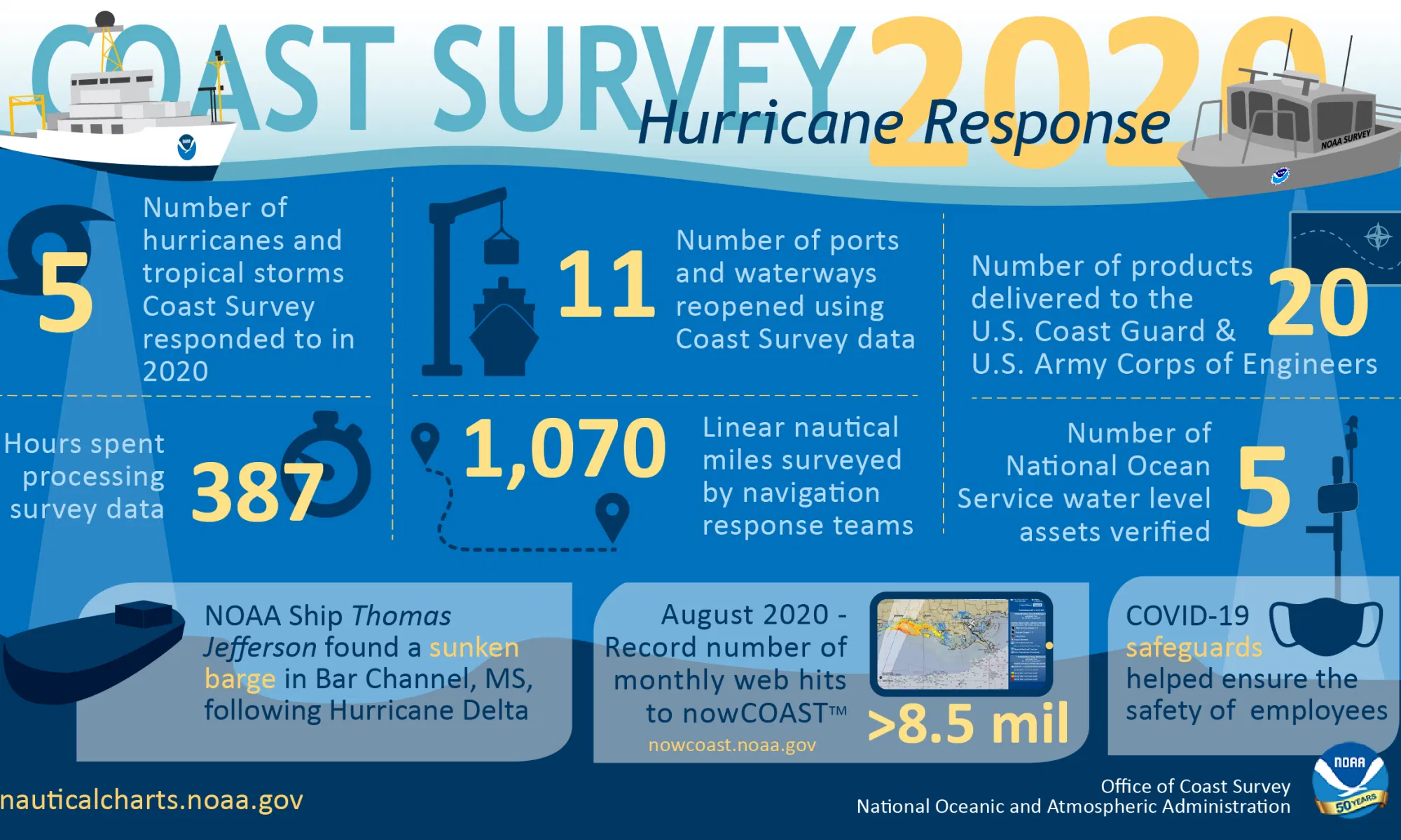
By the Numbers: Coast Survey's 2020 Atlantic Hurricane Season
As the 2020 Atlantic hurricane season came to a close on November 30, NOAA's Office of Coast Survey tallied a few numbers to see what the combined response effort of the navigation response teams, NOAA Ship Thomas Jefferson, and hydrographic survey contractor David Evans & Associates, Inc., looked like. Read more
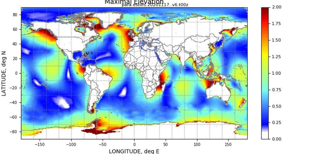
Model Upgrade: Extratropical Surge & Tide Operational Forecast System (ESTOFS) is Now Global
On November 24, an upgrade to Global ESTOFS was implemented to provide NWS forecasters with high resolution water level forecast guidance including storm tide (storm surge plus tides) for the entire globe. Global ESTOFS forecast guidance will be used by forecasters at WFOs and the Ocean Prediction Center (OPC) to generate their storm surge forecasts during winter storms including Nor'easters along the U.S. East Coast. Read more
World Hydrography Day - Recognizing the importance of
hydrography work being done around the world
By Rear Adm. Rick Brennan
It's June so that means kids are out of school for the summer, parents are dreaming of a little family vacation, and if it's June 21 it means it is World Hydrography Day. On November 29, 2005, the United Nations adopted Resolution A/60/30, which "welcomes the adoption by the International Hydrographic Organization (IHO) of the World Hydrography Day with the aim of increasing the coverage of hydrographic information on a global basis." Read more
World Hydrography Day 2020
This year's theme: Hydrography - enabling autonomous technologies

A message to hydrographers: Your time is now
By Rear Adm. Shep Smith, Director, Office of Coast
Survey
There has never been a better time to be a hydrographer. Our skills, data, and technology are in high demand globally, driven by an increased emphasis both on supporting the blue economy and of protecting the ocean upon which all life on earth depends. Read more
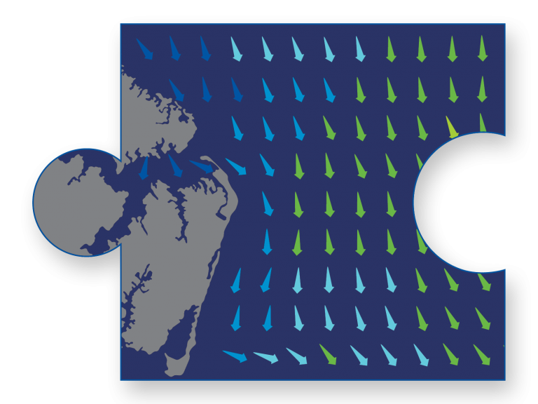
Precision marine navigation surface current dissemination
trials
By Erin Nagel, University Corporation for Atmospheric
Research (UCAR) Visiting Scientist
NOAA is preparing to release a prototype of the new Precision Navigation Data Dissemination System in July, and the S-111 surface current forecast guidance will be the first prototype service available in this new system. Read more
High-definition charts advance precision marine
navigation
By Craig Winn, HD Charting Portfolio Manager
For large vessels entering port where there is next to zero margin for error, pilots and shipmasters are looking for the highest resolution data available to help them navigate these tight spaces safely and efficiently. Read more
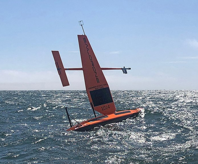
Webinar
recording: An autonomous approach to ocean mapping: A Saildrone,
USM, and NOAA collaboration
In 2019, the University of Southern Mississippi, NOAA's
Office of Coast Survey, and Saildrone began a collaboration
to test the accuracy and longevity of the Saildrone platform
for shallow-water multibeam bathymetry in an effort to
develop new technologies to address gaps in ocean mapping
and exploration in the U.S. EEZ. During this webinar, the
project partners discuss the origins of the project, the
technology innovation and the achievements of the first year
of collaboration, and a preview of future development plans.
(transcript forthcoming)
Coast Survey spotlight: Meet Glen Rice
Glen is the technical team lead for NOAA's National
Bathymetric Source Project. Critical to our national
infrastructure, this project aims to serve the best
available bathymetry to support NOAA, other federal
agencies, and the public.
Read
more
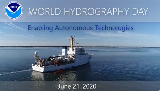
Video: World Hydrography Day
2020
It's World Hydrography Day! Today we recognize the great
work that hydrographers in NOAA and other organizations do
to keep our waterways safe, our economy and blue economy
strong, and our communities resilient.
World Hydrography Day 2019
This year's theme: Hydrographic information driving marine knowledge
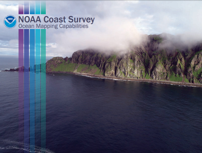
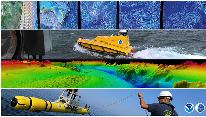
Ocean Mapping Capabilities
Coast Survey's seafloor mapping program comprises a
comprehensive set of capabilities that range from not just
data collection, but rigorous quality control, an expert
workforce, and ability to collaborate widely.
Learn more
about our ocean mapping capabilities.
Coast Survey spotlight: Meet Kurt Mueller
As a physical scientist and eleven-year veteran of Coast
Survey, Kurt Mueller works to ensure that hydrographic data
coming from NOAA ships, as well as other data from external
agencies, meets the rigid standards required to build an
accurate and reliable nautical chart.
Read more
World Hydrography Day 2018
This year's theme: Bathymetry - the foundation for sustainable seas, oceans and waterways
From seaports to the deep blue sea, bathymetry matters on
many scales
By Rear Adm. Shep Smith, Director, Office of Coast
Survey
On Thursday, June 21, we celebrate World Hydrography Day. This year's theme - Bathymetry - the foundation for sustainable seas, oceans and waterways - is very timely as many hydrographic organizations worldwide are focusing on bathymetry at local and global scales... Read more
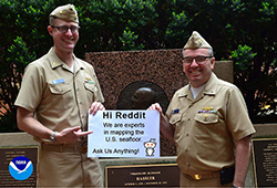
World Hydrography Day Reddit "Ask Us Anything"
Join us on Thursday, June 21, 2018, from 1 p.m. to 3 p.m.
(EDT) for a
Reddit "Ask Us
Anything"
featuring Rear Adm. Smith, director of the Office of Coast
Survey and Lt. Cmdr. Greenaway, chief of Coast Survey's
Hydrographic Systems and Technology Branch as they answer
your questions on how NOAA maps the U.S. seafloor.
Coast Survey spotlight: Meet Starla Robinson
Starla Robinson was drawn to Coast Survey by her desire for
adventure on the high seas, exploration, and also a desire
to balance it with time on land. As a physical scientist,
she plans, coordinates, and communicates the details of
hydrographic survey projects.
Read
more
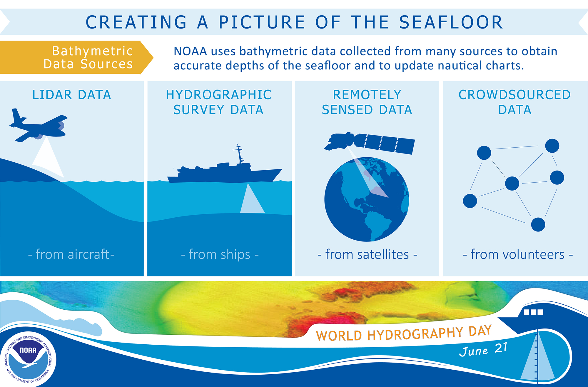
Creating a picture of the seafloor: Bathymetric data
sources
From lidar and hydrographic survey data to remote sensing
and crowdsourced data, NOAA uses data from many sources to
obtain accurate depths of the seafloor and to update
nautical charts. Click the image for a larger view.

Coast Survey spotlight: Meet Brian Martinez
After graduating with a bachelor of science degree from the
University of Maryland Baltimore County, Brian landed a job
as a contractor for Coast Survey and has been there ever
since. As a lead cartographer, Brian ensures that the
nautical products Coast Survey updates and maintains are
high quality.
Read
more
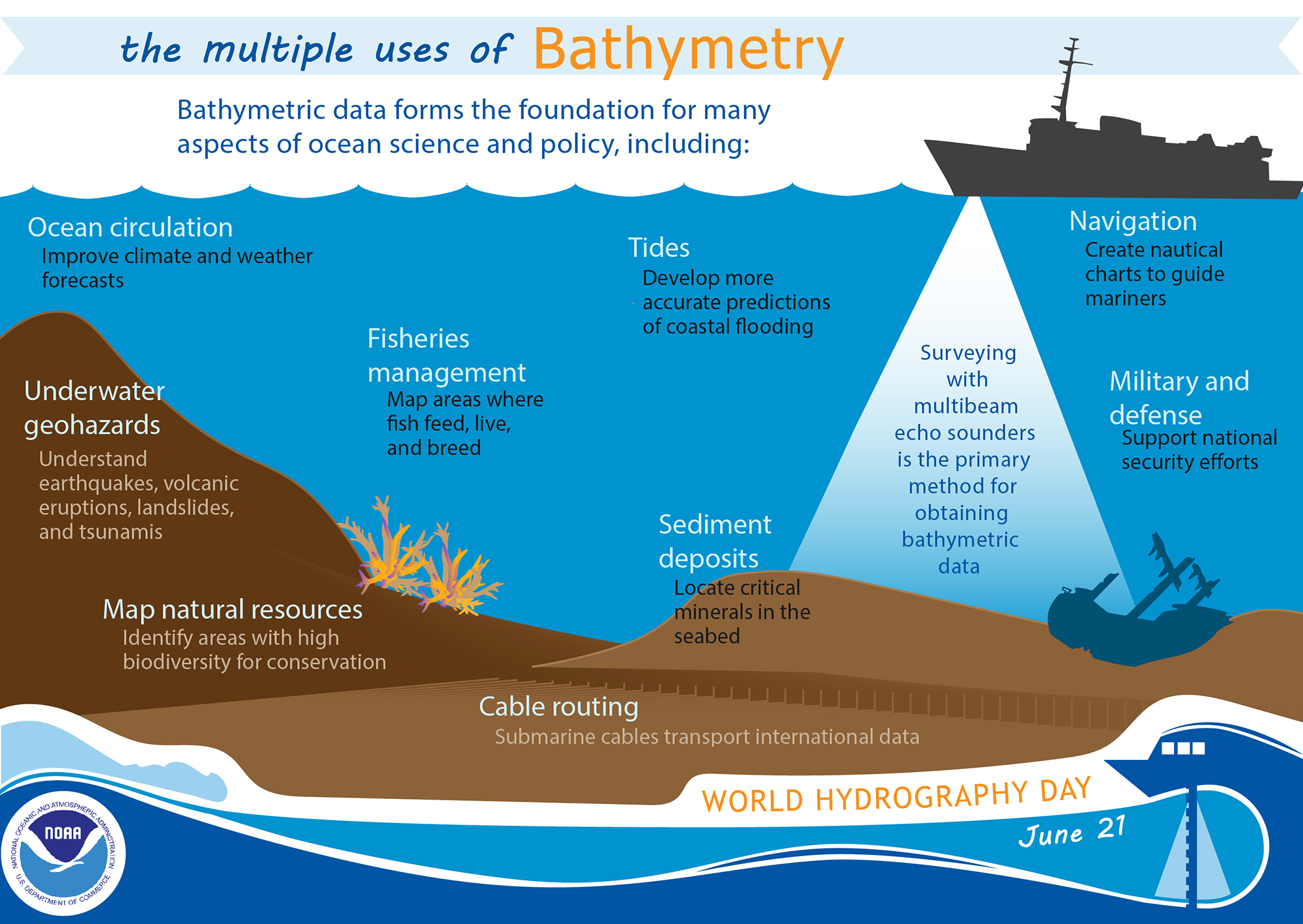
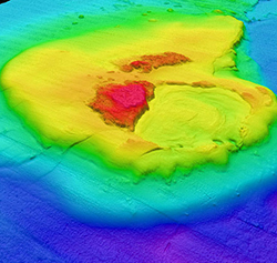
Multiple uses of bathymetric data
The value of bathymetric data extends beyond navigational
products. Fisheries management, military and defense
efforts, and our knowledge of tides, ocean circulation
patterns, and underwater geohazards can all be informed by
bathymetric data. Learn more from this
infographic.