
By Lt. j.g. Michelle Levano
Starting in the Rocky Mountains of British Columbia, the Columbia River flows through Washington state and turns west to form the border of Washington and Oregon, serving as the largest river in the Pacific Northwest region.
The river and its tributaries are central to Pacific Northwest culture and the lifeblood of the regional economy. The Columbia River is the West Coast’s leader in foreign trade supporting 50 million tons of dry bulk, mineral bulk, wood, and auto imports and exports. It is also the nation’s leading wheat export gateway and second for corn and soybean exports.

With an average flow at its mouth of about 265,000 cubic feet per second (Kammerer 2005), it is no wonder this dynamic river’s soundings (or depth measurements) are constantly changing. The last commissioned NOAA survey of the river was in 2009 and since then, the Columbia Snake River System is poised to handle more cargo than it has historically carried. Safe anchorage areas are critical and allow for ships to rest at sea securely while waiting to enter port. The anchorages that make up the river system serve as a vital component in the safe and efficient transport of goods.
Vessels safely navigate the river under the guidance of the Columbia River Pilots (COLRIP), an association of more than 40 professional mariners licensed by the state of Oregon to provide maritime pilotage service to all ports on the lower Columbia and Willamette rivers. The pilots are charged with safely providing vessels with extensive navigational experience, local knowledge, and ship handling skills in all weather conditions 24/7, 365 days a year.
In January 2018, COLRIP and the Columbia River Steamship Operators Association (CRSOA) met with Crescent Moegling, NOAA’s northwest and Pacific Islands navigation manager, to discuss survey priorities for the anchorages in the Columbia River. When examining anchorage priorities, COLRIP and CRSOA put careful consideration into safety, width for large vessels or depth for deeper vessels, locations, proximity to berths, anchor buoy locations, emergency anchor locations, and other such factors.
From there, the request to survey was sent to Coast Survey’s Navigational Response Branch (NRB) and assigned to navigation response team (NRT) 3, serving the Pacific Northwest.
Data collection on the Columbia River anchorage areas started in early June in Longview, Washington, with NRT3 team member Timothy Wilkinson and NRT2 team member (serving the South Atlantic region), Lucas Blass.
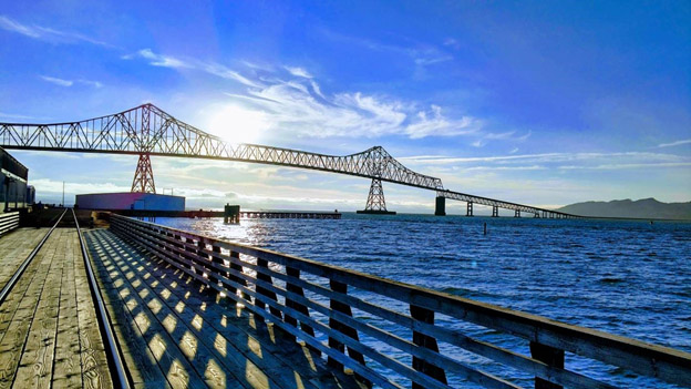
In the beginning of August, NRT3 returned to the Columbia River ready to survey with additional support from NOAA’s Pacific Hydrographic Branch Physical Scientist Adam Argento, and five members with two launches from NOAA Ship Rainier. The group started with the three anchorage areas at the mouth of the river, in Astoria, Oregon.

While surveying, the group met unique challenges, such as large vessels anchored in the survey area. The team overcame this challenge by waiting for the tide to turn in the early afternoon, and for the ships to sway in on their anchor in the opposite direction. Numerous large vessels wait at anchor outside Astoria before heading into Portland or wait to cross the Columbia River Bar.

Known for its constantly changing conditions, the Columbia River Bar near Astoria can change from calm to dismal in five minutes as the direction of the wind, swell, and current vary significantly and can cause hazards to vessels. This proved to be a challenge as the team would experience placid seas in the morning, which would quickly turn to hazardous in the midafternoon.

After a week of survey in Astoria, the group moved to Portland to continue surveying various anchorage areas, terminals, and industrial areas on the Columbia and Willamette rivers. Here, the group meet with the COLRIP and CRSOA for a day of surveying in the upper and lower Vancouver anchorage area.
So far, 656 square nautical miles of the Columbia River anchorages have been surveyed, with more to come in early fall. NOAA met constituent and stakeholder needs in a timely and efficient matter. Safe anchorage locations on the Columbia River increases safety and business, which has a positive impact on the local, regional, and national economy.
NRT3 thanks Shaver Transportation for providing moorage to NRT3 and the Rainier launches while in Portland.

