
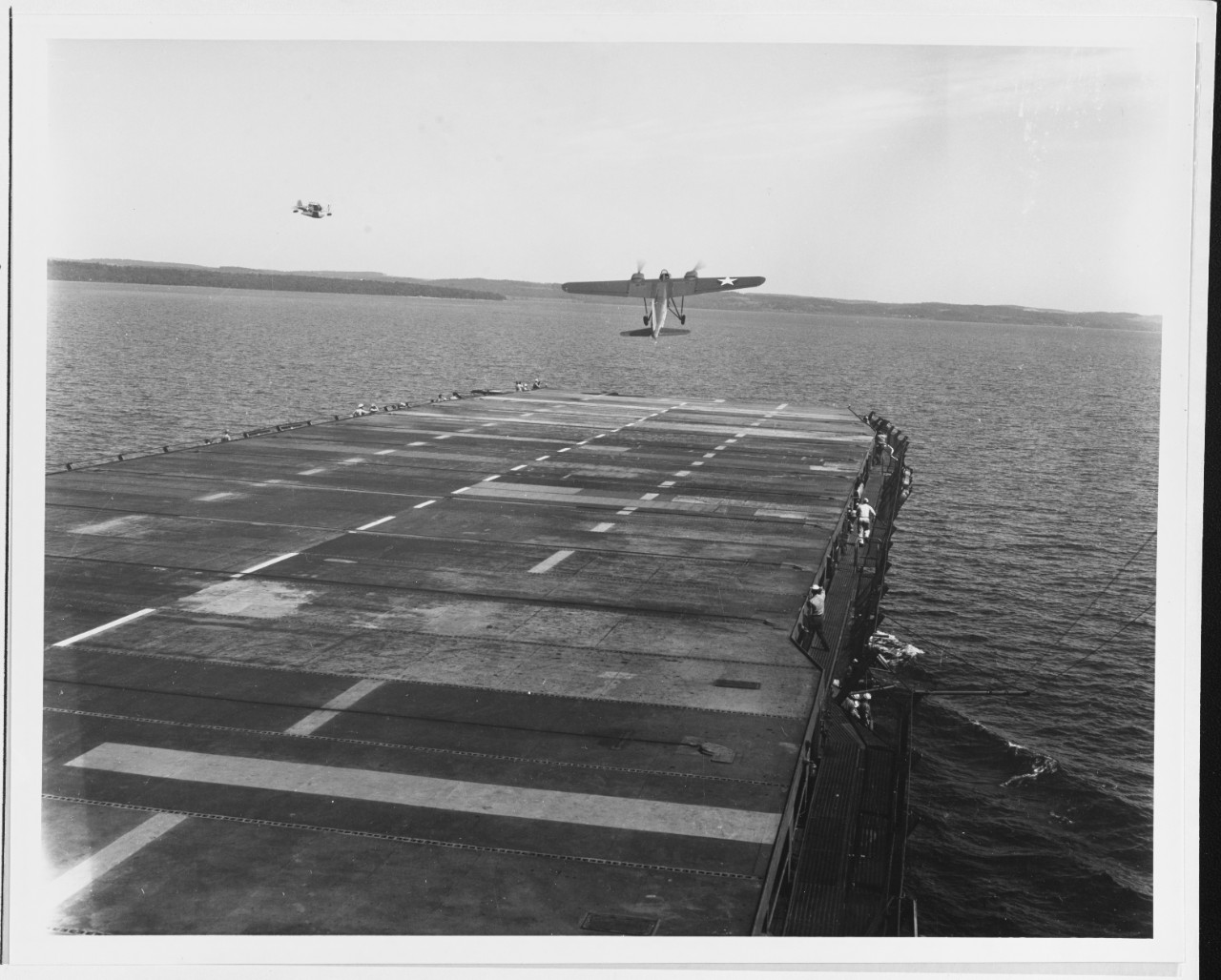
Did you know that there are about 120 World War II era aircraft lying at the bottom of Lake Michigan? The Navy used these aircraft to train and certify pilots to take off and land from aircraft carriers during World War II. U.S. Naval operations along Lake Michigan, one of the Great Lakes, began in 1923. Between 1923 and 1942, operations expanded as the Navy built hangars, airfields, and landing strips across the village of Glenview, Illinois. By 1942, the Navy had a robust presence on the shores of Lake Michigan. With the U.S. entrance into World War II, the Navy needed a location to train carrier pilots. The growing threat of enemy vessels and mines along the Pacific and Atlantic coastlines and an already strong Naval presence in the area made Lake Michigan the safest location for carrier training.
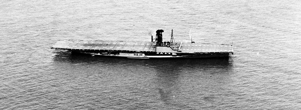
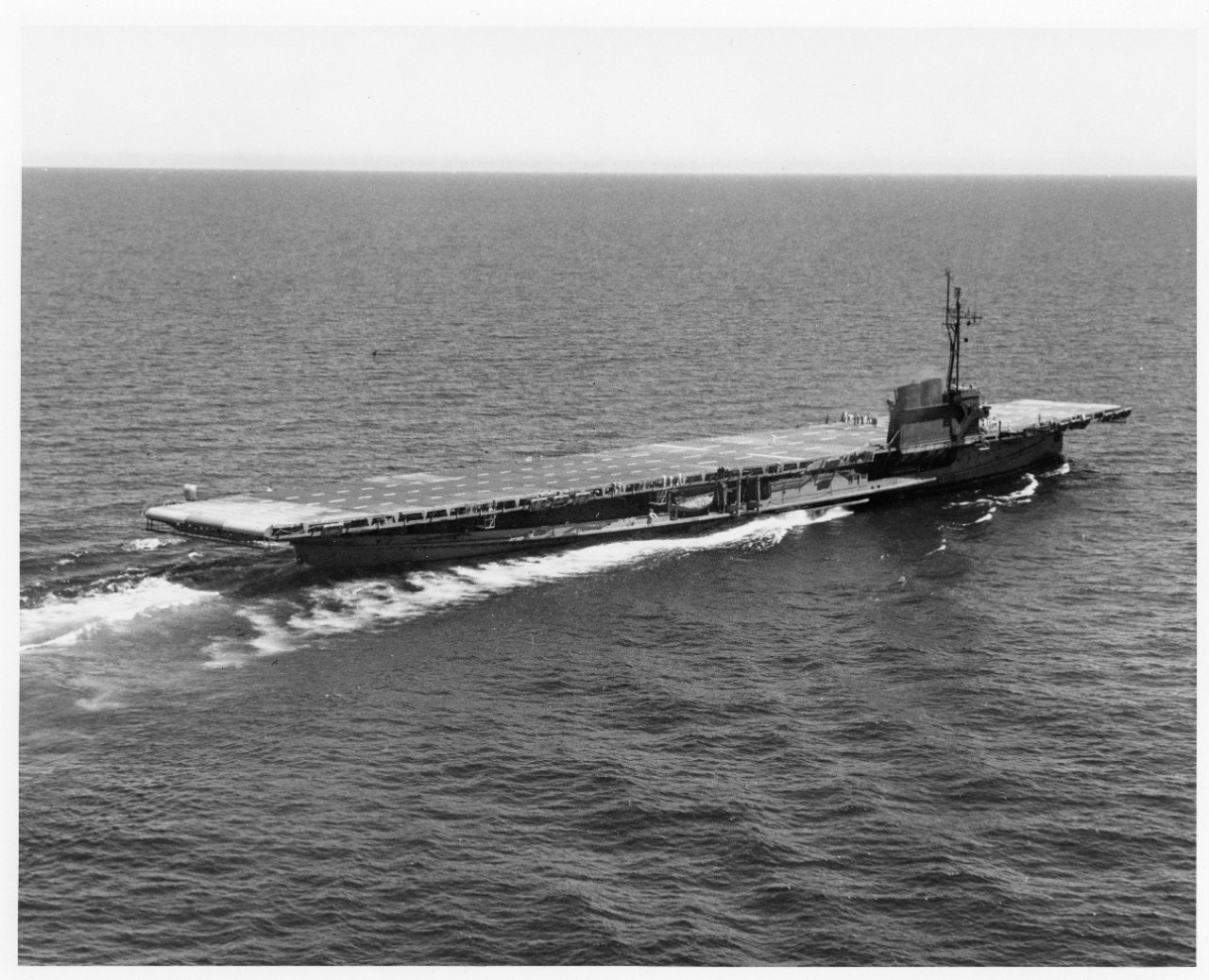
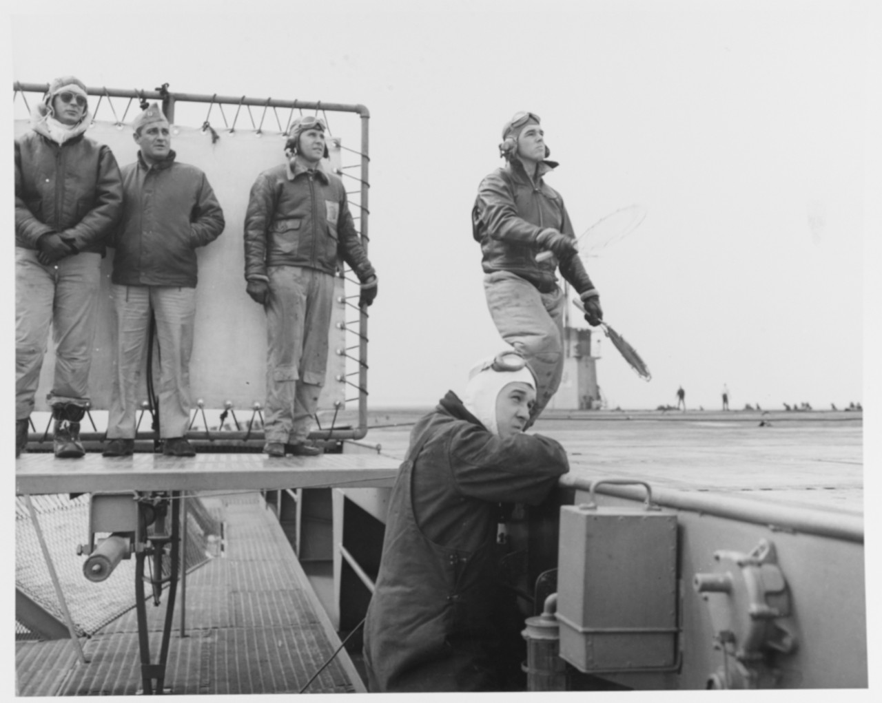
All existing carriers were needed on the front, so the Navy bought two sidewheel paddle steamers, the SS Seaandbee and SS Greater Buffalo, which they stripped and fitted with flight decks. Commissioned as the USS Wolverine and USS Sable these ships helped to train and qualify 17,820 pilots, including former President George H.W. Bush.
As this was a training site, crashes and emergency water landings did happen. The U.S. Coast Guard operated small yard patrol craft to rescue the pilots and drop a buoy over the downed plane to mark the location for recovery. Not all planes were recoverable and over 100 remained on the bottom of Lake Michigan.
These aircraft represent a significant part of U.S. history and offer a wealth of knowledge about the history of naval aviation. The cold, fresh waters of Lake Michigan provide ideal preservation conditions, and many of the aircraft are in such good condition that the paint scheme can still be used to help identify them. As part of an initiative to manage this collection of sunken aircraft, the Naval History and Heritage Command is leading an effort to find and preserve this piece of history.
NOAA recently supported a three-week survey led by the Naval History and Heritage Command’s Underwater Archaeology Branch, as managers of the U.S. Navy’s sunken military craft.
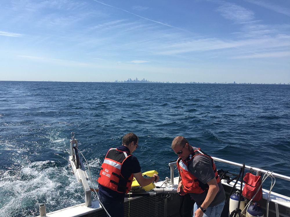
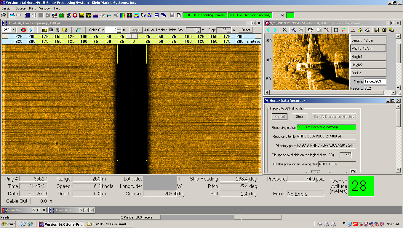
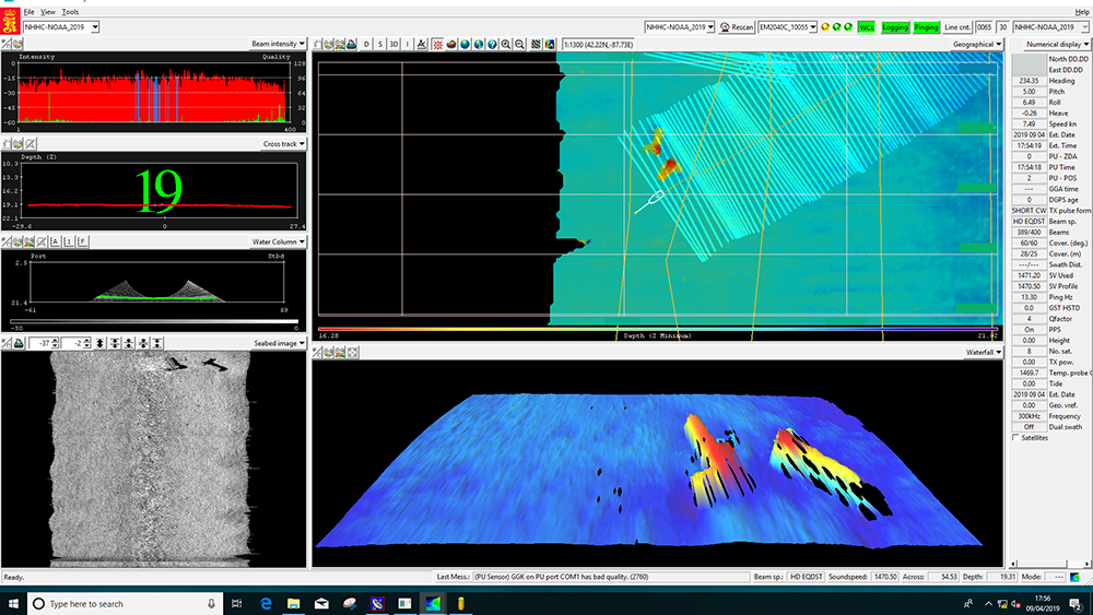
At the start of the survey, the interagency team identified nine target areas which were likely to contain sunken military craft. From August 22 to September 12, seven of the nine target areas were surveyed. The total area covered and mapped was 30 square km. Six of the seven areas were fully mapped with multibeam echo sounder object detection (MBES) and one location with partial coverage due to time and weather limitations. The team used side scan sonar when appropriate for the site conditions and also when a target was acquired.
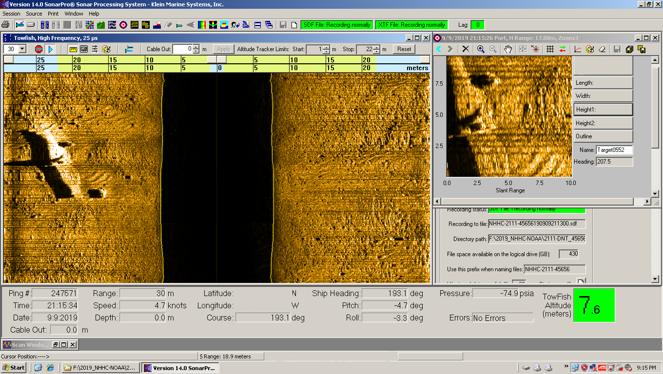
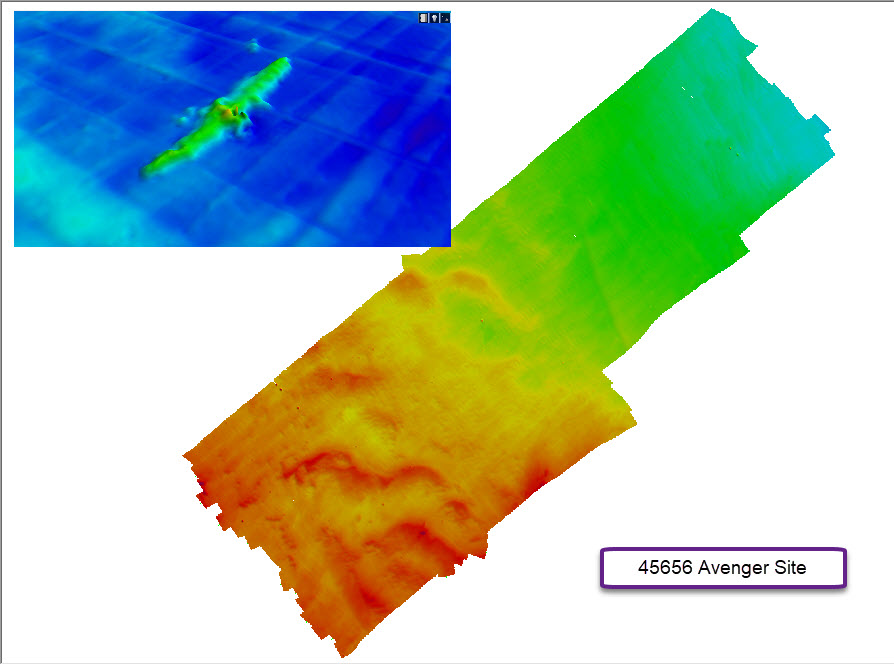
The team located four targets over the three week project. Two of these targets are aircraft. One is an Avenger, which was confirmed by divers and is likely Bureau Number 45656. The second aircraft appears to be an Avenger as well. The site will hopefully be confirmed by a future survey with either divers or using a Remotely Operated Vehicle (ROV).

Two of the four targets turned out to not be aircraft. One of the targets was a broken-up ship. The other target looked very much like an aircraft based on the dimensions, but when the divers investigated the site, they found two large boilers.

NOAA was able to quickly and effectively bring together resources and operational expertise needed to facilitate a successful survey. These resources include a survey vessel and marine operations support from the Great Lakes Environmental Research Lab; staff, sonar, equipment, and coordination from the Office of National Marine Sanctuaries Thunder Bay NMS and the Maritime Heritage Program; and hydrographic survey staff and expertise from the Office of Coast Survey.
The sunken aircraft of Lake Michigan represent just a small portion of the valuable environmental, cultural, and economic resources provided by the Great Lakes. As the largest freshwater ecosystem in the world, the five Great Lakes provide drinking water to 40 million people in the U.S. and Canada, and it is home to 3,500 species of plants and animals. The region draws 37 million anglers, hunters, and bird watchers each year and residents and tourists spend $16 billion annually on boating trips and equipment in the Great Lakes. The Great Lakes directly support more than 1.5 billion jobs making it an important component of the regional and national GDP.
In 2015 NOAA announced its intent to designate a new national marine sanctuary to preserve shipwrecks and related maritime heritage resources along the Wisconsin shoreline of Lake Michigan. While this proposed sanctuary does not include the area surveyed for this project, it emphasizes another one of the many different ways NOAA is committed to providing tools and information to research, manage, and protect this vital resource.