
In preparation for the M/V TERN’s anticipated arrival this week in San Francisco Bay, the Coast Guard and Port of San Francisco asked Coast Survey for a bathymetric survey of the proposed anchorage site. TERN is a semi-submersible vessel with a 60-foot draft, and the proposed anchorage site has charted depths of 62 feet and 63 feet ‒ leaving no room for error, to say the least. The question was whether there are any spots shoaler than 62 feet.
This isn’t your everyday anchorage.
Continue reading “Survey helps ensure safe “parking” for deep-draft vessel in SF”
NOAA is open for business with navigation industry
At the first NOAA Navigation Industry Day, held October 10 in conjunction with the Annapolis Boat Show, over two dozen of the world’s top maritime app and navigation system developers met with NOAA experts to learn more about the vast amounts of NOAA data that is available for free access and use.

Continue reading “NOAA is open for business with navigation industry”
NOAA Ship Thomas Jefferson celebrates survey success with maritime community
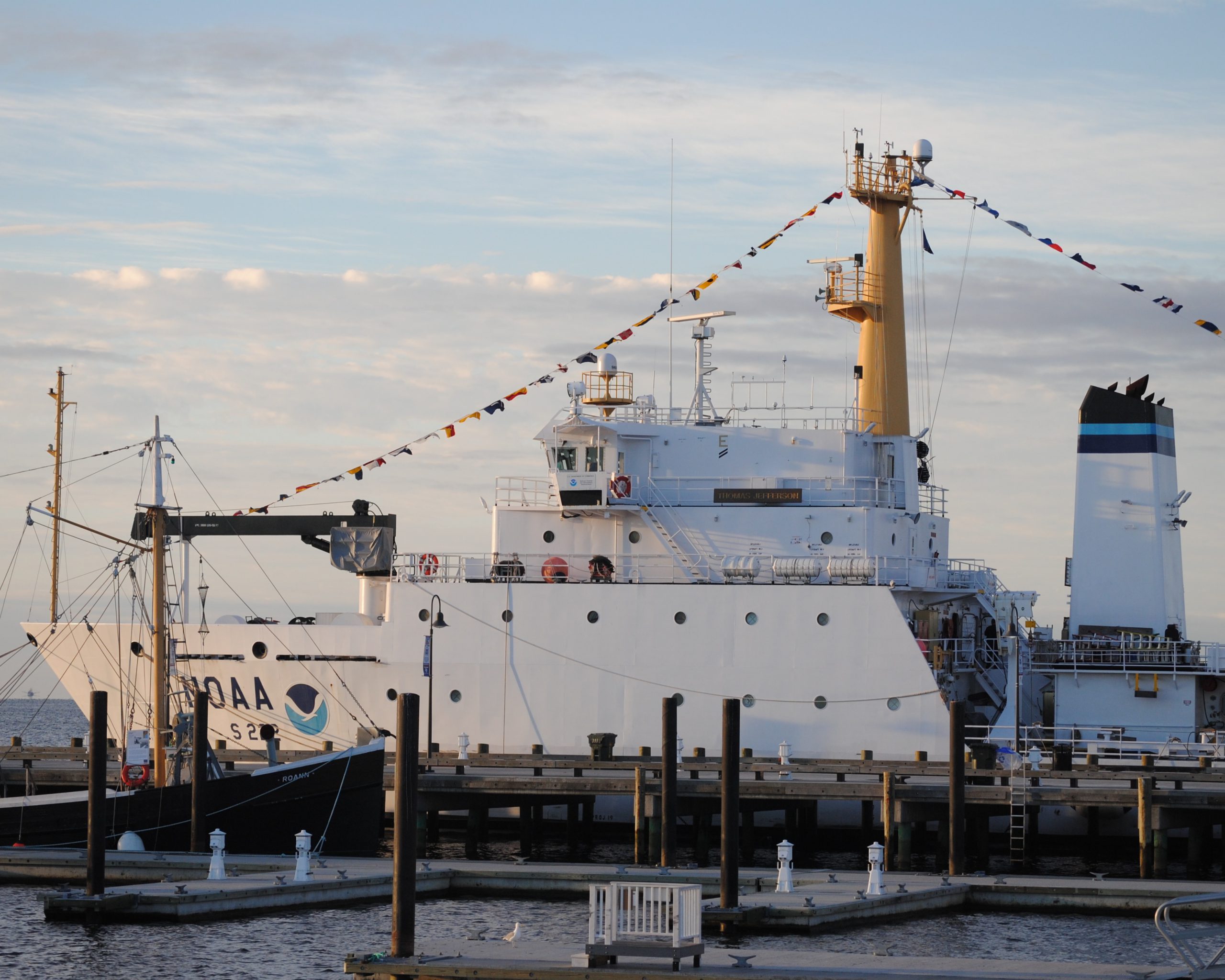
by Ensign Diane Perry, onboard NOAA Ship Thomas Jefferson
From 2005 through today, NOAA Ship Thomas Jefferson has been surveying Long Island Sound, one project area at a time. Some of the area was last surveyed between the late 1800s and 1939. For the 2014 field season, Thomas Jefferson was assigned her final Long Island Sound project, 89 square nautical miles of Eastern Long Island Sound, Fisher Island Sound, and Western Block Island Sound. When this project is complete, we will have resurveyed over 95% of Long Island Sound and all of Block Island Sound with modern survey technology that allows for a complete picture of the seafloor and highly accurate soundings.

Continue reading “NOAA Ship Thomas Jefferson celebrates survey success with maritime community”
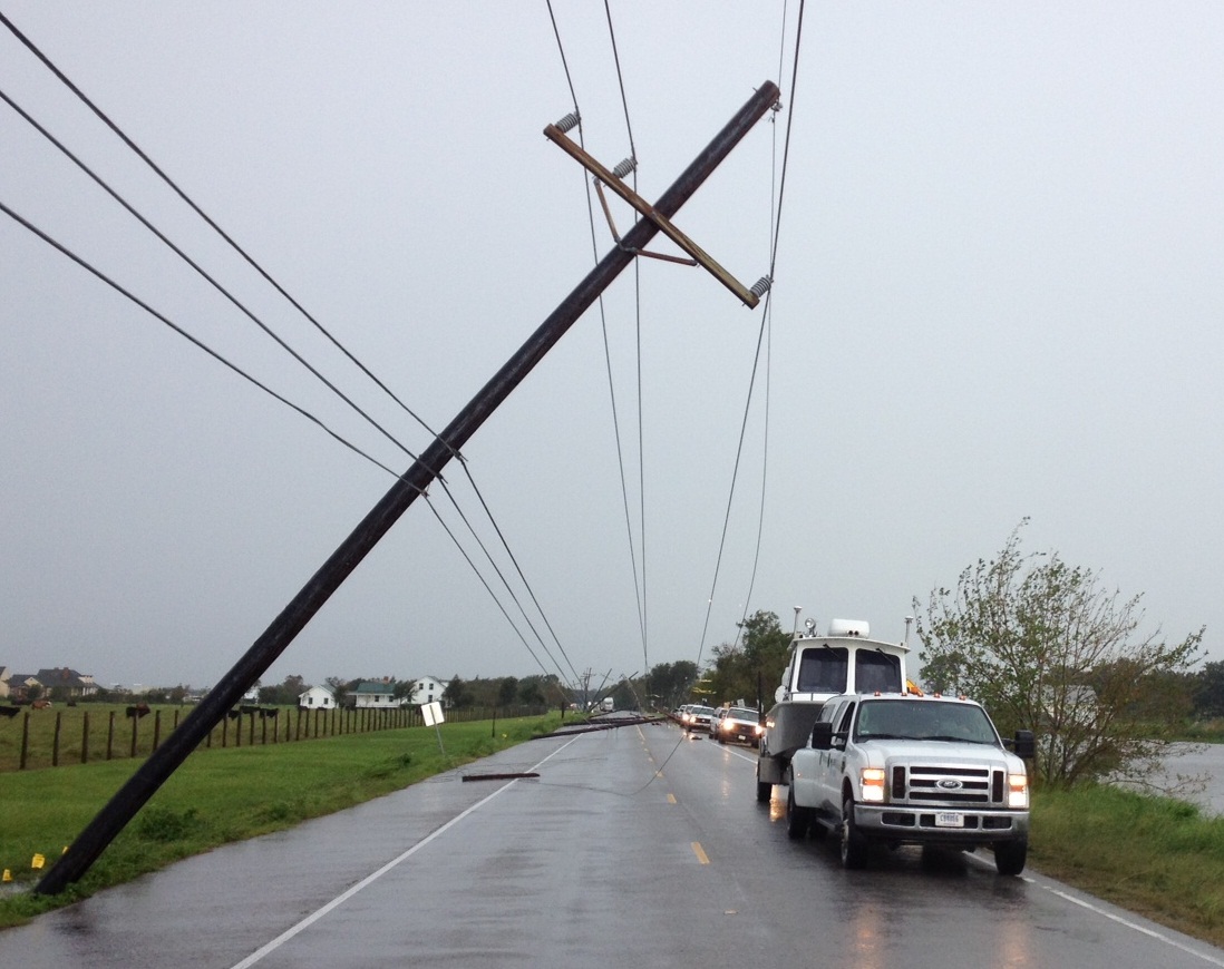
A “soft” resilience strategy is part of successful hurricane response
We hear about the infrastructure investments that often follow major disasters like hurricanes ‒ the “hard” port resilience strategies necessary in the wake of catastrophic human, environmental, and economic loss. But the sturdiest, most flood-proof building is just one part of a larger system of assets in coastal resilience. We don’t hear much about the “soft” resilience strategies ‒ those that build and maintain ties among the people responsible for responding to a hurricane, for instance ‒ that are important to a successful response. Those strategies are part of the social capital between communities and government, and among government agencies.

Continue reading “A “soft” resilience strategy is part of successful hurricane response”
NOAA helps Port Fourchon determine safe anchorage areas
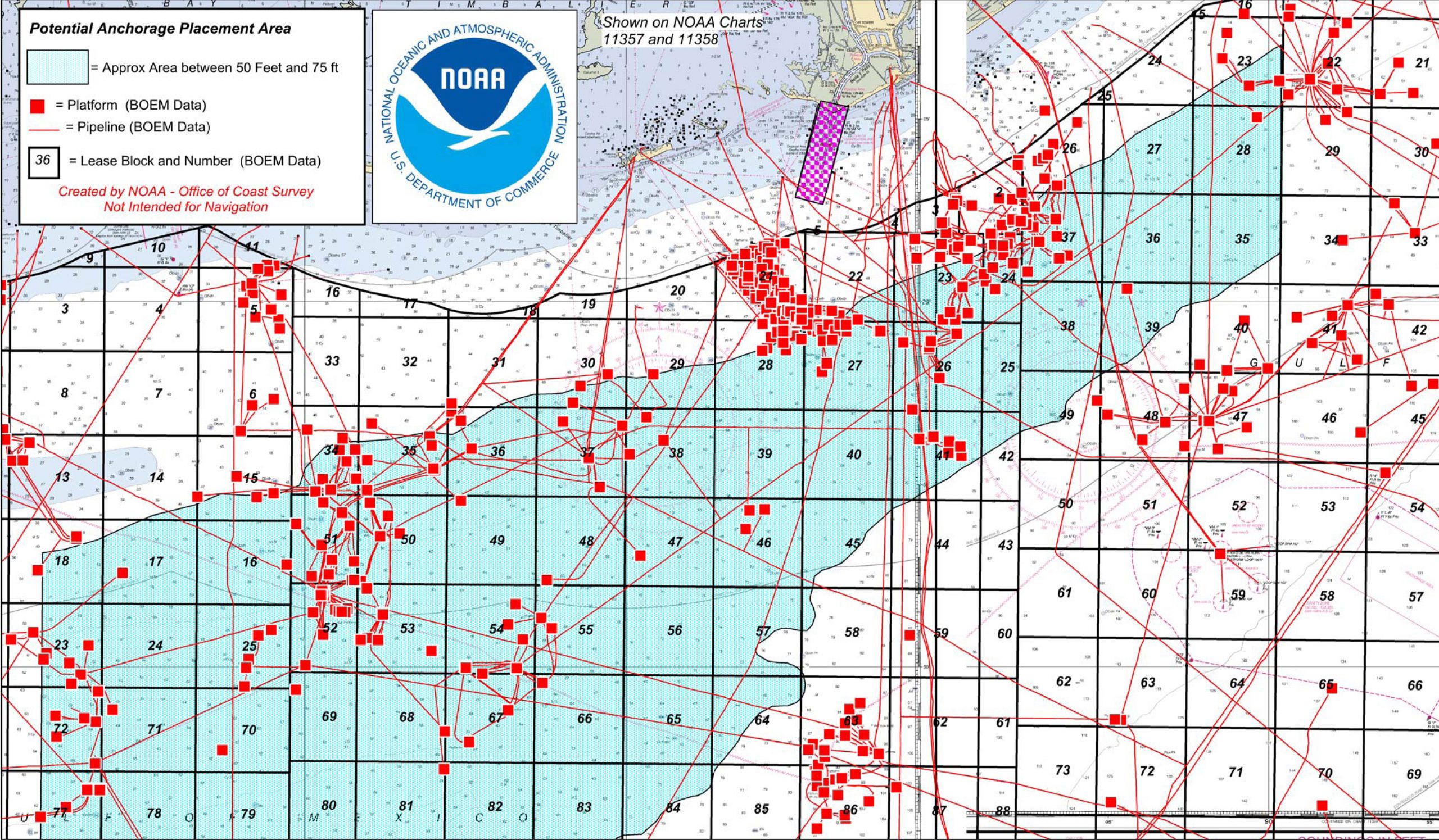
Port officials around the country know they can rely on the expert advice of Coast Survey’s navigation managers, cartographic experts, and hydrographers as the ports plan the essential improvements necessary for a thriving maritime economy. One example of Coast Survey assistance is in Port Fourchon, Louisiana, where port officials have determined that the volume and density of vessels have reached a level that requires one or more offshore anchorage areas. Sending vessels to a designated anchorage reduces the population in port and provides a safe area for vessels to power down their engines (rather than hold in place offshore in dynamic positioning mode), which would improve both safety and efficiency in the area known as the “Gulf’s Energy Connection.”
Continue reading “NOAA helps Port Fourchon determine safe anchorage areas”
Lt. Smith shows us the beauty of Gambell Alaska

This summer, the Bering Sea Alliance hosted a private-public summit in Gambell, Alaska, to discuss Arctic resource development and infrastructure. (See page 10 in this edition of the Nome Nugget for a good summary of the meeting.) Lt. Tim Smith, NOAA Coast Survey’s regional manager for Alaska, updated the participants on the status of Arctic nautical charts and described NOAA’s Arctic Nautical Charting Plan. He also outlined the preliminary 2015 survey plans to acquire hydrographic data around Point Hope, Point Barrow, Port Clarence, and Kotzebue Sound, as NOAA strives to ensure the navigational safety of the increasing ship traffic through Arctic waters.
Continue reading “Lt. Smith shows us the beauty of Gambell Alaska”
NOAA awards contract to build new navigation response boats
NOAA today announced that Lake Assault Boats of Superior, Wisconsin, will build two small vessels for the Office of Coast Survey’s navigation response program, part of a plan to eventually replace all six of the program’s small survey boats. The combined cost of both 28-foot vessels is $538,200.
“All of the navigation response team survey boats are nearing or have exceeded their designed service life,” said Russ Proctor, division chief of Coast Survey’s Navigation Services Division. “A phased program to replace the navigation response team boats over the next three to five years will help NOAA maintain the program’s crucial capacity for inshore surveys and rapid response in emergencies.”
Continue reading “NOAA awards contract to build new navigation response boats”
NOAA R/V Bay Hydro II has a ball meeting the public in Baltimore!
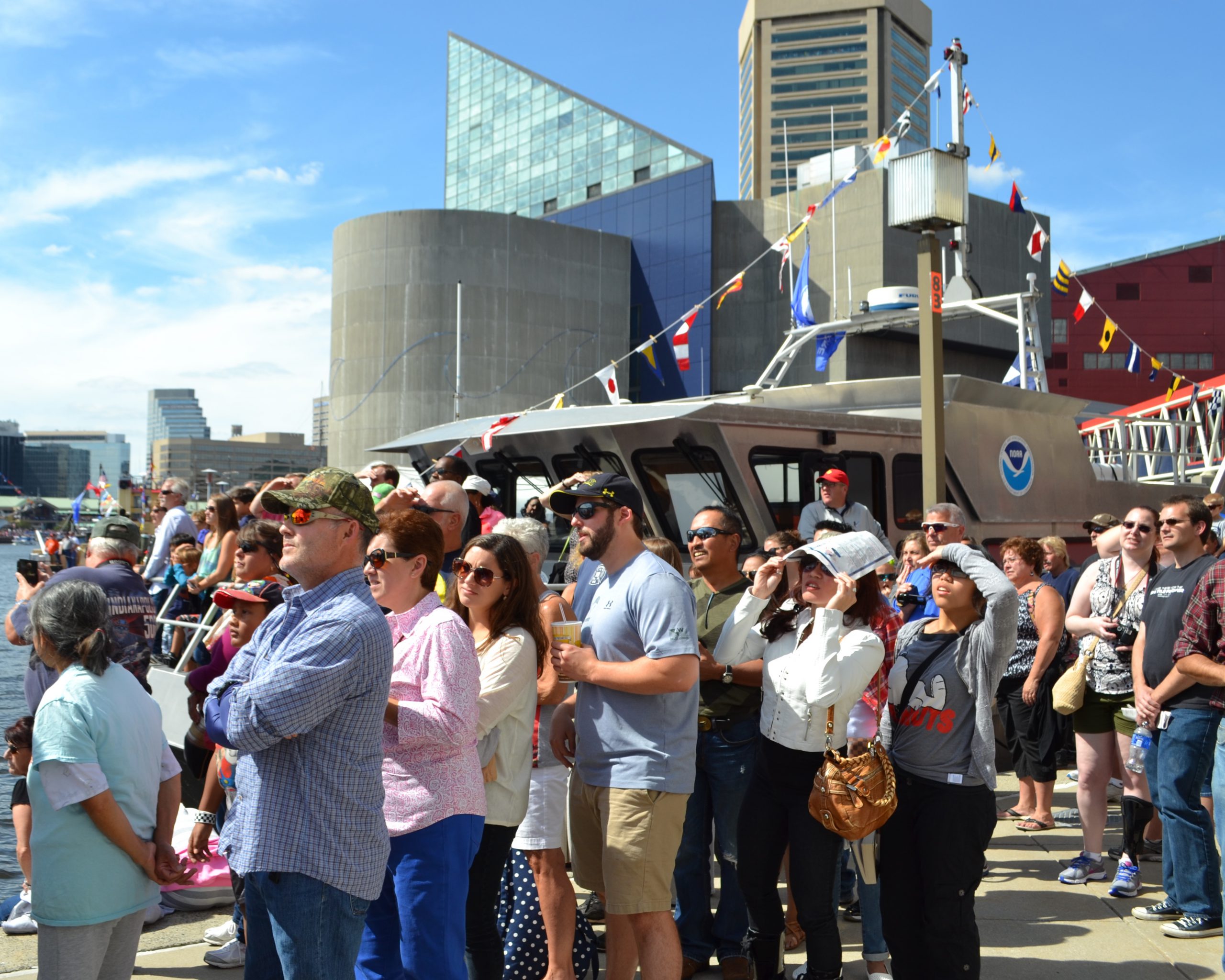
Last week we blogged about Coast Survey’s research vessel Bay Hydro II, a small hydro research vessel that delivers big results. The vessel was heading into Baltimore Harbor for five days of public tours at Star Spangled Spectacular.
The Bay Hydro II crew and headquarters personnel had a great time with everyone — from the kids who learned about charts from an admiral, to the map geeks who enjoyed a discussion down in the hydro weeds. More than 4,000 people toured the Bay Hydro II during the celebration, and we hope they all learned at least a little about hydrographic surveying and nautical charts.
Continue reading “NOAA R/V Bay Hydro II has a ball meeting the public in Baltimore!”
A small hydro research vessel delivers big results
by Dawn Forsythe, Coast Survey communications
Remember when your mom told you, “The best things come in small packages”? It turns out that is true for more than diamonds, puppies, and kids who think they are too short.
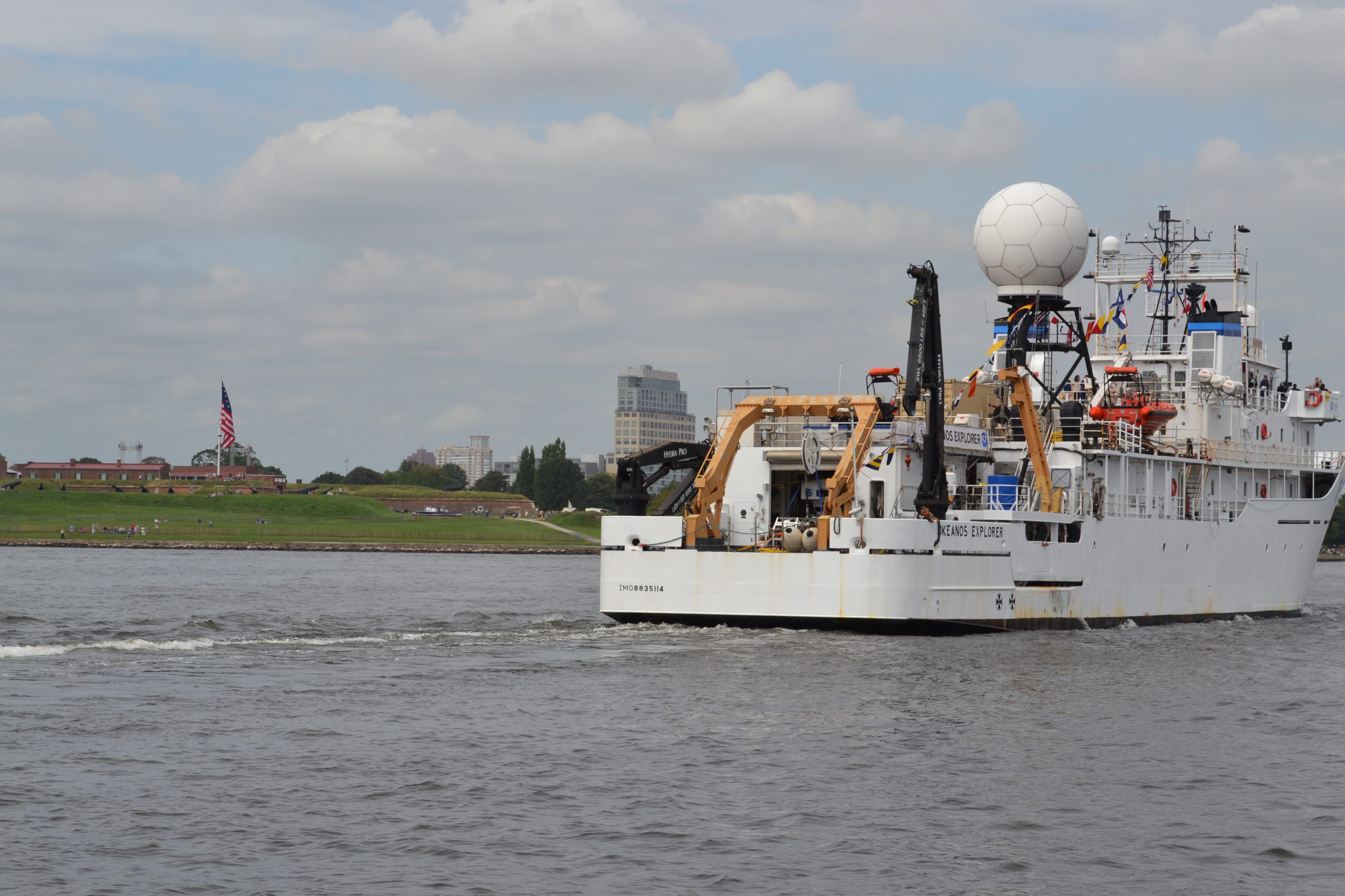
Today it was my privilege to ride with the 57-foot Bay Hydro II, one of NOAA’s smallest research vessels, as she came into Baltimore Harbor for the Star Spangled Spectacular, a festival that celebrates the 200th anniversary of our National Anthem. As we sailed alongside the impressive NOAA Ship Okeanos Explorer, past historic Fort McHenry, a 19th century cannon boomed ‒ probably sounding much as it did 200 years ago during the War of 1812, when the British attack was turned back at Baltimore. With that historic reminder, I was struck by how the Bay Hydro II represents Coast Survey’s two-century commitment to the Chesapeake Bay, starting with our surveys in 1843.
Continue reading “A small hydro research vessel delivers big results”
Whistler hints at artistic flair during Coast Survey stint
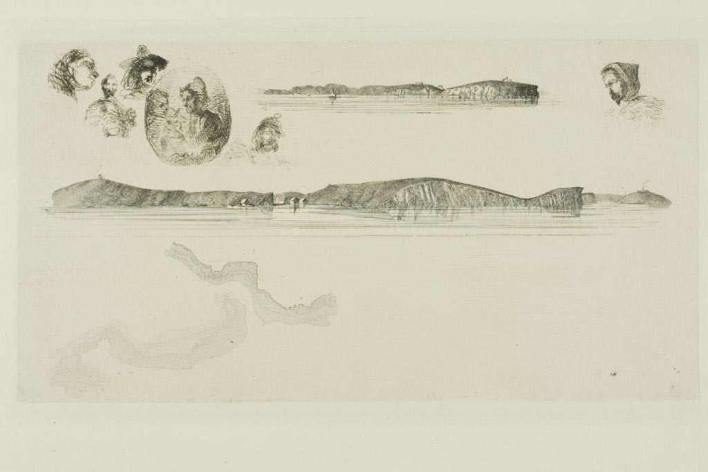
By Darcy Herman
Over its 200-year history, NOAA’s Office of Coast Survey has employed men who are preeminent in their fields. Most of the time, their career successes follow traditional professional trajectories ‒ but at least one Coast Survey alum’s ultimate renown was born of his failure at Coast Survey.
James McNeill Whistler (1834 – 1903), the American artist best known for his painting colloquially known as “Whistler’s Mother,” was briefly and unhappily employed in the drawing division of the U.S. Coast Survey in 1854 and 1855.
Continue reading “Whistler hints at artistic flair during Coast Survey stint”