
By Julia Powell, deputy chief of the Coast Survey Development Lab
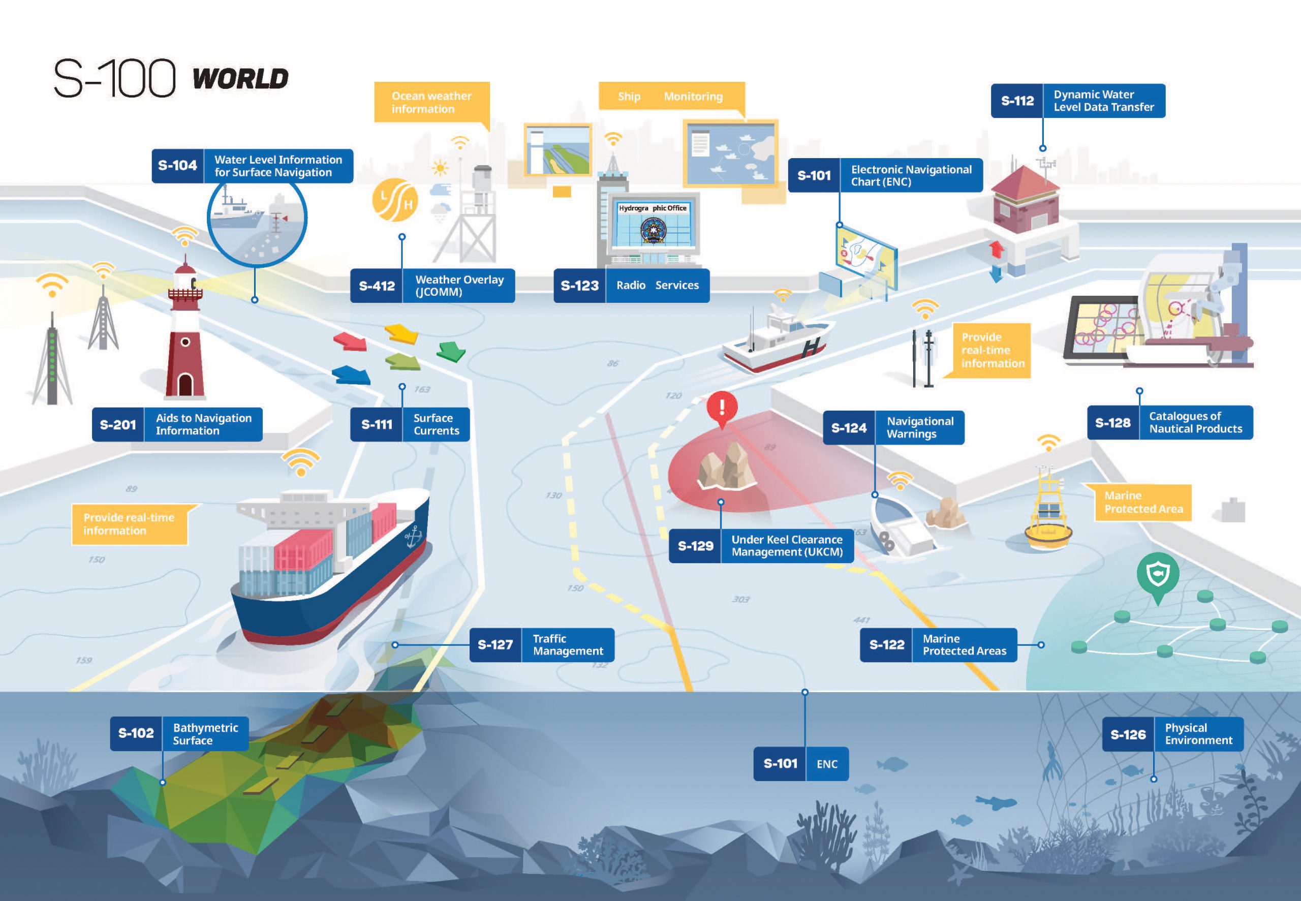
As e-Navigation becomes more popular, mariners are provided with streams of maritime data from multiple sources that allow them to more safely and efficiently navigate the seas. However, as the amount of information and number of sources grows, there is a need to standardize the data so it can be easily integrated and seamlessly displayed on navigation systems. Later this year, the International Hydrographic Organization (IHO) will publish edition 4.0.0 of S-100 – Universal Hydrographic Data Model. S-100 is the IHO’s framework for the standardization of maritime data products such as high resolution bathymetry, surface currents, marine protected areas, and the new standards for electronic navigational charts (ENCs).
At its foundation, the S-100 framework uses machine readable catalogs that will lead to plug and play systems and allow for easier updating of data standards. In other words, the S-100 framework and corresponding standards will be easily applied to a suite of S-series hydrographic products. NOAA is an active participant in the development of S-100 and associated product specifications, and works to align new products and services to the S-100 suite of standards under development. This will enable mariners to have more information integrated within their navigation systems which helps them plan optimal routes and make critical decisions at sea.

NOAA has several initiatives that align to S-100 products that are currently under development. For example, NOAA works to operationalize the soon-to-be published edition 1.0.0 of S-111 Surface Currents by extracting data from NOAA operational forecast systems and converting it into a format that can be ingested and displayed by navigation systems. In addition, the National Weather Service’s Ocean Prediction Center works through the World Meteorological Organization to produce S-412 Ocean Forecasts, which also utilizes the S-100 infrastructure. Other products, including S-102 – High Resolution Bathymetry, S-102 – Predicted Water Levels, and S-129 Underkeel Clearance Management Systems, are also in various stages of development that will eventually facilitate precision navigation in busy ports around the world.

The development of the S-100 infrastructure is governed by the IHO’s S-100 Working Group and is currently chaired by NOAA. A key item of focus for the S-100 Working Group during the next couple of years is the development of the S-100 Interoperability Specification, which provides a machine readable mechanism for front of bridge systems to portray different types of data in a harmonious fashion. Another focus area is the establishment of the S-100 Test Bed to support the testing of the wide range of S-100 based product specifications based on their intended use.
2018 represents a banner year in the development of S-100 and associated product specifications. The IHO is on track to release the latest edition of S-100, but also the product specifications for S-102 edition 2.0.0 – High Resolution Bathymetry, and the following first editions that will be used for system implementation:
- S-101 – Electronic Navigational Charts
- S-111 – Surface Currents
- S-122 – Marine Protected Areas
- S-123 – Radio Services
With the development of e-Navigation, an increasing number of stakeholders use the S-100 framework. By establishing and maintaining appropriate standards, the IHO’s release of edition 4.0.0 of the S-100 will assist in proper and efficient use of hydrographic data and information.
Good Julia and the S-100 IHOWG… this is nice to see progress and acceleration of implementation of S-100… this is becoming an urgent requirement for HOs in the context of MSDI, SDB, CSB and the emergence of MASS operationalization… what about S-121? IHO should distniguishe itself of eNavigation by offering “Hydrographic Dynanic Products” feeding it through S-100 rather than being packaged under eNavigation… keep the excellent work,
Denis