
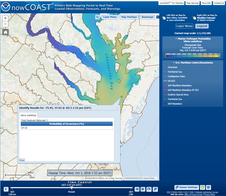
NOAA’s nowCOAST®, a GIS-based online web mapping service that provides frequently updated weather and ocean observations, analyses, imagery, and ocean model forecast guidance, along with weather watches and warnings and forecasts, now provides maps of oceanographic forecast guidance from the National Ocean Service (NOS) 3-D operational forecast modeling system for the Gulf of Maine (GoMOFS) and NOS forecast guidance of the marine pathogen, Vibrio Vulnificus (Vv), for the Chesapeake Bay via two new map services and map viewer.

GoMOFS provides high resolution nowcasts (analyses) and forecast guidance of 3-D water currents, water temperatures, and salinity at 3-hourly increments out to 48 hours. NOS’ latest forecast guidance on the probability of occurrence of Vv, a marine pathogen which can cause illness and hospitalization, is issued once per day for Chesapeake Bay and includes predictions for the present day (Day 1) and the next day (Day 2).
Additional nowCOAST updates include:
- Incorporation of water level forecast guidance from NOS Extratropical Surge and Tide Operational Forecast System (ESTOFS) for Micronesia into the existing ESTOFS map service.
- Ability to display National Hurricane Center Potential Storm Surge Flooding Maps for multiple tropical cyclones at the same time.
- Addition of georeferenced hyperlinks to Canada Marine Weather Forecast Zones.

Detailed information about the new version can be found in the NOS Service Change Notice.
nowCOAST is an ArcGIS-based web mapping application developed by the Office of Coast Survey’s Coast Survey Development Laboratory and is hosted on NOAA’s 24×7 Integrated Dissemination Program IT infrastructure operated by the National Weather Service’s National Centers for Environmental Prediction.